Related Research Articles

The Mississippi River is the primary river, and second-longest river, of the largest drainage basin in the United States. From its traditional source of Lake Itasca in northern Minnesota, it flows generally south for 2,340 miles (3,766 km) to the Mississippi River Delta in the Gulf of Mexico. With its many tributaries, the Mississippi's watershed drains all or parts of 32 U.S. states and two Canadian provinces between the Rocky and Appalachian mountains. The main stem is entirely within the United States; the total drainage basin is 1,151,000 sq mi (2,980,000 km2), of which only about one percent is in Canada. The Mississippi ranks as the thirteenth-largest river by discharge in the world. The river either borders or passes through the states of Minnesota, Wisconsin, Iowa, Illinois, Missouri, Kentucky, Tennessee, Arkansas, Mississippi, and Louisiana.

The Ohio River is a 981-mile (1,579 km) long river in the United States. It is located at the boundary of the Midwestern and Southern United States, flowing in a southwesterly direction from western Pennsylvania to its mouth on the Mississippi River at the southern tip of Illinois. It is the third largest river by discharge volume in the United States and the largest tributary by volume of the north-south flowing Mississippi River, which divides the eastern from western United States. It is also the 6th oldest river on the North American continent. The river flows through or along the border of six states, and its drainage basin includes parts of 14 states. Through its largest tributary, the Tennessee River, the basin includes several states of the southeastern U.S. It is the source of drinking water for five million people.
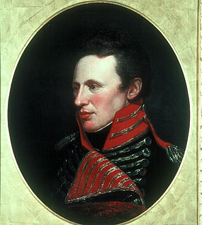
Zebulon Montgomery Pike was an American brigadier general and explorer for whom Pikes Peak in Colorado was named. As a U.S. Army officer he led two expeditions through the Louisiana Purchase territory, first in 1805–1806 to reconnoiter the upper northern reaches of the Mississippi River, and then in 1806–1807 to explore the southwest to the fringes of the northern Spanish-colonial settlements of New Mexico and Texas. Pike's expeditions coincided with other Jeffersonian expeditions, including the Lewis and Clark Expedition and the Red River Expedition in 1806.

Zadok Casey was an American politician who served as a U.S. representative from Illinois and founded the city of Mount Vernon.
A navigator is an individual responsible for guiding a vehicle to its destination.
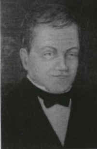
Victor Collot, in full Georges Henri Victor Collot, was a French military officer who served in the New World in various capacities, among them as Governor of Guadeloupe.

The Mitchell Map is a map made by John Mitchell (1711–1768), which was reprinted several times during the second half of the 18th century. The map, formally titled A map of the British and French dominions in North America &c., was used as a primary map source during the Treaty of Paris for defining the boundaries of the newly independent United States. The map remained important for resolving border disputes between the United States and Canada as recently as the 1980s dispute over the Gulf of Maine fisheries. The Mitchell Map is the most comprehensive map of eastern North America made during the colonial era. Its size is about 6.5 feet (2.0 m) wide by 4.5 feet (1.4 m) high.
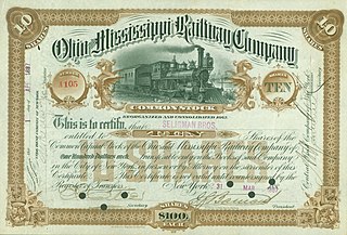
The Ohio and Mississippi Railway, abbreviated O&M, was a railroad operating between Cincinnati, Ohio, and East St. Louis, Illinois, from 1857 to 1893.

The Monongahela and Ohio Steam Boat Company was the second company to engage in steamboat commerce on the rivers west of the Allegheny Mountains. The company was founded in 1813 under the leadership of Elisha Hunt and headquartered in his store which was located close to the boat landing in Brownsville, Pennsylvania. Daniel French designed and built the engines and power trains for both the Despatch, or Dispatch, and the Enterprise. During the Battle of New Orleans in 1815, the shareholders of the Monongahela and Ohio Steam Boat Company sent the Enterprise to aid the American cause. In 1815, the Enterprise demonstrated for the first time by her epic 2,200-mile voyage from New Orleans to Brownsville that steamboat commerce was practical on America's western rivers.
The United States Senate Committee on Transportation Routes to the Seaboard, was a Senate committee, initially authorized by Senate resolution as a select committee on December 16, 1872. The select committee, also known as the Windom Select Committee for its first chairman, William Windom, submitted their significant report regarding current rail and water transportation on April 24, 1874; it was ordered to be printed the same day. The committee became a standing committee on March 19, 1879, with little documented activity, and continued to exist until 1921.
The origin of the name of the U.S. state of Oregon is unknown, and a subject of some dispute.

Grand Gulf is a ghost town in Claiborne County, Mississippi, United States.
The steamboat Enterprise demonstrated for the first time by her epic 2,200-mile (3,500 km) voyage from New Orleans to Brownsville, Pennsylvania that steamboat commerce was practical on the Mississippi River and its tributaries.

New Orleans was the first steamboat on the western waters of the United States. Owned by Robert Fulton and Robert R. Livingston, and built by Nicholas Roosevelt, its 1811–1812 voyage from Pittsburgh, Pennsylvania, to New Orleans, Louisiana, on the Ohio and Mississippi rivers ushered in the era of commercial steamboat navigation on the western and mid-western continental rivers.
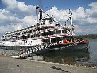
Steamboats played a major role in the 19th-century development of the Mississippi River and its tributaries, allowing practical large-scale transport of passengers and freight both up- and down-river. Using steam power, riverboats were developed during that time which could navigate in shallow waters as well as upriver against strong currents. After the development of railroads, passenger traffic gradually switched to this faster form of transportation, but steamboats continued to serve Mississippi River commerce into the early 20th century. A small number of steamboats are still used for tourist excursions in the 21st century.
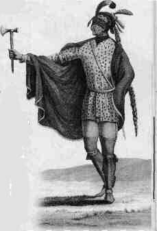
Moncacht-Apé was a Native American explorer of the Yazoo tribe in the present-day Mississippi area; in the late 1600s or early 1700s, he may have made the first recorded round-trip transcontinental journey across North America.
George Gauld (1731–1782) was a British military engineer, artist, cartographer, geographer and surveyor.

Port Perry was a town along the Monongahela River near Braddock, Pennsylvania and by the mouth of Turtle Creek. It disappeared by 1945, having been gradually replaced by railroad tracks serving the nearby Edgar Thomson Steel Works.

Lloyd's Steamboat Directory, and Disasters on the Western Waters is a book published in 1856 listing steamboat businesses in the United States, along with an illustrated catalog of American maritime disasters. It covers "mainly river material, with a substantial scattering of lake items."
References
- ↑ Buck Rinker. 2022. Life on the Mississippi: an epic American adventure. First Avid Reader Press.
- Who's Who on the Ohio River and its Tributaries, (Cincinnati 1931) by Ethel C. Leahy. Pages 79–81
- Historic Highways of America (Cleveland 1903) by Archer B. Hulbert. Pages 73–99