The Quay School of the Arts is a Tertiary Art School in Whanganui, a west coast city in the North Island of New Zealand. It was part of the Wanganui Polytechnic but now is an adjunct of Whanganui UCOL (Universal College of Learning).
The Quay School of the Arts is a Tertiary Art School in Whanganui, a west coast city in the North Island of New Zealand. It was part of the Wanganui Polytechnic but now is an adjunct of Whanganui UCOL (Universal College of Learning).

Moutoa Island is an island of shingle approximately 500 metres (1,600 ft) long, 80 kilometres (50 mi) up the Whanganui River, New Zealand between the towns of Rānana and Hiruharama.
Okoia is a small rural community approximately 5 km east of Whanganui, New Zealand. It is centred on the Okoia Primary School. The area is predominantly subject to sheep and beef pastoral farming, but in recent years some farms have been divided into lifestyle blocks.
Rangitikei is an area in New Zealand that follows the course of State Highway 1, from just south of Waiouru with the QEII Army Memorial Museum, through Taihape, Mangaweka, Hunterville, Marton and Bulls, and then winds down a minor road to the coast at Turakina & Scott's Ferry.

Whanganui District is one of the districts of New Zealand. It includes the city of Whanganui and surrounding areas.
St. Dominic's College is a private, traditionalist Catholic secondary school, located in Gonville, Parish of St. Anthony's & St. Edmund's Catholic Church, Whanganui, New Zealand. The school was founded in 1994 by the Society of Saint Pius X. The school is divided into two campuses both situated in Gonville.

Ranana is a settlement 60 kilometres (37 mi) up the Whanganui River from Whanganui, New Zealand.

Pipiriki is a settlement in New Zealand, on the east bank of the Whanganui River, due west of the town of Raetihi and 79 kilometres (49 mi) upriver from Whanganui; it was originally on the opposite bank. It is the home of Ngāti Kura, a hapū of the Ngāti Ruanui iwi. It is also the location of the Paraweka Marae of the hapū Ngāti Kurawhatia of the iwi Te Āti Haunui-a-Pāpārangi.

The Whanganui District Health Board is a district health board with the focus on providing healthcare to the Wanganui, Rangitikei, and parts of the Ruapehu districts of New Zealand.

Koriniti is a settlement 47 kilometres (29 mi) upriver from Whanganui, New Zealand, home to the Ngāti Pāmoana hapū of the iwi Te Āti Haunui-a-Pāpārangi.

Parikino is a settlement 24 kilometres (15 mi) upriver from Whanganui, New Zealand; the original pā site was across the Whanganui River.

Kaiwhaiki is a settlement 18 kilometres (11 mi) upriver from Whanganui, New Zealand.

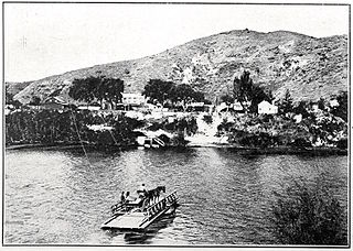
Upokongaro or Ūpokongaro is a settlement 12 kilometres (7.5 mi) upriver from Whanganui, New Zealand, in the Makirikiri Valley. Settled by Europeans in the 1860s, it was an important ferry crossing and riverboat stop. A spectacular discovery of moa bones was made in the area in the 1930s.
Aramoho is a settlement on the Whanganui River, in the Whanganui District and Manawatū-Whanganui region of New Zealand's North Island. It is an outlying suburb of Whanganui.
Whanganui East is a suburb of Whanganui, in the Whanganui District and Manawatū-Whanganui region of New Zealand's North Island.

Whanganui Central is the central business district and central suburb of Whanganui, in the Whanganui District and Manawatū-Whanganui region of New Zealand's North Island.
Tawhero is a suburb of Whanganui, in the Whanganui District and Manawatū-Whanganui region of New Zealand's North Island.
St Johns Hill is a suburb of Whanganui, in the Whanganui District and Manawatū-Whanganui region of New Zealand's North Island.

College Estate is a suburb of Whanganui, in the Whanganui District and Manawatū-Whanganui region of New Zealand's North Island.
Springvale is a suburb of Whanganui, in the Whanganui District and Manawatū-Whanganui region of New Zealand's North Island.
Taoroa Junction or Taoroa is a rural community in the Rangitikei District and Manawatū-Whanganui region of New Zealand's North Island.
Coordinates: 39°55′33″S175°02′35″E / 39.92590°S 175.04313°E