
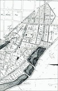
Thomasville is the county seat of Thomas County, Georgia, United States. The population was 18,413 at the 2010 United States Census, making it the second largest city in southwest Georgia after Albany.

Buckhead is the uptown commercial and residential district of the city of Atlanta, Georgia, comprising approximately the northernmost fifth of the city. Buckhead is the third largest business district within the Atlanta city limits, behind Downtown and Midtown, a major commercial and financial center of the Southeast.

Grant Park refers to the oldest city park in Atlanta, Georgia, United States, as well as the Victorian neighborhood surrounding it.
The Neighborhood Planning Unit is a neighborhood-scale governmental structure used in the city of Atlanta, Georgia.

State Route 3 (SR 3) is a 351-mile-long (565 km) state highway that travels south-to-north through portions of the western part of the U.S. state of Georgia, roughly paralleling Interstate 75 (I-75). The highway travels from its southern terminus at the Florida state line, where SR 3 and SR 300 both reach their southern terminus, concurrent with US 19. Here, US 19 travels concurrent with State Road 57, 12 miles (19 km) south-southeast of Thomasville. SR 3 travels through portions of Thomas, Mitchell, Dougherty, Lee, Sumter, Schley, Taylor, Upson, Pike, Spalding, Henry, Clayton, Fulton, Cobb, Bartow, Gordon, Whitfield, and Catoosa counties to its northern terminus at the Tennessee state line, in East Ridge, where US 41/US 76 continue, concurrent with State Route 8. It travels through Thomasville, Albany, Griffin, Atlanta, Calhoun, and Dalton.

Cascade Heights is an affluent neighborhood in southwest Atlanta. It is bisected by Cascade Road, which was known as the Sandtown Road in the nineteenth century. The road follows the path of the ancient Sandtown Trail which ran from Stone Mountain to the Creek village of Sandtown on the Chattahoochee River and from there on into Alabama. Ironically, the name lived on even after the Indians were expelled in the 1830s.

The Atlanta, Birmingham and Coast Railroad was organized in 1926 to replace the Atlanta, Birmingham and Atlantic Railway. The AB&C was controlled by the Atlantic Coast Line Railroad, which owned a majority of the stock. In 1944 it reported 763 million net ton-miles of revenue freight and 33 million passenger-miles; at the end of that year it operated 639 miles of road and 836 miles of track.

State Route 300, is a 107-mile-long (172 km) state highway in the southern part of the U.S. state of Georgia. Its southern terminus is at the Florida state line south-southeast of Thomasville, where the roadway continues as US 19/SR 57. This is also the southern terminus of SR 3, with which US 19 and SR 300 travel concurrently through the southern part of the state. Its northern terminus is at Interstate 75 (I-75) in Cordele.

Historic Collier Heights is a neighborhood in the northwest corner of Atlanta, Georgia. It is bordered to the west by Fairburn Road, the east by Hamilton E. Holmes Drive, the north by Donald L. Hollowell Parkway, and to the south by Interstate 20 bridge at Linkwood Road. It is one of the first communities in the nation built exclusively by African-American planners for the upcoming Atlanta African-American middle class and has been featured in several national publications such as Ebony and Jet magazines, as well as featured in the "Homefinder" section of the Atlanta Journal-Constitution. Since 2009, the community has been listed on the United States National Register of Historic Places. The community achieved local historic designation in June 2013.
Piedmont Heights is an intown neighborhood on the east side of Atlanta, Georgia, founded in the early 20th century as a streetcar suburb. It is located between the BeltLine on the west; across from the Sherwood Forest neighborhood; I-85 on the north, across from an industrial area ; and Piedmont Avenue/Road and Morningside-Lenox Park on the east.

Chosewood Park is a neighborhood in southeast Atlanta, Georgia in the United States. It is located south of Peoplestown and Grant Park, west of Boulevard Heights and Benteen Park, northwest of Thomasville Heights and the Atlanta federal penitentiary, and northeast of South Atlanta and Lakewood Heights. It is situated directly on the path of the Atlanta Beltline, which has begun to acquire and develop properties along the rail lines in the Chosewood corridor, including the Boulevard Crossing Park.

Lakewood Heights is a Black neighborhood in southeast Atlanta. It is bounded by:
Copenhill, Copenhill Park, or Copen Hill was a neighborhood of Atlanta, Georgia which was located largely where the Carter Center now sits, and which now forms part of the Poncey-Highland neighborhood.
Benteen Park is a neighborhood in southeast Atlanta, Georgia, bounded on the west by Boulevard and the Chosewood Park neighborhood, on the north by Boulevard Heights, on the east by Custer/McDonough/Gulce and on the south by Atlanta Federal Prison, which also lies in the Benteen Park neighborhood.
Lenox Park is a neighborhood of homes and office buildings located primarily within the city of Brookhaven, Georgia, just east of the northern border of the city of Atlanta.
Joyland is a neighborhood of small, single family homes in southeast Atlanta, Georgia and site of a former 1921 amusement park built for African Americans.
Carey Park is a neighborhood on the Upper Westside of Atlanta with a population of 1,739.
Ashview Heights is a historic intown neighborhood located in southwest Atlanta, Georgia, United States. Established in the 1920s, it was one of the first planned African-American middle-class communities in Atlanta. The neighborhood is served by Booker T. Washington High School, which is Atlanta’s first African American high school and is listed on the National Register of Historic Places. The neighborhood is in close proximity to the Atlanta University Center.
Thomasville Heights was a 350-unit public housing project in Atlanta, Georgia, built in 1967, demolished in 2010, and the remainder of the Thomasville community which is section-8 housing Forest Cove Apartments(also known as Villa Monte aka 4 Season) is also scheduled to be demolished. Forest Cove was constructed in 1971 with 404 units originally owned by the Atlanta Housing Authority. Like all of atlanta other housing projects it deteriorated and became very dangerous throughout the late 70s,80s and 90s. After being scheduled to be demolished in 1999, a private investor bought and made plans to renovate turning the community into a section8 housing project which are one of the main reasons they still exist today. Still to this day it remains one of the most dangerous housing project Atlanta has left. The project made national headlines in the 1970s and 1980s with the child abduction cases and the murder of Officer Johantgen.

Atlanta's Berlin Wall, also known as the Peyton Road Affair or the Peyton Wall, refers to an event during the civil rights movement in Atlanta, Georgia, United States, in 1962. On December 17 of that year, the government of Atlanta, led by Atlanta mayor Ivan Allen Jr., erected a barricade in the Cascade Heights neighborhood, mostly along Peyton Road, for the purposes of dissuading African Americans from moving into the neighborhood. The act was criticized by many African American leaders and civil rights groups in the city, and on March 1 of the following year the barricade was ruled unconstitutional and removed. The incident is seen as one of the most public examples of white Americans fears of racial integration in Atlanta.
