Edgecumbe is a town in the Bay of Plenty of the North Island of New Zealand, 15 kilometres to the west of Whakatane and eight kilometres south of the Bay's coast.

Hauraki District is a territorial authority within the Waikato Region of New Zealand. The seat of the council is at Paeroa.

Western Bay of Plenty District is a territorial authority within the Bay of Plenty Region of New Zealand. The district envelops Tauranga City by land, and includes Matakana Island, at the entrance to Tauranga Harbour.
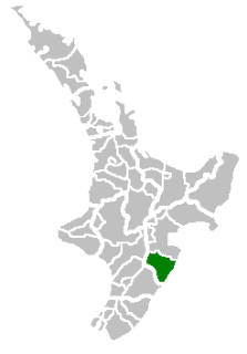
Central Hawke's Bay District is part of the Hawke's Bay Region in the North Island of New Zealand. It has an area of 3,327.92 square kilometres with a population of 14,150. It had a population of 12,717 people as of the 2013 census. This is a decrease of 237 people, or 1.8 percent, since the 2006 Census. It covers the area from Pukehou in the north to Takapau in the south, and from the western Ruahine Range to the Pacific coast in the east.

Ohope Beach is a beach in the eastern Bay of Plenty, on the northeast coast of the North Island of New Zealand, six kilometres east and over the hill, from Whakatane.
Murupara is a town located in the North Island of New Zealand. The town is situated in an isolated part of the Bay of Plenty region between the Kaingaroa Forest and Te Urewera National Park, on the banks of the Rangitaiki River, 65 kilometres southeast of Rotorua, along SH38. Murupara is the terminus of the Murupara Branch railway. Its principal industries are all related to forestry. The name Murupara means "to wipe off mud".

Waihi Beach is a coastal town at the western end of the Bay of Plenty in New Zealand's North Island. It lies 10 kilometres to the east of the town of Waihi, at the foot of the Coromandel Peninsula. The main beach itself extends approximately 10 kilometres. The town had a permanent population of 1773 as of 2006, but that increases to 16,000 in summer.

Matata is a town located in the North Island of New Zealand. The town is 24 kilometres (15 mi) to the north-west of Whakatane. The population of Matata in the 2013 census was 642.
The Taupo District Council is a territorial authority that administers the Taupo District in the Central North Island of New Zealand. The district stretches from the small town of Mangakino in the northwest to the Tongariro National Park in the south, and east into the Kaingaroa Forest, covering 6,970 km2. It had a population of 37,200 as of the June 2018.
Te Kaha is a small New Zealand community situated in the Bay of Plenty near Opotiki. It has a population of about 387, up from 306 in 2006. Approximately 85% of whom are of Māori descent.
Oropi is a rural district located in the Bay of Plenty region of the North Island of New Zealand. It is located 20 kilometres south of Tauranga and 43 kilometres north of Rotorua. It has been suggested that the word Oropi is the Māori language equivalent of Europe. This is derived from the 1860s when government forces were based in the area at the time of the Battle of Gate Pā.

Taneatua is a small town in the Bay of Plenty region of New Zealand's North Island. The town is located southeast of Pekatahi, a similarly small settlement; Whakatane is the nearest significantly sized town. Just to the southwest of Taneatua, the Whakatane River and Waimana Rivers meet. The Whakatane River itself flows to the west of Taneatua, while the Waimana River is south of the township.
Awakeri is a village located southwest of Whakatane in the Bay of Plenty region of New Zealand's North Island. It is located in a farming and fruit-growing area, has basic amenities and a primary school for students aged 5 to 13, and is best known for nearby hot springs.
Te Teko is a small inland township in the Bay of Plenty region of New Zealand's North Island. According to the 2006 New Zealand census, its population is 627, a decrease of 3 from the previous census in 2001.
Pikowai is a rural community located near the beach on the shoreline of the Eastern Bay of Plenty in the North Island of New Zealand. Pikowai is located 34 km southeast of Te Puke and 10 kilometres northwest of Matata. It is said to be a place where the Mataatua Canoe made landfall on its journey along the coast from Tauranga. Known for its fishing, the beach itself is well used for surf casting.
Galatea is a settlement in the Whakatane district in the Bay of Plenty region of the North Island of New Zealand.

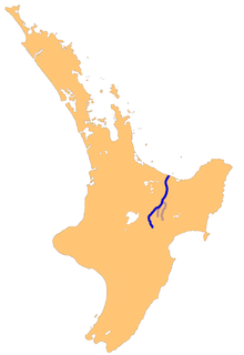
The Bay of Plenty is a large bight in the northern coast of New Zealand's North Island. It stretches from the Coromandel Peninsula in the west to Cape Runaway in the east, a wide stretch of some 259 km of open coastline. The Bay of Plenty Region is situated around this body of water, also incorporating several large islands in the bay. The bay was named by James Cook after he noticed the abundant food supplies at several Māori villages there, in stark contrast to the earlier observations he had made in Poverty Bay.
Ruatoki is a locality in the Bay of Plenty Region of New Zealand. It is located at the base of the Urewera Valley, approximately 20 km south of Whakatane. The predominantly Māori community of approximately 600 people affiliate with the Tūhoe iwi, with at least ten marae located in the area. Ruatoki was one of the main sites involved in the 2007 New Zealand anti-terror raids, conducted under the Terrorism Suppression Act 2002.

Pukehina is a township located in the Bay of Plenty, New Zealand, which consists of a white sandy beach, an estuary, farms and residential houses. Activities that take place there are surfing, windsurfing, kite surfing, boating and farming. There is a campground located at the south-eastern end of the beach. Further to the south-east there is an extensive area of Māori land, which is not part of Pukehina Beach itself.