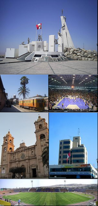
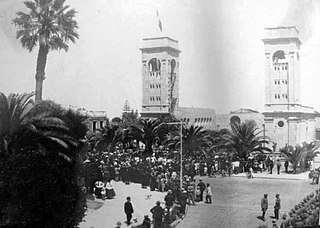
Tacna, officially known as San Pedro de Tacna, is a city in southern Peru and the regional capital of the Tacna Region. A very commercially active city, it is located only 35 km (22 mi) north of the border with Arica y Parinacota Region from Chile, inland from the Pacific Ocean and in the valley of the Caplina River. It is Peru's tenth most populous city.

Tacna is the southernmost department and region in Peru. The Chilean Army occupied the present-day Tacna Department during the War of the Pacific from 1885 until 1929 when it was reincorporated into Peru.

Tacna is the largest of four provinces in the Department of Tacna in southern Peru located on the border with Chile and Bolivia. Its capital is Tacna.
Tarata is a city in the Tacna Region in southern Peru. It is the capital of Tarata District and Tarata Province.

Sama District is one of eleven districts that make up Tacna Province, located in the department of Tacna, under the administration of the Regional Government of Tacna, in southern Peru. In 2017 it had a population of 3,106 inhabitants and a population density of 2.89 per km². It covers a total area of 1,116 km².

Ticaco District is one of eight districts of the Tarata province in Peru.

Tarapacá was a Department of Peru, which existed between 1878 and 1884, when it was unconditionally ceded to Chile after the War of the Pacific under the Treaty of Ancón.

The Chilean occupation of Peru began on November 2, 1879, with the beginning of the Tarapacá campaign during the War of the Pacific. The Chilean Army successfully defeated the Peruvian Army and occupied the southern Peruvian territories of Tarapacá, Arica and Tacna. By January 1881, the Chilean army had reached Lima, and on January 17 of the same year, the occupation of Lima began.
The Chilenization of Tacna, Arica, and Tarapacá was a process of forced transculturation or acculturation in the areas which were invaded and incorporated by Chile since the War of the Pacific (1879–1883). The aim of the Chilenization was to create a dominance of Chilean traditions and culture in that region, in preference to those of the Peruvian population. The British desire to reunite all saltpeter mines under one political administration was also a major factor that influenced the outcome of the war.

The Mar de Grau is the official name for the body of water in the Pacific Ocean under the control of the South American country of Peru. This body of water extends in length approximately 3,079.50 km, from the parallel of the Boca de Capones in northern Peru to the parallel of the Punto Concordia and the parallel in front of the city of Tacna in southern Peru. In terms of width, the maritime zone extends from the Peruvian coast to 200 nautical miles into the Pacific Ocean.

Wallatiri is a mountain in the northwestern extensions of the Barroso mountain range in the Andes of Peru, about 4,600 metres (15,092 ft) high. It is situated in the Tacna Region, Tarata Province, Tarata District.
The Tacna Province was a territorial division of Chile that existed between 1884 and 1929. It was ceded by the Treaty of Ancón in 1883 and placed under military administration, and then created on 31 October 1884, incorporating the former Peruvian provinces of Tacna and Arica of the also former Tacna Department, as well as a contested claim over Tarata, and was returned to Peru at midnight on 28 August 1929, under the terms agreed upon in the Treaty of Lima of the same year.
The Tacna Department was a territorial division of Chile that existed between 1884 and 1929. It was ceded by the Treaty of Ancón in 1883 and placed under military administration, and then created on the 31st of October 1884, as one of the three departments of the Tacna Province, incorporating as well a disputed claim over Tarata, and was returned to Peru at midnight on the 28th of August 1929, under the terms agreed upon in the Treaty of Lima of the same year.
The Tarata Department was a territorial division of Chile that existed between 1911 and 1921. Its territory comprised some controversial territory east of Sama River.
The Arica Department was a territorial division of Chile that existed between 1884 and 1929. It was ceded by the Treaty of Ancón in 1883 and placed under military administration, and then created on the 31st of October 1884, as one of the three departments of the Tacna Province, and was returned to Peru at midnight on the 28th of August 1929, under the terms agreed upon in the Treaty of Lima of the same year.
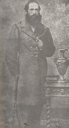
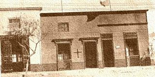
Gregorio Albarracín Lanchipa was a Peruvian Colonel and War Hero who participated in the Peruvian-Bolivian War of 1841-1842, the Peruvian Civil War of 1843–1844, the Peruvian Civil War of 1856–1858 and the War of the Pacific. He is known as El Centauro de las Vilcas as he was notable for using a vilca, a typical tree from Tacna, as a pole to raise the Peruvian flag during the Chilean administration of the area.
The handover of Tacna from Chile to Peru took place on August 28, 1929. The event ended 49 years of Chilean rule over its then newest province, which began in 1880 after the Bolivian–Peruvian defeat at the Battle of Tacna against the Chilean Army during the War of the Pacific.
The Battle of Buenavista was a battle of the Tacna and Arica campaign of the War of the Pacific on April 18, 1880, between a Chilean cavalry detachment led by Commander José Francisco Vergara, and the forces of Colonel Gregorio Albarracín in the Sama River, Tacna Province, Peru.

The Chilean–Peruvian territorial dispute is a territorial dispute between Chile and Peru that started in the aftermath of the War of the Pacific and ended significantly in 1929 with the signing of the Treaty of Lima and in 2014 with a ruling by the International Court of Justice. The dispute applies since 2014 to a 37,610 km2 territory in the Chile–Peru border, as a result of the maritime dispute between both states.
Sama River is a river on the Pacific slope, located on the southern coast of Peru, in the department of Tacna. It is born in the Cotanvilque lagoon located in the Andean peaks south of the western mountain range of the Peruvian Andes in the province of Tarata, between the Contanvilque and Cauchina hills, and runs from east to west crossing the coastal desert of Peru to its mouth in the Mar de Grau, located in the province of Tacna.
