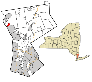
Crugers is a hamlet and census-designated place (CDP) located in the town of Cortlandt, Westchester County, New York. The population was 1,534 at the 2010 census.

Guarenas is a city in Miranda, Venezuela. It was established in 1621 as Nuestra Señora de Copacabana de los Guarenas. It is part of the Guarenas-Guatire conurbation

The Vinton Street Commercial Historic District is located along Vinton Street between Elm Street on the west and South 17th Street on the east in south Omaha, Nebraska. This district is located adjacent to Sheelytown, a residential neighborhood that had historically significant populations of Irish, Poles, and Eastern European immigrants. It grew along with the success of the Union Stockyards and South Omaha. It was added to the National Register of Historic Places in 2006.

La Torre is a municipality composed of the following districts, Balbarda, Blacha, Guareña, Oco and Sanchicorto located in the province of Ávila, Castile and León, Spain. According to the 2004 census (INE), the municipality has a population of 357 inhabitants.

Castrillo de la Guareña is a municipality located in the province of Zamora, Castile and León, Spain.
La Hiniesta, 7 km from the capital, Zamora, of currently belongs to the province of the same name in the Comunidad Autónoma de Castilla-León in Spain. Uts population was 364 inhabitants. Its major attraction is the Iglesia de Santa María, a church that King Sancho IV of Leon ordered built in the honor of the Virgin, who appeared to him in una cacería entre unas hiniestas o retamas, from whence it gets its more frequently-used name, Virgen de la Hiniesta. Among its products más destacados, están los Quesos, de una exquisite purity, of both natural and artisanal manufacture.
San Cebrián de Castro is a municipality located in the province of Zamora, Castile and León, Spain. According to the 2004 census (INE), the municipality has a population of 337 inhabitants.

Tábara is a municipality located in the province of Zamora, Castile and León, Spain. According to the 2004 census (INE), the municipality has a population of 950 inhabitants. Tábara is the capital of the Tierra de Tábara comarca.

Vadillo de la Guareña is a municipality located in the province of Zamora, Castile and León, Spain.
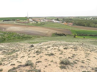
Vallesa de la Guareña is a municipality located in the province of Zamora, Castile and León, Spain. According to the 2015 census (INE), the municipality has a population of 106 inhabitants.

Villalpando is a municipality located in the province of Zamora, Castile and León, Spain. According to the 2004 census (INE), the municipality has a population of 1,624 inhabitants.

San Pelayo de Guareña is a municipality located in the province of Salamanca, Castile and León, Spain. As of 2016 the municipality has a population of 99 inhabitants.

Tarazona de Guareña is a municipality located in the province of Salamanca, Castile and León, Spain. As of 2016 the municipality has a population of 330 inhabitants.
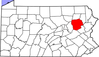
Waterton is an unincorporated community in Huntington Township, Luzerne County, Pennsylvania, United States. It lies between the boroughs of New Columbus and Shickshinny.

The Cathedral of Our Lady of the Assumption also called Santarém Cathedral formerly known as Church of Our Lady of Conception, is located in the historic center of Santarém, more precisely in the parish of São Salvador in Portugal.
Swartzville is a census-designated place located in East Cocalico Township in Lancaster County in the state of Pennsylvania. It is located at the intersections of Pennsylvania Routes 272 and 897 between the borough of Adamstown and the community of Reamstown. As of the 2010 census the population was 2,283 residents.
Villaverde de Guareña is a municipality located in the province of Salamanca, Castile and León, Spain.
Division No. 1, Subdivision C is an unorganized subdivision on the Avalon Peninsula in Newfoundland and Labrador, Canada. It is in Division 1 and contains the unincorporated communities of Cape St. Mary's, Cuslett, Gooseberry Cove, Great Barasway, Lears Cove, Patrick's Cove-Angels Cove, Ship Cove and Stoney House.
Mount Olive is an unincorporated community in Clermont County, in the U.S. state of Ohio.

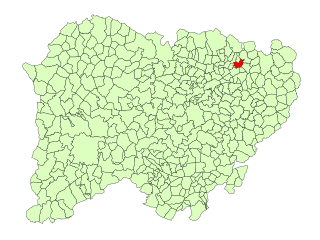
Ojo Guareña is a karst complex located in the Cantabrian Mountains of Castile and Leon, Spain, declared a natural monument by the government of Castile and Leon in 1996. It is composed of over 90 kilometres (56 mi) of galleries and passages within an area of some 13,850 hectares. The limestone formation containing the system is approximately 100 metres (330 ft) thick and sits on a massive water-resistant layer of marl. The caves were formed in the limestone by erosion sometime within the Coniacian Age. Ojo Guareña was considered the greatest karst system of the Iberian Peninsula until 2009, when a significant length of new passages was discovered in the Mortillano system.


