Related Research Articles

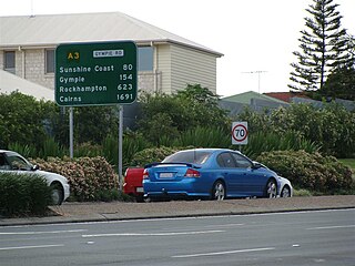
Gympie is a city and a locality in the Gympie Region, Queensland, Australia. In the Wide Bay-Burnett District, Gympie is about 170.7 kilometres (110 mi) north of the state capital, Brisbane. The city lies on the Mary River, which floods Gympie occasionally. Gympie is the administrative centre for the Gympie Region area. As of June 2018 Gympie had a population of 51,578.

Gympie North railway station is located on the North Coast line in Queensland, Australia. It serves the town of Gympie.

Kandanga Creek is a rural locality in the Gympie Region, Queensland, Australia. In the 2016 census Kandanga Creek had a population of 118 people.
The Shire of Cooloola was a local government area located about 170 kilometres (106 mi) north of Brisbane – the state capital of Queensland, Australia. The shire covered an area of 2,968.8 square kilometres (1,146.3 sq mi), and was the product of a merger in 1993 between the City of Gympie and the Shire of Widgee, which had both existed since 1879–1880. It merged with several other LGAs to form the Gympie Region on 15 March 2008.
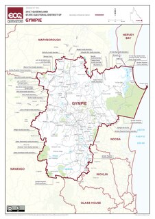
Gympie is an electoral district of the Legislative Assembly in the Australian state of Queensland The electorate is centred on the city of Gympie and stretches north to Rainbow Beach and as far south to Pomona.

Tin Can Bay is a coastal town and locality in the Wide Bay–Burnett region in Queensland, Australia. The locality is split between the Fraser Coast Region and the Gympie Region, but the town itself is within Gympie Region. In the 2016 census, Tin Can Bay had a population of 2,242 people.
Gympie Road is a major road in the northern suburbs of Brisbane, Queensland, Australia. The road forms part of the main road route from the Brisbane Central Business District (CBD) to the northern suburbs, Sunshine Coast and east coast of Queensland.

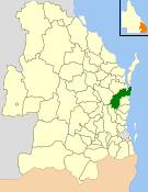
The Gympie Region is a local government area in the Wide Bay–Burnett region of Queensland, Australia, about 170 kilometres (110 mi) north of Brisbane, the state capital. It is between the Sunshine Coast and Hervey Bay and centred on the town of Gympie. It was created in 2008 from a merger of the Shires of Cooloola and Kilkivan and part of the Shire of Tiaro.
Veteran is a rural residential locality in the Gympie Region, Queensland, Australia. In the 2016 census Veteran had a population of 892 people.
Victory Heights is a rural residential locality in the Gympie Region, Queensland, Australia. In the 2016 census Victory Heights had a population of 555 people.

Monkland is a rural locality in the Gympie Region, Queensland, Australia. In the 2016 census Monkland had a population of 1,125 people.
Southside is a semi-rural locality in the Gympie Region, Queensland, Australia. In the 2016 census, Southside had a population of 5,737 people.
Glanmire is an urban industrial locality in Gympie in the Gympie Region, Queensland, Australia. In the 2016 census, Glanmire had a population of 20 people.
Kybong is a rural locality in the Gympie Region, Queensland, Australia. In the 2016 census, Kybong had a population of 333 people.

The Gympie Times was a daily newspaper serving Gympie in Queensland, Australia. The newspaper is owned by News Corp Australia and was published from Monday to Saturday but ceased printed publication in June of 2020. The final printed edition was on Saturday 26 June, 2020. The Gympie Times remains an online only news source.

Gympie Airport is located approximately 12 km (7.5 mi) south of the town centre. The airport serves as a small regional airport serving the local area.

The City of Gympie is a former local government area in the south-east of Queensland, Australia, responsible for governing Gympie.
The Shire of Widgee is a former local government area in the Wide Bay–Burnett area of Queensland, Australia. It was located in the rural areas around the town of Gympie but did not include the town itself, which was always in a separate local government area. The administrative offices of the Shire of Widgee were located in Gympie.
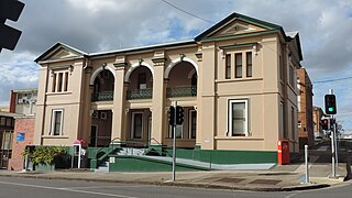
The Old Gympie Post Office is a heritage-listed former post office at 22 Channon Street, Gympie, Gympie Region, Queensland, Australia. It was designed by Francis Drummond Greville Stanley and built from 1878 to 1880 by Andrew Collins. It is also known as My Country. It was added to the Queensland Heritage Register on 21 October 1992.
Neerdie is a rural locality split between the Gympie Region and the Fraser Coast Region, both in Queensland, Australia. In the 2016 census, Neerdie had a population of 109 people.
References
| | This bromeliad article is a stub. You can help Wikipedia by expanding it. |