The Neman, Nemunas, Nyoman, Niemen or Memel, is a major Eastern European river. It rises in Belarus and flows through Lithuania before draining into the Curonian Lagoon, and then into the Baltic Sea at Rusnė Island. It begins at the confluence of two smaller tributaries, about 15 kilometers (9 mi) southwest of the town of Uzda in central Belarus, and about 55 km (34 mi) southwest of Minsk. In its lower reaches it forms the border between Lithuania and Russia's Kaliningrad Oblast. It also, very briefly, forms part of the Belarus–Lithuania border. The largest river in Lithuania, and the third-largest in Belarus, the Neman is navigable for most of its 900 km (560 mi) length.

The River Sheaf is a river in Sheffield, South Yorkshire, England. Its source is the union of the Totley Brook and the Old Hay Brook in Totley, now a suburb of Sheffield. It flows northwards, past Dore, through the valley called Abbeydale and north of Heeley. It then passes into a culvert, through which it flows under the centre of Sheffield emerging just once before joining the River Don near Blonk Street Bridge. This lower section of the River Sheaf together with the River Don, between the present Blonk Street and Lady's Bridges, formed two sides of the boundary of Sheffield Castle.

Ostróda is a town in Ostróda County in the Warmian-Masurian Voivodeship in Poland, with 33,191 inhabitants as of December 31, 2009.
Mill Creek or Millcreek may refer to:

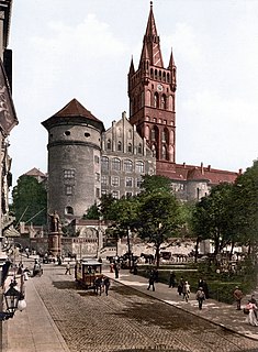
Lithuania Minor or Prussian Lithuania is a historical ethnographic region of Prussia, later East Prussia in Germany, where Prussian Lithuanians or Lietuvininkai lived. Lithuania Minor enclosed the northern part of this province and got its name due to the territory's substantial Lithuanian-speaking population. Prior to the invasion of the Teutonic Knights in the 13th century, the main part of the territory later known as Lithuania Minor was inhabited by the tribes of Skalvians and Nadruvians. The land became depopulated to some extent during the warfare between Lithuania and the Order. The war ended with the Treaty of Melno and the land was resettled by Lithuanian newcomers, returning refugees, and the remaining indigenous Baltic peoples; the term Lithuania Minor appeared for the first time between 1517 and 1526. With the exception of the Klaipėda Region, which became a mandated territory of the League of Nations in 1920 by the Treaty of Versailles and was annexed to Lithuania from 1923 to 1939, the area was part of Prussia until 1945. Today a small portion of Lithuania Minor is within the borders of modern Lithuania and Poland while most of the territory is part of the Kaliningrad Oblast of Russia.

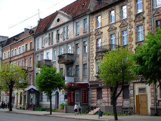
Neman, prior to 1946 known by its German name Ragnit, is a town and the administrative center of Nemansky District in Kaliningrad Oblast, Russia, located in the historic East Prussia, on the steep southern bank of the Neman River, where it forms the Russian border with the Klaipėda Region in Lithuania, and 130 kilometers (81 mi) northeast of Kaliningrad, the administrative center of the oblast. Population: 11,798 (2010 Census); 12,714 (2002 Census); 13,821 (1989 Census).

The Polish–Lithuanian–Teutonic War or Great War occurred between 1409 and 1411, pitting the allied Kingdom of Poland and Grand Duchy of Lithuania against the Teutonic Knights. Inspired by the local Samogitian uprising, the war began by Teutonic invasion of Poland in August 1409. As neither side was ready for a full-scale war, Wenceslaus IV of Bohemia brokered a nine-month truce. After the truce expired in June 1410, the military-religious monks were decisively defeated in the Battle of Grunwald (Tannenberg), one of the largest battles in medieval Europe. Most of the Teutonic leadership was killed or taken prisoner. While defeated, the Teutonic Knights withstood the siege on their capital in Marienburg (Malbork) and suffered only minimal territorial losses in the Peace of Thorn (1411). Territorial disputes lasted until the Peace of Melno of 1422. However, the Knights never recovered their former power and the financial burden of war reparations caused internal conflicts and economic decline in their lands. The war shifted the balance of power in Central Europe and marked the rise of the Polish–Lithuanian union as the dominant power in the region.

Geldern is a city in the federal German state of North Rhine-Westphalia. It is part of the district of Cleves, which is part of the Düsseldorf administrative region.
Pagėgiai is a city in the south western Lithuania. It is located in the region of the former Prussian tribe of Skalvians. It is the capital of Pagėgiai municipality, and as such it is part of Tauragė County.
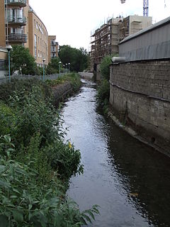
The River Camac is one of the larger rivers in Dublin and was one of four tributaries of the Liffey critical to the early development of the city.

Evitts Creek is a tributary stream of the North Branch Potomac River in the U.S. states of Pennsylvania and Maryland. The confluence of Evitts Creek and the North Branch Potomac River is located 2 miles (3 km) east of Cumberland, Maryland.

Dubysa, at 131 km, is the 15th longest river solely in Lithuania. It originates just a few kilometers from Lake Rėkyva near Šiauliai city. At first it flows south, but at Lyduvėnai turns southeast and near Ariogala - southwest. Dubysa is a Samogitian river. The first few kilometres of Dybysa are also known as Genupis or Šventupis.
The Hunger War or Famine War was a brief conflict between the allied Kingdom of Poland, and Grand Duchy of Lithuania, against the Teutonic Knights in summer 1414 in an attempt to resolve territorial disputes. The war earned its name from destructive scorched earth tactics followed by both sides. While the conflict ended without any major political results, famine and plague swept through Prussia. According to Johann von Posilge, 86 knights of the Teutonic Order died from plague following the war. In comparison, about more than 200 knights perished in the Battle of Grunwald of 1410, one of the biggest battles in medieval Europe.

Rimburg is a village in the Dutch province of Limburg. It is located in the municipality of Landgraaf, on the German border.
The River Slang, also known as the Dundrum Slang or the Dundrum River, a tributary of the River Dodder, is a stream which rises on Three Rock Mountain, County Dublin. It is in the jurisdiction of Dun Laoghaire-Rathdown County Council.

The Schönebecker Aue is a geest stream in Bremen and Lower Saxony, Germany.
The Eckbach is a small river in the northeastern Palatinate and the southeastern Rhenish Hesse. It is slightly over 39 kilometres (24 mi) long.

The Eisbach, locally known as die Eis, is a 38-kilometre (24 mi) long river and left or western tributary of the Rhine in the northeastern Palatinate and southeastern Rhenish Hesse, in the German state of Rhineland-Palatinate.

Mill Pond Park is a public park in the Bronx, New York City. It was built to compensate for the loss of parkland resulting from the construction of new Yankee Stadium between 2006 and 2009. The park’s name was inspired by a dam near the site of a creek that emptied into the Harlem River.