Chernyakhovsk Черняховск | |
---|---|
![]() In Chernyakhovsk | |
Coordinates: 54°38′05″N21°48′43″E / 54.63472°N 21.81194°E Coordinates: 54°38′05″N21°48′43″E / 54.63472°N 21.81194°E | |
Country | Russia |
Federal subject | Kaliningrad Oblast [1] |
Administrative district | Chernyakhovsky District [1] |
Town of district significance | Chernyakhovsk [1] |
Founded | 1337 [2] |
Town status since | 10 October 1583 |
Area | |
• Total | 58 km2 (22 sq mi) |
Elevation | 30 m (100 ft) |
Population | |
• Estimate (2018) [3] | 35,888 |
• Density | 628/km2 (1,630/sq mi) |
• Capital of | Chernyakhovsky District [1] , town of district significance of Chernyakhovsk [1] |
• Municipal district | Chernyakhovsky Municipal District [4] |
• Urban settlement | Chernyakhovskoye Urban Settlement [4] |
• Capital of | Chernyakhovsky Municipal District [4] , Chernyakhovskoye Urban Settlement [4] |
Time zone | UTC+2 (MSK–1 ![]() |
Postal code(s) [6] | 238150–238154, 238158, 238165, 238169, 238170, 238816 |
Dialing code(s) | +7 40141 |
OKTMO ID | 27739000001 |
Website | inster39 |
Chernyakhovsk (Russian : Черняхо́вск) – known prior to 1946 by its German name of
Chernyakhovsk was founded in 1336 by the Teutonic Knights on the site of a former Old Prussian fortification when Dietrich von Altenburg, the Grand Master of the Teutonic Knights, built a castle called Insterburg following the Prussian Crusade. [2] During the Teutonic Knights' Northern Crusades campaign against the Grand Duchy of Lithuania, the town was devastated in 1376 and then again by Polish troops in 1457. The castle had been rebuilt as the seat of a Procurator and a settlement also named Insterburg grew up to serve it.
When the Prussian Duke Albert of Brandenburg-Ansbach in 1525 secularized the monastic State of the Teutonic Order, Insterburg became part of the Duchy of Prussia and was granted town privileges on 10 October 1583 by the Prussian regent Margrave George Frederick.[ citation needed ] Insterburg became part of the Kingdom of Prussia in 1701, and because the area had been depopulated by plague in the early 18th century, King Frederick William I of Prussia invited Protestant refugees who had been expelled from the Archbishopric of Salzburg to settle in Insterburg in 1732.
In 1818, after the Napoleonic Wars, the town became the seat of Insterburg District within the Gumbinnen Region. Michael Andreas Barclay de Tolly died at Insterburg in 1818 on his way from his Livonian manor to Germany, where he wanted to renew his health. In 1863, a Polish secret organization was founded and operated in Insterburg, which was involved in arms trafficking to the Russian Partition of Poland during the January Uprising. Since May 1864, the leader of the organization was Józef Racewicz.
Insterburg became a part of the German Empire following the 1871 unification of Germany, and on May 1, 1901, it became an independent city separate from Insterburg District. During World War I the Russian Army seized Insterburg on 24 August 1914, but it was retaken by Germany on 11 September 1914. The Weimar Germany era after World War I saw the town separated from the rest of the country as the province of East Prussia had become an exclave. The association football club Yorck Boyen Insterburg was formed in 1921. During World War II, Insterburg was heavily bombed by the British Royal Air Force on July 27, 1944. The town was stormed by Red Army troops on January 21–22, 1945. As part of the northern part of East Prussia, Insterburg was transferred from Germany to the Soviet Union after the war as previously agreed between the victorious powers at the Potsdam Conference. The German population was either evacuated or expelled and replaced with Russians. On 7 April 1946, Insterburg was renamed as Chernyakhovsk in honor of the Soviet World War II Army General, Ivan Chernyakhovsky, who commanded the army that first entered East Prussia in 1944. [2]
After 1989, a group of people introduced the Akhal-Teke horse breed to the area and opened an Akhal-Teke breeding stable.
Within the framework of administrative divisions, Chernyakhovsk serves as the administrative center of Chernyakhovsky District. [1] As an administrative division, it is, together with five rural localities, incorporated within Chernyakhovsky District as the town of district significance of Chernyakhovsk. [1] As a municipal division, the town of district significance of Chernyakhovsk is incorporated within Chernyakhovsky Municipal District as Chernyakhovskoye Urban Settlement. [4]
Year | Number |
---|---|
1790 | 4,972, without military [8] |
1875 | 16,303 [9] |
1880 | 18,745 [9] |
1885 | 22,227 [9] |
1890 | 31,624, incl. 437 Catholics and 348 Jews [9] |
1900 | 27,787, incl. 788 Catholics and 350 Jews [10] |
1910 | 31,624, incl. 29,672 Protestants and 1,040 Catholics [9] |
1925 | 39,311, incl. 36,792 Protestants, 1,174 Catholics, 86 other Christians, and 338 Jews [9] |
1933 | 41,230, incl. 39,458 Protestants, 1,078 Catholics, five other Christians, and 273 Jews [9] |
1939 | 43,620, incl. 40,677 Protestants, 1,388 Catholics, 563 other Christians, and 87 Jews [9] |
1959 | approx. 29,100[ citation needed ] |
1979 | approx. 35,600[ citation needed ] |
1989 Census | 39,622 [11] |
2002 Census | 44,323 [12] |
2010 Census | 40,449 [13] |
Chernyakhovsk is home to the Chernyakhovsk naval air facility.
On September 2019 the local court ruled [14] that the coat of arms was illegal because it carries "elements of foreign culture." The local court alleged that Russian laws do not allow the use of foreign languages and symbols in Russian state symbols and ordered the town "to remove any violations of the law."
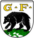
The town's coat of arms, adopted in 2002, was based on the historic coat of arms of the town that before 1946 was known under its original Prussian name - Insterburg.
The full version of coat of arms in question has a picture of a Prussian man with a horn and the Latin initials G.F. for the Regent of Prussia George Frederick, margrave of Brandenburg-Ansbach (1543–1603), who gave Insterburg the status of town and with it his family coat of arms.
The case brought before the court follows a trend among several towns in the region that have announced their intentions to change their coat of arms as tensions mount between Russia and the West following Moscow's annexation of Ukraine's Crimea in 2014 and its support for pro-Russian separatists in Ukraine's east. [14]
Chernyakhovsk is twinned with:
Gusev, previously known by its German name Gumbinnen, is a town and the administrative center of Gusevsky District of Kaliningrad Oblast, Russia, located at the confluence of the Pissa and Krasnaya Rivers, near the border with Poland and Lithuania, east of Chernyakhovsk. Population figures: 28,260 (2010 Census); 28,467 (2002 Census); 27,031 (1989 Census).
Baltiysk, prior to 1946 known by its German name Pillau, is a seaport town and the administrative center of Baltiysky District in Kaliningrad Oblast, Russia, located on the northern part of the Vistula Spit, on the shore of the Strait of Baltiysk separating the Vistula Lagoon from Gdańsk Bay. Population: 32,697 (2010 Census); 33,252 (2002 Census); 27,070 (1989 Census).
Zelenogradsk, prior to 1946 known by its German name Cranz, is a town and the administrative center of Zelenogradsky District in Kaliningrad Oblast, Russia, located 34 kilometers (21 mi) north of Kaliningrad, on the Sambian coastline near the Curonian Spit on the Baltic Sea. Population figures: 13,026 (2010 Census); 12,509 (2002 Census); 10,786 (1989 Census).
Svetlogorsk, prior to 1947 known by its German name Rauschen ), is a coastal resort town and the administrative center of Svetlogorsky District of Kaliningrad Oblast, Russia, located on the coast of the Baltic Sea on the Sambia Peninsula, 39 kilometers (24 mi) northwest of Kaliningrad. Population figures: 10,772 (2010 Census); 10,950 (2002 Census); 11,881 (1989 Census).
Neman, prior to 1946 known by its German name Ragnit, is a town and the administrative center of Nemansky District in Kaliningrad Oblast, Russia, located in the historic East Prussia, on the steep southern bank of the Neman River, where it forms the Russian border with the Klaipėda Region in Lithuania, and 130 kilometers (81 mi) northeast of Kaliningrad, the administrative center of the oblast. Population figures: 11,798 (2010 Census); 12,714 (2002 Census); 13,821 (1989 Census).
Gvardeysk, known prior to 1946 by its German name
Pravdinsk, prior to 1946 known by its German name Friedland is a town and the administrative center of Pravdinsky District in Kaliningrad Oblast, Russia, located on the Lava River, approximately 30 kilometers (19 mi) east of Bagrationovsk and 53 kilometers (33 mi) southeast of Kaliningrad. Population figures: 4,323 (2010 Census); 4,480 (2002 Census); 4,143 (1989 Census).
Bagrationovsk, prior to 1946 known by its German name Preußisch Eylau is a town and the administrative center of Bagrationovsky District in Kaliningrad Oblast, Russia, located 37 kilometers (23 mi) south of Kaliningrad, the administrative center of the oblast. It has a population of 6,400 (2010 Census).
Primorsk, prior to 1946 known by its German name Fischhausen, is a town in Baltiysky District of Kaliningrad Oblast, Russia, located on the Vistula Lagoon.
Ozyorsk, known prior to 1938 by its German name Darkehmen, and from 1938 to 1946 as Angerapp, is a town and the administrative center of Ozyorsky District in Kaliningrad Oblast, Russia, located on the Angrapa River near the border with the Polish Warmian-Masurian Voivodeship, 120 kilometers (75 mi) southeast of Kaliningrad, the administrative center of the oblast. Population: 4,740 (2010 Census); 5,801 (2002 Census); 6,219 (1989 Census).
Polessk, prior to 1946 known by its German name Labiau, is a town and the administrative center of Polessky District in Kaliningrad Oblast, Russia, located 49 kilometers (30 mi) northeast of Kaliningrad, the administrative center of the oblast, at the junction of a main road and a railroad at the Deyma River, shortly before it enters the Curonian Lagoon. Population figures: 7,581 (2010 Census); 7,681 (2002 Census); 6,859 (1989 Census); 4,744 (1885).
Ladushkin, formerly known as Ludwigsort in German, is a town in Kaliningrad Oblast, Russia, located between Kaliningrad and the Polish border. Population figures: 3,787 (2010 Census); 3,796 (2002 Census); 3,108 (1989 Census).
Slavsk, prior to 1946 known by its German name Heinrichswalde, is a town and the administrative center of Slavsky District in the Kaliningrad Oblast, Russia, located 105 kilometers (65 mi) northeast of Kaliningrad. Population figures: 4,614 (2010 Census); 5,172 (2002 Census); 4,682 (1989 Census).
Mamonovo, prior to 1945 known by its German name Heiligenbeil, is a town in Kaliningrad Oblast, Russia. Population figures: 7,761 (2010 Census); 7,393 (2002 Census); 7,816 (1989 Census).
Pionersky is a town in Kaliningrad Oblast, Russia, located along the Baltic Sea on the Sambian Peninsula, between Zelenogradsk and Svetlogorsk. Population figures: 11,016 (2010 Census); 11,816 (2002 Census); 11,635 (1989 Census).
Bagrationovsky District is an administrative district (raion), one of the fifteen in Kaliningrad Oblast, Russia. As a municipal division, it is incorporated as Bagrationovsky Municipal District. It is located in the southwest of the oblast. The area of the district is 1,146 square kilometers (442 sq mi). Its administrative center is the town of Bagrationovsk. Population: 32,352 (2010 Census); 45,672 ; 39,724 (1989 Census). The population of Bagrationovsk accounts for 19.8% of the district's total population.
Chernyakhovsky District is an administrative district (raion), one of the fifteen in Kaliningrad Oblast, Russia. As a municipal division, it is incorporated as Chernyakhovsky Municipal District. It is located in the center of the oblast. The area of the district is 1,285.75 square kilometers (496.43 sq mi). Its administrative center is the town of Chernyakhovsk. Population: 51,936 (2010 Census); 57,521 ; 12,806 (1989 Census). The population of Chernyakhovsk accounts for 77.9% of the district's total population.
Nemansky District is an administrative district (raion), one of the fifteen in Kaliningrad Oblast, Russia. As a municipal division, it is incorporated as Nemansky Municipal District. It is located in the north of the oblast. The area of the district is 699.3 square kilometers (270.0 sq mi). Its administrative center is the town of Neman. Population: 20,132 (2010 Census); 22,536 ; 8,904 (1989 Census). The population of Neman accounts for 58.6% of the district's total population.
Guryevsk, previously known by its German name Neuhausen, is a town and the administrative center of Guryevsky District of Kaliningrad Oblast, Russia, located 7 kilometers (4.3 mi) northeast of Kaliningrad. Population figures: 12,431 (2010 Census); 10,913 (2002 Census); 7,934 (1989 Census).
Nesterov, until 1938 known by its German name Stallupönen and in 1938-1946 as Ebenrode, is a town and the administrative center of Nesterovsky District in Kaliningrad Oblast, Russia, located 140 kilometers (87 mi) east of Kaliningrad, near the Russian-Lithuanian border on the railway connecting Kaliningrad Oblast with Moscow. Population figures: 4,595 (2010 Census); 5,049 (2002 Census); 4,826 (1989 Census).