Pico de São Tomé is the highest mountain in São Tomé and Príncipe at 2,024 m (6,640 ft) elevation. It lies just west of the centre of São Tomé Island, in the Parque Natural Obô de São Tomé and in the Lembá District. The second highest point, Pico de Ana Chaves, lies about 3 km to its south east. The town Santa Catarina is 8 km to the west.

Ilhéu das Rolas is an islet in the African island nation of São Tomé and Príncipe. The island lies on the equator, off the southern tip of São Tomé Island, separated by Canal das Rolas. Its maximum elevation is 96 m. Its population is 76. It is part of the Caué District. Access is only by ferry departing from Ponta Baleia on São Tomé Island. There is a lighthouse on the islet, built in 1929. Its focal height is 106 meters and its range is 12 nmi. The island is home to a small resort, the Pestana Equador.

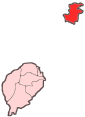
Ilhéu Bom Bom is an island in the Gulf of Guinea. The islet is located near the north coast of the island of Príncipe, one of the main islands of São Tomé and Príncipe and is almost completely forested. Its population is 15. There is a tourist resort near the island. There is a lighthouse on the island built in 1997. Its focal height is 64 meters and its range is 12 nmi.
Pedras Tinhosas is a small archipelago of two small islets, Tinhosa Grande and Tinhosa Pequena, southwest of the island of Príncipe in the Atlantic Ocean. Since 2012, it forms part of the UNESCO's Island of Príncipe Biosphere Reserve, which includes the island of Príncipe and the surrounding islets.

Ilhéu das Cabras is an uninhabited island in the Gulf of Guinea. It is one of the smaller islands of São Tomé and Príncipe. The islet is located about 2 km off the northeast coast of the island of São Tomé, 8 km north of the city centre of São Tomé. The islet consists of two hills, about 90 metres high. There is a lighthouse on the northeastern summit, built in 1890; its focal height 97 metres and its range is 12 nmi. The islet was mentioned as "Mooro Caebres" in the 1665 map by Johannes Vingboons.
Ilhéu Caroço is an uninhabited islet in the Gulf of Guinea, part of São Tomé and Príncipe. The islet is located southeast of the island of Príncipe, about 3 km off the coast. Its area is about 0.4 km². The islet is steep, rocky and wooded, and rises to 305 metres elevation.
Tinhosa Grande is an uninhabited islet in São Tomé and Príncipe, located 23 km (14 mi) southwest of the island of Príncipe and 124 km (77 mi) northeast of the island of São Tomé. Together with the smaller islet Tinhosa Pequena, 4 kilometers to its north, it forms the Pedras Tinhosas group. It is 55 metres high, and its area is 20 hectares.
Tinhosa may refer to two islets in São Tomé and Príncipe:
The São Tomé, Príncipe, and Annobón moist lowland forests is a tropical moist broadleaf forest ecoregion that covers the islands of São Tomé and Príncipe, which form the island nation of São Tomé and Príncipe, as well as the island of Annobón, which is part of Equatorial Guinea.
The wildlife of São Tomé and Príncipe is composed of its flora and fauna. São Tomé and Príncipe are oceanic islands which have always been separate from mainland West Africa and so there is a relatively low diversity of species, restricted to those that have managed to cross the sea to the islands. However the level of endemism is high with many species occurring nowhere else in the world.

Ana Chaves Bay is a bay on the northeast coast of São Tomé Island in São Tomé and Príncipe. The capital city of São Tomé and its port are situated by the bay. It stretches from the Ponta Oque del Rei in the north to Ponta São Sebastião in the south. Forte de São Sebastião, now part of São Sebastião Museum, occupies Ponta São Sebastião. The port of São Tomé was built at the end of the 1950s on reclaimed land that extends 0.2 miles (0.32 km) north of Ponta São Sebastião; there is a 200 m quay at its north end, with a depth of 3 metres alongside. It is the main port of the country for solid goods; the port of Neves is the main point of entry for liquid fuels. The bay is generally shallow, offering anchorage for small vessels in depths of less than 5 metres (16 ft).

Ilhéu de Santana is an uninhabited island in the Gulf of Guinea and is one of the smaller islands of São Tomé and Príncipe. The islet is located 0.7 nmi (1.3 km) off the east coast of the island of São Tomé near the town of Santana in Cantagalo District. It is 50 metres high. The islet was mentioned in the 1616 map by Jodocus Hondius as I. de S. Anne.
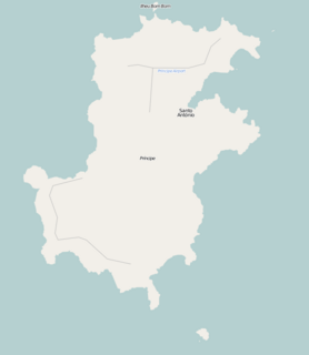
Ponta da Mina is a headland located some 2 km northeast of Santo António, the island capital of Príncipe in São Tomé and Príncipe. The point is on the southern shores of Baía de Santo António. It is fringed by rocks, and the ancient fortress Fortaleza de Santo António da Ponta da Mina stands at its summit.
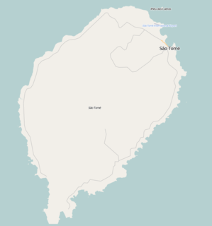
Sete Pedras is a group of rocky islets in the Gulf of Guinea, part of São Tomé and Príncipe. The islets lie about 2.5 nmi (4.6 km) off the southeast coast of the island of São Tomé. The largest islet is 42 metres high. The islets were mentioned as "Seven Steen" in the 1665 map by Johannes Vingboons.

Pedra da Galé is an uninhabited islet in the Gulf of Guinea, part of São Tomé and Príncipe. It lies 3.7 km westnorthwest the north coast of the island of Príncipe. It is 190 meters long and up to 60 meters wide in its northern part, and four meters high. Since 2012, the islet forms a part of the Island of Príncipe Biosphere Reserve.
Ilhéu dos Mosteiros is an uninhabited islet in the Gulf of Guinea, part of São Tomé and Príncipe. It lies about 0.8 km off the northeast coast of the island of Príncipe. It is 20 metres high. Since 2012, the islet forms a part of Island of Príncipe Biosphere Reserve.

The Canal das Rolas is a strait of the Atlantic Ocean separating the small Ilhéu das Rolas from the southernmost point of the island of São Tomé, in São Tomé and Príncipe. It is 1.2 nautical miles wide. There is a ferry departing from Ponta Baleia on São Tomé Island to Ilhéu das Rolas.