
County Kilkenny is a county in Ireland. It is in the province of Leinster and is part of the South-East Region. It is named after the city of Kilkenny. Kilkenny County Council is the local authority for the county. As of the 2016 census the population of the county was 99,232. The county was based on the historic Gaelic kingdom of Ossory (Osraighe), which was coterminous with the Diocese of Ossory.
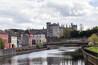
Kilkenny is a city in County Kilkenny, Ireland. It is located in the South-East Region and in the province of Leinster. It is built on both banks of the River Nore. The 2016 census gave the total population of Kilkenny as 26,512.
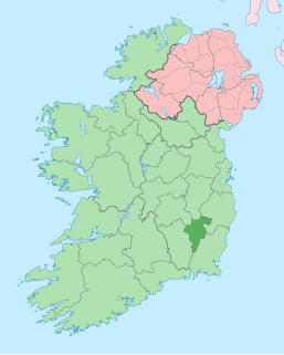
County Carlow is a county located in the South-East Region of Ireland, within the province of Leinster. Carlow is the second smallest and the third least populous of Ireland's 32 traditional counties. Carlow County Council is the governing local authority.
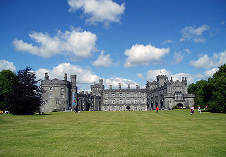
Kilkenny Castle is a castle in Kilkenny, Ireland built in 1195 to control a fording-point of the River Nore and the junction of several routeways. It was a symbol of Norman occupation and in its original thirteenth-century condition it would have formed an important element of the defences of the town with four large circular corner towers and a massive ditch, part of which can still be seen today on the Parade.

Trim Castle is a castle on the south bank of the River Boyne in Trim, County Meath, Ireland, with an area of 30,000 m². Over a period of 30 years, it was built by Hugh de Lacy and his son Walter as the caput of the Lordship of Meath. The Irish Government currently own and are in charge of the care of the castle, through the state agency The Office of Public Works (OPW).

Roscrea is a market town in County Tipperary, Ireland, which in 2016 had a population of 5,446. Roscrea is one of the oldest towns in Ireland, having developed around the 7th century monastery of Saint Crónán of Roscrea, parts of which remain preserved today.

King John's Castle also known as Limerick Castle is a 13th-century castle located on King's Island in Limerick, Ireland, next to the River Shannon. Although the site dates back to 922 when the Vikings lived on the Island, the castle itself was built on the orders of King John in 1200. One of the best preserved Norman castles in Europe, the walls, towers and fortifications remain today and are visitor attractions. The remains of a Viking settlement were uncovered during archaeological excavations at the site in 1900.
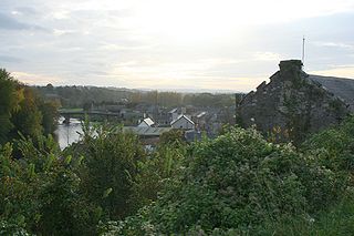
Thomastown, historically known as Grennan, is a town in County Kilkenny in the province of Leinster in the south-east of Ireland. It is a market town along a stretch of the River Nore which is known for its salmon and trout, with a number of historical landmarks in the vicinity. Visitor attractions include Jerpoint Abbey, Kilfane Glen gardens, and Mount Juliet Golf Course.

Gowran is a town located on the eastern side of County Kilkenny, Ireland. The historic St. Mary's Collegiate Church is located in the centre of Gowran close to Gowran Castle. Gowran Park race course and Golf Course is located one km from the centre of Gowran. Gowran is located on the R448 regional road where it is crossed by the R702 regional road.

Denbigh Castle and town walls were a set of fortifications built to control the lordship of Denbigh after the conquest of Wales by King Edward I in 1282. The King granted the lands to Henry de Lacy, the Earl of Lincoln, who began to build a new walled town, colonised by immigrants from England, protected by a substantial castle and surrounded by deer parks for hunting. The work had not been completed by 1294, when the Welsh temporarily seized the castle during the Madog ap Llywelyn revolt. The defences continued to be improved, although the castle was not completely finished by the time of Henry's death in 1311.
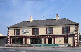
Castledermot is an inland village in the south-east of Ireland in County Kildare, about 75 km (47 mi) from Dublin, and 10 km (6.2 mi) from the town of Carlow. The N9 road from Dublin to Waterford previously passed through the village but upon completion of a motorway bypass in 2010, it was redesignated the R448.
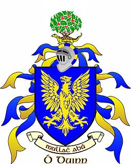
Dunne is an Irish surname, derived from the Irish Ó Duinn and Ó Doinn, meaning "dark" or "brown." The name Dunne in Ireland is derived from the Ó Duinn and the Ó Doinn Gaelic septs who were based in County Laois, County Meath and County Wicklow. These septs in turn are descendants of the O'Regan noble family. It is in these counties that the majority of descendants can still be found. Hundreds of years ago, the Gaelic name used by the Dunn family in Ireland was Ó Duinn or Ó Doinn. Both Gaelic names are derived from the Gaelic word donn, which means "brown". Ó Doinn is the genitive case of donn. First found in county Meath, where they held a family seat from very ancient times. Variations: Dunn, Dunne, Dun, Duen, O'Dunne, O'Doyne, Doine, Doin, O'Dunn.

Carlow is the county town of County Carlow, in the south-east of Ireland, 84 km (52 mi) from Dublin. At the 2016 census, it had a combined urban and rural population of 24,272.
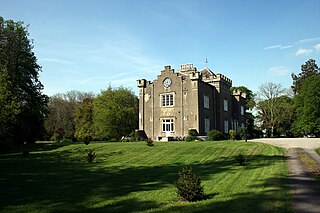
Paulstown is a small village in County Kilkenny in Ireland.

Carlow Castle is located near to the River Barrow in County Carlow, Ireland. It was built between 1207 and 1213, and is a National Monument of Ireland.

Leighlinbridge Castle, also called Black Castle, is in the village of Leighlinbridge, County Carlow, Ireland, on the River Barrow.

Ballyhide is a rural townland and village in the extreme south eastern corner of County Laois, Ireland at the border with County Carlow. The nearest urban centre is Carlow town which is 3 kilometres to the north east. It is located in the Luggacurren Local Electoral District.

Duckett's Grove(Irish: Garrán Duckett) is a ruined 19th-century great house and former estate in County Carlow, Ireland. Belonging to the Duckett family, the house was formerly the focal point of a 12,000-acre (49 km2) estate, and dominated the local landscape of the area for more than two centuries. The interior of the house was destroyed by a major fire in the 1930s and is now inaccessible. The surrounding gardens, including two inter-connecting walled gardens, are now managed by Carlow County Council and open as a public park.
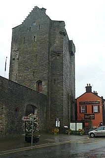
Roscrea Castle is a 13th-century motte castle in the town of Roscrea, Ireland. The Castle consists of a walled courtyard, gate block, and angled towers. Along with 18th century Damer House and gardens, the Castle forms part of Roscrea Heritage Centre.

The Siege of Kilkenny was the isolation and capture of the fortified capital of the Irish Confederates by the New Model Army of the English Parliamentarians in March 1650 during the conquest of Ireland by Oliver Cromwell.


