Related Research Articles

The Little Miami River is a Class I tributary of the Ohio River that flows 111 miles (179 km) through five counties in southwestern Ohio in the United States. The Little Miami joins the Ohio River east of Cincinnati. It forms parts of the borders between Hamilton and Clermont counties and between Hamilton and Warren counties. The Little Miami River is one of 156 American rivers designated by the U.S. Congress or the Secretary of the Interior as a National Wild and Scenic River and lends its name to the adjacent Little Miami Scenic Trail.
Harlan Township, one of the eleven townships of Warren County, Ohio, United States, and the last to be formed in that county, is located in the southeast corner of the county. The 2000 census found 3,627 inhabitants, up from 3,268 in 1990; of this total, 3,240 lived in the unincorporated portions of the township.
Beedles Station was the first settlement in what was to become Warren County, Ohio, United States. A blockhouse was established there in 1795 in what is now Section 28, Town 4, Range 3 of the Between the Miami Rivers Survey in western Turtlecreek Township. This is on the west side of State Route 741 about a mile south of Otterbein. The settlement was named for William Beedle, an early settler. A historical plaque marks the site.

Fort Ancient is a Native American earthworks complex located in Washington Township, Warren County, Ohio, along the eastern shore of the Little Miami River about seven miles (11 km) southeast of Lebanon on State Route 350. The site is the largest prehistoric hilltop enclosure in the United States with three and one-half miles (18,000 ft) of walls in a 100-acre (0.40 km2) complex. Built by the Hopewell culture, who lived in the area from the 200 BC to AD 400, the site is situated on a wooded bluff 270 feet (82 m) above the Little Miami. It is the namesake of a culture known as Fort Ancient who lived near the complex long after it was constructed.

Fosters is an unincorporated community in southern Warren County, Ohio, United States. It straddles the Little Miami River in Deerfield and Hamilton Townships. It is located about two miles southwest of Hopkinsville, two miles west of Maineville, and two miles northeast of Twenty Mile Stand just off U.S. Route 22/State Route 3, the 3C Highway. The community is in the Kings Local School District and is served by the Maineville post office. The settlement was originally called Foster's Crossing. The community was named after the local Foster family.

The Warren County Canal was a branch of the Miami and Erie Canal in southwestern Ohio about 20 miles (32 km) in length that connected the Warren County seat of Lebanon to the main canal at Middletown in the mid-19th century. Lebanon was at the crossroads of two major roads, the highway from Cincinnati to Columbus and the road from Chillicothe to the College Township (Oxford), but Lebanon businessmen and civic leaders wanted better transportation facilities and successfully lobbied for their own canal, part of the canal fever of the first third of the 19th century. The Warren County Canal was never successful, operating less than a decade before the state abandoned it.

The Licking River is a partly navigable, 303-mile-long (488 km) tributary of the Ohio River in northeastern Kentucky in the United States. The river and its tributaries drain much of the region of northeastern Kentucky between the watersheds of the Kentucky River to the west and the Big Sandy River to the east. The North Fork Licking River, in Pendleton County, Kentucky, is one of its tributaries.

Mathers Mill, alternately called Mathers Mills or Mather's Mills, is an unincorporated community in Warren County, Ohio, United States. It is approximately 5 miles east of Lebanon, and 2 miles south of Oregonia in eastern Turtlecreek Township. The area is served by the Oregonia post office, and Lebanon phone exchange and school district. Wilmington Road crosses the Little Miami River and intersects Corwin Road in this area. The bridge is known as the Mathers Mill bridge and the steep hill up out of the valley is sometimes referred to as Mathers Mill Hill.
Turtle Creek is a 13.7-mile-long (22.0 km) tributary of the Little Miami River in Turtlecreek Township, Warren County, Ohio, which takes its name from this creek. Turtle Creek is named for Chief Little Turtle, of the Miami Indian Tribe Turtle Creek is a tributary within the Little Miami and Ohio River watersheds.

Wolf Creek is a 19.8-mile-long (31.9 km) tributary of the Great Miami River in southwestern Ohio in the United States. It rises in western Montgomery County, northwest of Brookville, and flows generally southeast, passing through the center of Trotwood and joining the Great Miami in downtown Dayton.
Lytle Creek is a stream in Clinton County, Ohio, in the United States.
Caesar Creek is a stream in Clinton, Greene, and Warren counties, Ohio, in the United States.

Anderson Fork is a stream in Clinton and Greene counties, Ohio, in the United States.
Wilson Creek is a stream in Clinton County, Ohio, in the United States.
Newman Run is a stream in the U.S. state of Ohio. It is a tributary to the Little Miami River.
Halls Creek is a stream in the U.S. state of Ohio. It is a tributary to the Little Miami River.
Baker Creek is a stream in the U.S. state of Ohio. It is a tributary to the Little Miami River.
Muddy Creek is a stream in the U.S. state of Ohio. It is a tributary to the Little Miami River.
Grog Run is a stream in the U.S. state of Ohio.
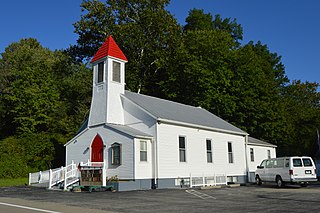
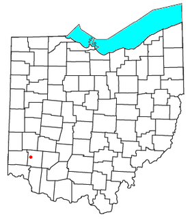
Butterworth is an extinct town in Warren County, Ohio.
References
- 1 2 3 U.S. Geological Survey Geographic Names Information System: Todd Fork
- ↑ Brown, Albert J. (1915). History of Clinton County, Ohio: Its People, Industries, and Institutions. B.F. Bowen. p. 51.
- ↑ "Warren County, Ohio Place Names". Warren County Genealogical Society. Archived from the original on 13 March 2018. Retrieved 13 March 2018.
| | This Clinton County, Ohio state location article is a stub. You can help Wikipedia by expanding it. |
| | This Warren County, Ohio state location article is a stub. You can help Wikipedia by expanding it. |