
Lafayette is a city in the U.S. state of Louisiana, and the most populous city and parish seat of Lafayette Parish, located along the Vermilion River. It is Louisiana's fourth largest incorporated municipality by population and the 234th-most populous in the United States, with a 2020 census population of 121,374; the consolidated city-parish's population was 241,753 in 2020. The Lafayette metropolitan area was Louisiana's third largest metropolitan statistical area with a population of 478,384 at the 2020 census. The Acadiana region containing Lafayette is the largest population and economic corridor between Houston, Texas and New Orleans.

Navarre is a census-designated place and unincorporated community in Santa Rosa County in the northwest Florida Panhandle. It is a major bedroom community for mostly U.S. military personnel, federal civil servants, local population, retirees and defense contractors. Due to Navarre Beach and the 4 miles (6.4 km) of beach front on the Gulf of Mexico thereof, as well as several miles of beaches within the Navarre Beach Marine Park and the Gulf Islands National Seashore, it has a small, but rapidly growing community of nature enthusiasts and tourists. Navarre has grown from being a small town of around 1,500 in 1970 to a town with a population estimated at 43,540 as of 2020, if including both the Navarre and Navarre Beach Census Designated Places.

The East Bay River in Florida is a 15-mile-long (24 km) river located in Santa Rosa and Okaloosa counties. It flows from east to west, forming near Hurlburt Field, and empties into the eastern portion of East Bay (Florida) near the towns Holley and Navarre. The river forms part of the southern boundary of Eglin Air Force Base.
Santa Rosa Sound is a sound connecting Pensacola Bay and Choctawhatchee Bay in Florida. The northern shore consists of the Fairpoint Peninsula and portions of the mainland in Santa Rosa County and Okaloosa County. It is bounded to the south by Santa Rosa Island, separating it from the Gulf of Mexico.

Pukekohe railway station is a railway station in Pukekohe, New Zealand. It is the southern terminus of the Southern Line of the Auckland railway network. The station has an island platform between the main lines and an original wooden station building complete with signal panel.
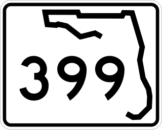
State Road 399 is a state road in Santa Rosa County, Florida. Although it only extends 0.32 miles (0.51 km) from U.S. Route 98 (US 98) to the Bob Sikes Bridge, County Road 399 continues over the bridge, along Santa Rosa Island, and back to US 98 via the Navarre Bridge. Other segments of CR 399 also exist on the mainland.
Hempstead Harbor is a bay hugging the northern coast of Long Island, New York. Located off of the Long Island Sound, it forms the northernmost portion of the political border between the Nassau County towns of Oyster Bay on the east and North Hempstead on the west, as well as the western border of the city of Glen Cove.
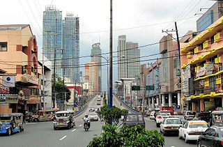
Shaw Boulevard is a 4-8 lane highway connecting the cities of Mandaluyong and Pasig in the Philippines. The boulevard is named after William James Shaw, the founder of the Wack Wack Golf and Country Club in Mandaluyong. The road is one of the major thoroughfares of the Ortigas Center in Mandaluyong and Pasig, housing many shopping malls like the Starmall shopping center and the posh Shangri-La Plaza at the EDSA-Shaw intersection and The Marketplace, which is visible from the Kalentong-Shaw intersection and Sevilla Bridge.
The Koi Nation of the Lower Lake Rancheria is a federally recognized tribe of Southeastern Pomo people in northern California. Their name for their tribe is Koi Nation of Northern California, from their traditional village, Koi, once located on an island in Clear Lake.

Squibb Park Bridge is a footbridge connecting Brooklyn Bridge Park and Squibb Park in Brooklyn Heights in Brooklyn, New York City. It is the second of two bridges on the same site. The original bridge opened in March 2013 and was demolished in late 2019, being replaced by the current bridge in April 2020. It is named after inventor and manufacturer of pharmaceutics E. R. Squibb.

The Sorentinos are an American rock music band based in Sonoma County, California, formed in 1985. The main members are Danny Sorentino, Rob Ruiz, Rory Judge (drums), Steve Barbieri, Russ Kerger (keyboards), and Steve Lee.
The Navarre Beach Causeway, also called the Navarre Beach Bridge, is a concrete bridge in Navarre, Florida, connecting the beach and mainland sides of the community. The bridge travels over the Santa Rosa Sound, which in turn, is part of the Intracoastal Waterway. The bridge is currently owned and managed by Santa Rosa County, as part of the roads and bridges department.

The Philadelphia Boulevard in Toruń - a wharf located on the right bank of the Vistula River in Toruń.
Dean Creek is a creek primarily on Eglin Air Force Base, near Holley and Navarre, Florida.
Poplar Creek is a creek tributary of the narrowed river-like side of East Bay, in the Holley neighborhood of Navarre, Florida.
The Navarre Library is the community library of Navarre, Florida. The library is part of the Santa Rosa County Library System based out of Milton, Florida.
Tom King Bayou is a small, but locally important, bayou and creek in Navarre, Florida. The mouth of the bayou opens onto East Bay near Axelson Point and Robledal.
The Santa Rosa County Library System is the primary provider of library services in Santa Rosa County, Florida. It is publicly funded and operated by Santa Rosa County.
