
Rafflesia, or stinking corpse lily, is a genus of parasitic flowering plants in the family Rafflesiaceae. The species have enormous flowers, the buds rising from the ground or directly from the lower stems of their host plants; one species has the largest flower in the world. Plants of the World Online lists up to 41 species from this genus, all of them are found throughout Southeast Asia.

Surat Thani, often shortened to Surat, is the largest of the southern provinces (changwat) of Thailand. It lies on the western shore of the Gulf of Thailand. Surat Thani means 'city of good people', a title given to the city by King Vajiravudh ; Surat Thani is therefore the sole province in Southern Thailand for which the native name is in the Central Thai language.
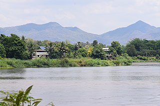
Tak is one of Thailand's seventy-seven provinces (changwat) and lies in lower northern Thailand. Neighbouring provinces are Mae Hong Son, Chiang Mai, Lamphun, Lampang, Sukhothai, Kamphaeng Phet, Nakhon Sawan, Uthai Thani and Kanchanaburi. The western edge of the province has a long boundary with Kayin State of Myanmar (Burma).
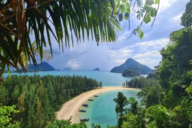
Ranong is one of Thailand's southern provinces (changwat), on the west coast along the Andaman Sea. It has the fewest inhabitants of all Thai provinces. Provinces neighboring Ranong are (clockwise) Chumphon, Surat Thani, and Phang Nga. To the west, it borders Kawthaung, Tanintharyi, Myanmar.

Phang Nga is one of the southern provinces (Changwat) of Thailand, on the shore of the Andaman Sea to the west and Phang Nga Bay to the south. Neighbouring provinces, from north and moving clockwise, are Ranong, Surat Thani, and Krabi. Towards the south of Phang Nga is the Phuket province, connected by the Sarasin Bridge.
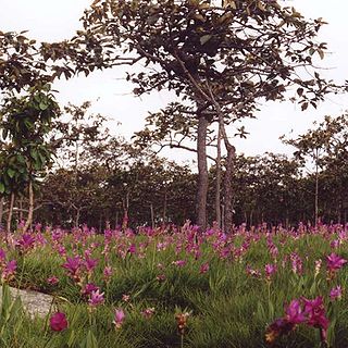
Pa Hin Ngam is a national park in Chaiyaphum Province, Thailand. "Hin ngam" means "beautiful stone", "pa" means "forest". The park got its name from the strange rock formations at the west end of the park. Erosion has carved several large rocks into striking and unusual shapes.

Khao Sok National Park is in Surat Thani Province, Thailand. Its area is 461,712 rai ~ 739 square kilometres (285 sq mi), and it includes the 165 km2 (64 sq mi) Cheow Lan Lake contained by the Ratchaprapha Dam. The park is the largest area of virgin forest in southern Thailand and is a remnant of rain forest which is older and more diverse than the Amazon rain forest.

The Phetchabun mountains are a mountain massif in Phetchabun, Phitsanulok, Loei and Chaiyaphum Provinces, Thailand. It consists of two parallel mountain chains, with the valley of the Pa Sak River in the middle.

Rafflesia kerrii is a member of the genus Rafflesia. It is found in the rainforest of southern Thailand and peninsular Malaysia, with notable populations in Khao Sok National Park and Khlong Phanom National Park. Local Thai names are บัวผุด, ย่านไก่ต้ม and บัวตูม.
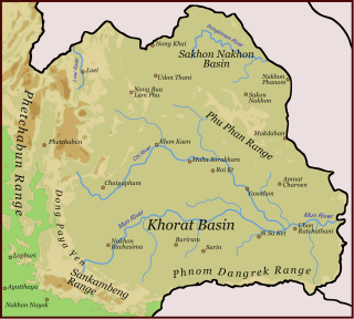
Dong Phaya Yen or Dong Phya Yen is a mountain range in Phetchabun, Chaiyaphum, Lopburi, Saraburi, and Nakhon Ratchasima Provinces, Thailand.

Phanom is a district (amphoe) in the southwest of Surat Thani province of southern Thailand.

Phang Nga Bay is a 400 km2 (150 sq mi) bay in the Andaman Sea between the island of Phuket and the mainland of the Kra Isthmus of southern Thailand. Since 1981, an extensive section of the bay has been protected as the Ao Phang Nga National Park. The park is in Phang Nga Province, at 8°17′N98°36′E.

Mueang Phang Nga is the capital district of Phang Nga province in southern Thailand.

Si Phang Nga National Park is in Phang Nga Province in southern Thailand, covering the eastern parts of the districts Khura Buri and Takua Pa.
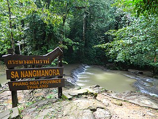
Sa Nang Manora is a forest park in southern Thailand. It covers an area of 0.29 km2 of the Khao Thoi-Nang Hong Forest, Nop Pring Sub-district, Mueang District, Phang Nga Province, about four km north of Phang Nga town. It was established on 15 September 1980.
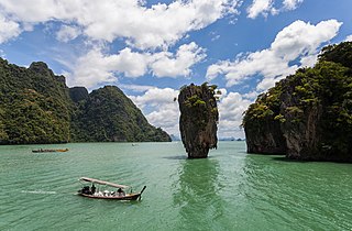
Ao Phang Nga National Park, located in the Phang Nga Province of the Southern Thailand, encompasses parts of Mueang Phang Nga District and Takua Thung District. The park is predominantly maritime, featuring a section of the Strait of Malacca dotted with numerous limestone tower karst islands. Among these islands, Khao Phing Kan stands out as particularly well-known, having gained the nickname 'James Bond Island' due to its use as a filming location for the James Bond film The Man with the Golden Gun.

The Phuket Range is a subrange of the Tenasserim Hills in the Kra Isthmus, Thailand.

Khao Lak–Lam Ru National Park is a national park in Phang Nga Province, Thailand. The park is named for two of its mountain peaks, Khao Lak and Lam Ru. It also encompasses beaches and forests.
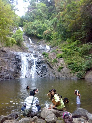
Khao Lampi–Hat Thai Mueang National Park is a national park in Phang Nga Province, Thailand. The park is named for its two separate sections: Khao Lampi named for the park section containing Lampi mountain range and Hat Thai Mueang, the beach section of the park.


