The Piscataquis River is a major tributary of the Penobscot River, found in Piscataquis County, Maine, United States. It starts from the confluence of its East Branch and West Branch in Blanchard. The river flows in a mostly eastern direction until it meets the Penobscot at Howland. It is approximately 65 miles (105 km) in length.

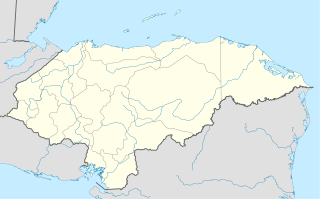
Sabá is a town, with a population of 16,460, and a municipality in the Honduran department of Colón.

Bailup is a Western Australian locality and rural residential estate located 62 kilometres (39 mi) north-east of the state capital, Perth, along Toodyay Road. The population recorded at the 2016 census was 40. The area is split between the Shire of Toodyay and Shire of Mundaring, the latter of which contains most of the land area.

Smith's Parish is one of the nine parishes of Bermuda. It is named for English aristocrat Sir Thomas Smith/Smythe (1558-1625).

Duchowo is a village in the administrative district of Gmina Milicz, within Milicz County, Lower Silesian Voivodeship, in south-western Poland. Prior to 1945 it was in Germany.

Twin Beach is an unincorporated community in Posey Township, Clay County, Indiana. It is part of the Terre Haute Metropolitan Statistical Area.

Reed Station is an unincorporated community in Mount Pleasant Township, Delaware County, Indiana.

Diffa is a department of the Diffa Region in Niger. It is bordered by Chad to the east. Its capital lies at the city of Diffa. As of 2011, the department had a total population of 209,249 people.

Przesławice is a village in the administrative district of Gmina Miechów, within Miechów County, Lesser Poland Voivodeship, in southern Poland. It lies approximately 6 kilometres (4 mi) south of Miechów and 29 km (18 mi) north of the regional capital Kraków.

The Ministry of Foreign Affairs (MOFA) is a cabinet-level government ministry responsible for the implementation and management of Uganda's foreign policy and international activity.
The Sac and Fox Reservation of the Sac and Fox Nation is a 23.639 sq mi (61.226 km²) tract located in southeastern Richardson County, Nebraska, and northeastern Brown County, Kansas near White Cloud, Kansas. It was created as a consequence of the Platte Purchase of 1836.

Gacyny is a settlement in the administrative district of Gmina Wejherowo, within Wejherowo County, Pomeranian Voivodeship, in northern Poland. It lies approximately 12 kilometres (7 mi) south-east of Wejherowo and 25 km (16 mi) north-west of the regional capital Gdańsk.
Egjert is a village and rural commune in Mauritania.

Strzelczyn is a village in the administrative district of Gmina Chojna, within Gryfino County, West Pomeranian Voivodeship, in north-western Poland, close to the German border. It lies approximately 9 kilometres (6 mi) north-east of Chojna, 28 km (17 mi) south of Gryfino, and 46 km (29 mi) south of the regional capital Szczecin.
Maiyara is a village and rural commune in Niger.
Kampala Speke Hotel is a hotel in Kampala, the capital and largest city in Uganda, the third-largest economy in the East African Community.
The Grindstone Indian Rancheria of Wintun-Wailaki Indians is a federally recognized tribe and ranchería of Wintun and Wailaki Indians from northern California. As of the 2010 Census the population was 164.

Playa de la Ribera is a beach of Ceuta, a Spanish city bordering northern Morocco. Like the Playa del Chorillo, it lies to the south of the isthmus but on the part where it joins the mainland. It is about 405 metres long, with an average width of 40 metres. It is very busy during the summer months.
Lemay Township is a township in St. Louis County, in the U.S. state of Missouri. Its population was 34,736 as of the 2010 census.


