
Sumner Township is a civil township of Gratiot County in the U.S. state of Michigan. The population was 1,863 at the 2020 census.

Fabius is a village in Onondaga County, New York, United States. As of the 2020 census, the population was 309. It is part of the Syracuse Metropolitan Statistical Area. The village is near the center of the town of Fabius and is south of Syracuse.
CBRX-FM is a Canadian radio station which broadcasts SRC's Ici Musique network at 101.5 FM in Rimouski, Quebec.

Northfield Park Arboretum is a public park and arboretum located in Gering, Nebraska.
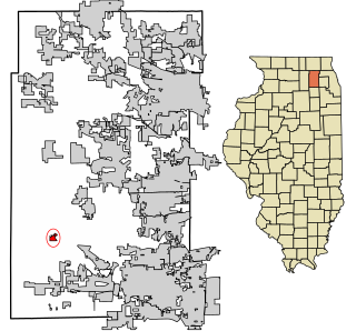
Kaneville is a village in southwestern Kane County, Illinois, United States. It was incorporated in November 2006, and the first elected officials were chosen in elections held on April 17, 2007. The village had a population of 484 at the 2010 census. Kaneville is part of the Chicago metropolitan area. The village was originally called "Royalton", but this was found to be taken by another settlement. The name was then changed to "Kaneville", referring to Elias Kane.
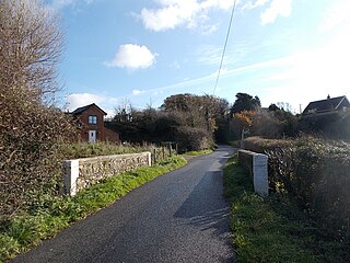
Roud is a hamlet on the Isle of Wight in southern England. According to the Post Office the population of the hamlet as at the 2011 census was included in the civil parish of Godshill.

SkyCity was a revolving restaurant and bar situated atop the Space Needle in Seattle, Washington, United States.

HMS Collingwood is a stone frigate of the Royal Navy, in Fareham, England. It is the lead establishment of the Maritime Warfare School and the largest naval training organisation in Western Europe. The Maritime Warfare School is a federated training establishment incorporating HMS Excellent, the Defence Diving School, the RN Physical Training School, the School of Hydrography and Meteorology in Plymouth and the Royal Marines School of Music in Portsmouth Naval Base.
Altar is small city and municipal seat of Altar Municipality in the Mexican state of Sonora. It is located in the northwest region of the state at 30°42′49″N111°50′07″W.

Santa Susana Pass State Historic Park is a California State Park of 670.68 acres (2.7141 km2) located in the city of Los Angeles, in Los Angeles County on the boundary between Ventura and Los Angeles counties, between the communities of Chatsworth and Simi Valley. Geologically, the park is located where the Simi Hills meet the Santa Susana Mountains. Here in the western part of the Transverse Ranges, the land is dominated by high, narrow ridges and deep canyons covered with an abundant variety of plant life. The park offers panoramic views of the rugged natural landscape as a striking contrast to the developed communities nearby. The park is also rich in archaeological, historical, and cultural significance.
Navan District is one of six districts of the province Oyón in Peru.
Karayarka is a village in the Jalilabad Rayon of Azerbaijan.
The Marlow Heights Shopping Center is an open-air shopping complex located in Marlow Heights, Maryland, on Branch Avenue at St. Barnabas Road, and is positioned just south of Shops at Iverson.

KidsQuest Children's Museum is a hands-on, interactive children's museum that encourages learning through play with an emphasis on science, technology, engineering, art and math (STEAM). Exhibits and programs are geared towards children 0-10 and their families. KidsQuest offers over 650 programs throughout the year including early learning classes, summer camps, drop-off and whole-family science workshops, free art programs and many special events including concerts and holiday programs.

Dawn, is an unincorporated community in Caroline County, in the U.S. state of Virginia. It is located at the intersection of US 301 / SR 2 and SR 30, roughly east of Doswell, north of Hanover, west of Central Garage, and south of Bowling Green.
Kovačevci is a village in the municipality of Glamoč in Canton 10, the Federation of Bosnia and Herzegovina, Bosnia and Herzegovina.
Hilldale is a census-designated place (CDP) in Plains Township, Luzerne County, Pennsylvania, United States. The population was 1,246 at the time of the 2010 census.
Barcelona is an unincorporated community in Crawford County, Arkansas, United States.
Bolton is an unincorporated community in eastern Harrison County, in the U.S. state of Missouri.
Saulsburg is an unincorporated community in Huntingdon County, in the U.S. state of Pennsylvania.

