Harish Kapadia is a Himalayan mountaineer, author and long-time editor of the Himalayan Journal from India.
Manirang is one of the highest mountains in the Indian state Himachal Pradesh. It lies on the border between Kinnaur district and Lahaul and Spiti district. Close to the peak is the high Manirang pass, which was one of the early trade routes between Spiti and Kinnaur, before the motorable road was built. The trail over the pass starts from Mane Yogma on the Spiti side and runs to the Ropa valley in Kinnaur.

Kalanag or Black Peak (6,387 m) is a peak in the Garhwal Himalaya in Uttarakhand, India. It is the highest peak in the Bandarpunch massif, others being Bandarpunch I (6,316 m) and White Peak or Bandarpunch II (6,102 m). The name literally means "Black Cobra" in Hindi.

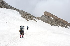
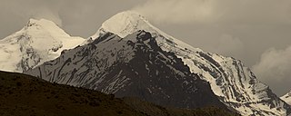
The Garhwal Himalayas are mountain ranges located in the Indian state of Uttarakhand.

Romilly Lisle Holdsworth, commonly known as R. L. Holdsworth, was an English scholar, academic, educationalist, cricketer and a distinguished Himalayan mountaineer. He was a member of the first expedition to Kamet in 1931, which included other stalwarts such as Eric Shipton and Frank Smythe. Holdsworth, along with Shipton and Smythe, are credited with the discovery of the Valley of Flowers, now a UNESCO World Heritage Site, during their return from Kamet.
Auden's Col is a high altitude mountain pass connecting Rudugaira valley and Bhilangna valley in India. It is situated at 5,490 metres (18,010 ft) elevation and connects the ridge coming from Gangotri III peak on the north-west and the ridge coming from Jogin I on the east, and also binds a glacier coming from Jogin I on the north side of Rudugaira valley, and deadly Khatling glacier on the south side of Bhilangna valley.
The Lamkhaga Pass is one of the toughest pass which connects Kinnaur district of Himachal Pradesh with Harshil in Uttarakhand. Harsil-Kharcham Highway will have a Lamkhaga Pass tunnel, and the highway route will also connect to Char Dham Highway and Pooh-Chumar-Hanle Highway.
The role of The Doon School in Indian mountaineering describes the formative links between The Doon School, an all-boys boarding school in Dehradun, India, and early, post-Independence Indian mountaineering. From the 1940s onwards, Doon's masters and students like A.E. Foot, R.L. Holdsworth, J.A.K. Martyn, Gurdial Singh, Jack Gibson, Aamir Ali, Hari Dang, Nandu Jayal, were among the first to go on major Himalayan expeditions in a newly independent nation. These early expeditions contributed towards laying the foundation of mountaineering in an independent India. Mountaineer and chronicler Harish Kapadia wrote in his book Across Peaks & Passes in Garhwal Himalaya: "To my mind, it was when Gurdial Singh [then a Doon School master] climbed Trisul in 1951 that was the beginning of the age of mountaineering for Indians."

Bhagirathi Massif or Bhagirathi Group is a mountain range of Garhwal Himalaya in Gangotri Glacier Uttarakhand India, It has four peaks between 6856 meter and 6193 meter. The Bhagirathi I summits is 6856 meter or 22493 feet. It was first climbed by A Japanese team in 1980. It is surrounded by Glaciers on four side on the eastern side of the Massif is Vasuki Glacier, on the western side its Gangotri Glacier the main glacier in this area, northern side is surrounded by Chaturangi Glacier and southern side guarded by Swachhhand Glacier.

Devtoli is a mountain of Kumaon Himalaya located in the Bageshwar district of Uttarakhand, India. It stands at 6,788 metres (22,270 ft). It is 36th highest located entirely within Uttarakhand. Nanda Devi is the highest mountain in this category. It is located at the southern rim of Nanda Devi Sanctuary. Devtoli is located just north west of Maiktoli and east of Mrigthuni. On the north east side lies Nanda Devi and Panwali Dwar on the east side. Tharkot on the southern side.
Koteshwar I is a mountain of the Garhwal Himalaya in Uttarakhand, India. The elevation of Koteshwar I is 6,080 metres (19,948 ft). It is the 161st highest peak in Uttrakhand. Nanda Devi, is the highest mountain in this category. It lies close to Sudarshan Parbat 6,507 metres (21,348 ft) in the south. It has two approach route one from Thely Bamak and another from Swetvarn Bamak. Its nearest higher neighbor Sudarshan Parbat 6,507 metres (21,348 ft) lies 1.3 km North. It is located 5 km SW of Yogeshwar 6,678 metres (21,909 ft) and 3.2 km east lies Shyamvarn 6,135 metres (20,128 ft).
Devistan I is a mountain of the Garhwal Himalaya located in the Chamoli district of Uttarakhand, India. The elevation of Devistan I is 6,678 metres (21,909 ft) and its prominence is 702 metres (2,303 ft). It is 52nd highest located entirely within the Uttrakhand. Nanda Devi is the highest mountain in this category. It stands on the western rim of the Nanda Devi Sanctuary. It lies between the Devisthan II 6,529 metres (21,421 ft) and Devtoli 6,788 metres (22,270 ft). Its nearest higher neighbor Devtoli 6,932 metres (22,743 ft) lies 6.6 km SSW. It is located 1 km South of Devisthan II and 9.6 km NE lies Nanda Devi 7,816 metres (25,643 ft).

Panwali Dwar is a mountain of the Kumaun Himalayas located in the Bageshwar district of Uttarakhand, India. The elevation of Panwali Dwar is 6,683 metres (21,926 ft) and its prominence is 763 metres (2,503 ft). It is 55th highest located entirely within the Uttarakhand. Nanda Devi, is the highest mountain in this category. It lies on southern wall of Nanda devi sanctuary. Its nearest higher neighbor Maiktoli 6,803 metres (22,320 ft) lies 8.2 km WSW. It is located 2.6 km SW of Nanda Khat 6,611 metres (21,690 ft) and 9.2 km NE lies Nanda Devi East 7,434 metres (24,390 ft).
Sakram is a mountain of the Garhwal Himalaya in Uttarakhand India. It's situated on the eastern rim of Nanda Devi Sanctuary on the watershed of Milam Glacier and Nanda Devi basin. The elevation of Sakram is 6,254 metres (20,518 ft) and its prominence is 134 metres (440 ft). It is 129th highest located entirely within the Uttrakhand. Nanda Devi, is the highest mountain in this category. It lies 1.2 km SSW of Lohar Deo 6,267 metres (20,561 ft) its nearest higher neighbor and 3.3 km SSE of Deo Damla 6,620 metres (21,719 ft). Kalanka 6,931 metres (22,740 ft) lies 11.9 km NNW and 8.7 km SW lies Nanda Devi 7,816 metres (25,643 ft).
Bamchu is a mountain of the Garhwal Himalaya in Uttarakhand India. It's situated on the eastern rim of Nanda Devi Sanctuary on the watershed of Milam Glacier and Nanda Devi basin. The elevation of Bamchu is 6,303 metres (20,679 ft) and its prominence is 241 metres (791 ft). It is 124th highest located entirely within the Uttrakhand. Nanda Devi, is the highest mountain in this category. It lies 3.4 km South of Deo Damla 6,620 metres (21,719 ft) its nearest higher neighbor and 3.1 km SSE of Mangraon 6,568 metres (21,549 ft). Kalanka 6,931 metres (22,740 ft) lies 9.8 km NNW and 9.3 km SW lies Nanda Devi 7,816 metres (25,643 ft).
Deo Damla is a mountain of the Garhwal Himalaya in Uttarakhand, India. It is situated in the eastern rim of Nanda Devi Sanctuary on the watershed of Milam Glacier and Nanda Devi basin. The elevation of Deo Damla is 6,620 metres (21,719 ft) and its prominence is 693 metres (2,274 ft). It is 63rd highest located entirely within the Uttrakhand. Nanda Devi, is the highest mountain in this category. It lies 1.8 km SSE of Mangraon 6,568 metres (21,549 ft). Its nearest higher neighbor Rishi Pahar 6,992 metres (22,940 ft) lies 8.3 km NNW and it is 10.6 km SSW of Nanda Devi 7,816 metres (25,643 ft). It lies 1.4 km north of Bamchu 6,303 metres (20,679 ft).
Shyamvarn is a mountain of the Garhwal Himalaya in Uttarakhand India. The peak lies above the Shyamvarn Glacier. The elevation of Shyamvarn is 6,135 metres (20,128 ft) and its prominence is 250 metres (820 ft). It is 150th highest located entirely within the Uttrakhand. Nanda Devi, is the highest mountain in this category. It lies 3.3 km east of Sudarshan Parbat 6,507 metres (21,348 ft). Saife 6,161 metres (20,213 ft) lies 2.5 km WSW and it is 3 km ESE of Shwetvarna 6,340 metres (20,801 ft). It lies 2.8 km South of Yogeshwar 6,678 metres (21,909 ft).

Badhangarhi temple is an ancient Hindu temple dedicated to Kali, worshipped as Maa Dakshineshwar kaali or Bhagwati. People living in Tharali, Naranbagar, Dewal block of Chamoli and garur, kapkot block of Bageshwar have a great faith in Badhangarhi, a popular deity in this region. It is situated in Tharali tehsil of Chamoli Garhwal district of Uttarakhand. The nearest town to Badhangarhi is Gwaldam which is 8 km from the main Badhangarhi temple. The temple is situated at the elevation of about 2260 m.