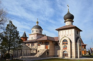
Przewodowice is a village in the administrative district of Gmina Rawa Mazowiecka, within Rawa County, Łódź Voivodeship, in central Poland. It lies approximately 9 kilometres (6 mi) north-east of Rawa Mazowiecka and 60 km (37 mi) east of the regional capital Łódź.

Obornjača is an uninhabited village in Serbia. It is situated in the Bačka Topola municipality, in the North Bačka District, Vojvodina province.
Lacka Buda is a village in the administrative district of Gmina Czarna Białostocka, within Białystok County, Podlaskie Voivodeship, in north-eastern Poland.

Luszyca is a village in the administrative district of Gmina Połaniec, within Staszów County, Świętokrzyskie Voivodeship, in south-central Poland. It lies approximately 4 kilometres (2 mi) north-east of Połaniec, 16 km (10 mi) south-east of Staszów, and 69 km (43 mi) south-east of the regional capital Kielce.

Stoczek is a village in the administrative district of Gmina Garwolin, within Garwolin County, Masovian Voivodeship, in east-central Poland. It lies approximately 11 kilometres (7 mi) west of Garwolin and 52 km (32 mi) south-east of Warsaw.
Chrzanowo is a village in the administrative district of Gmina Rzewnie, within Maków County, Masovian Voivodeship, in east-central Poland.
Dylewo is a village in the administrative district of Gmina Sypniewo, within Maków County, Masovian Voivodeship, in east-central Poland.
Ołdakowizna is a village in the administrative district of Gmina Stanisławów, within Mińsk County, Masovian Voivodeship, in east-central Poland.
Józefowo is a village in the administrative district of Gmina Strzegowo, within Mława County, Masovian Voivodeship, in east-central Poland.
Mogielnica-Kolonia is a village in the administrative district of Gmina Drobin, within Płock County, Masovian Voivodeship, in east-central Poland.
Gębarzów-Kolonia is a village in the administrative district of Gmina Skaryszew, within Radom County, Masovian Voivodeship, in east-central Poland.
Smółki is a village in the administrative district of Gmina Koźminek, within Kalisz County, Greater Poland Voivodeship, in west-central Poland.

Budowo is a village in the administrative district of Gmina Dębnica Kaszubska, within Słupsk County, Pomeranian Voivodeship, in northern Poland. It lies approximately 17 kilometres (11 mi) east of Dębnica Kaszubska, 29 km (18 mi) south-east of Słupsk, and 81 km (50 mi) west of the regional capital Gdańsk.

Gaj is a village in the administrative district of Gmina Sępopol, within Bartoszyce County, Warmian-Masurian Voivodeship, in northern Poland, close to the border with the Kaliningrad Oblast of Russia. It lies approximately 12 kilometres (7 mi) northeast of Sępopol, 25 km (16 mi) east of Bartoszyce, and 74 km (46 mi) northeast of the regional capital Olsztyn.

The Monument to Despot Stefan Lazarević is located in the village of Crkvine by Mladenovac, Serbia, in courtyard of the church of St. prophet Elijah. That is marble monument with medieval record on death of Despot Stefan Lazarević. The monument was declared Monument of Culture of Exceptional Importance in 1979, and it is now protected by Republic of Serbia. The monument is in the form of column, created from glazed white marble, height 186 cm, width 68 cm, and a thickness of 26 cm. The largest, main inscription is written in calligraphic letters, on the west side of monument, below ingraved three-sided cross. Monument was raised by his companion Đurađ Zubrović immediately after the death of Despot Stefan, in 1427.
Klinovac is a village in the municipality of Bujanovac, Serbia. According to the 2002 census, the town has a population of 539 people.
Zubovići u Oglečevi is a village in the municipality of Novo Goražde, Republika Srpska, Bosnia and Herzegovina.

Lipovac is a village in the municipality of Kruševac, Serbia. According to the 2002 census, the village has a population of 345 people.
Bairro Araújo is a region of Rio de Janeiro, but not officially recognized as a neighborhood.

Kafir, Idlib is a Syrian village located in Jisr al-Shughur Nahiyah in Jisr al-Shughur District, Idlib. According to the Syria Central Bureau of Statistics (CBS), Kafir, Idlib had a population of 1567 in the 2004 census.


