Trenton Dam

Last updated
Trenton Dam
USA Nebraska relief location map.svg
Red pog.svg
Location of Trenton Dam in Nebraska
Usa edcp relief location map.png
Red pog.svg
Trenton Dam (the United States)
Country United States
Location Hitchcock County, Nebraska
Coordinates 40°09′46″N101°03′48″W / 40.1628°N 101.0633°W / 40.1628; -101.0633
StatusOperational
Opening date1953
Dam and spillways
Height144 ft (44 m)
Length8,600 ft (2,600 m)
Reservoir
CreatesSwanson Lake
Total capacity246,291 acre⋅ft (303,795,000 m3)
Surface area4,974 acres (2,013 ha)
Normal elevation2,753 ft (839 m) [1]
Hitchcock County in Nebraska, with the city of Trenton in red Hitchcock County Nebraska Incorporated and Unincorporated areas Trenton Highlighted.svg
Hitchcock County in Nebraska, with the city of Trenton in red

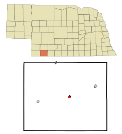
Trenton Dam is a dam on the Republican River in Nebraska, standing in Hitchcock County in the southwestern part of the state. The facility stands about 2 and one-half miles west of Trenton, Nebraska.

The dam is a project of the United States Bureau of Reclamation and was built between 1949 and 1953 for irrigation water storage and flood control. At 144 feet (44 m) high, the dam's length is 8,600 feet (2,600 m) at its crest. [2]

Lake Swanson is the reservoir formed by the dam, with a capacity of 246,291 acre-feet (303,795,000 m3). It is popular for recreational fishing, boating, camping, hunting and hiking, with 4,974 acres (2,013 ha) of water surface, 5,253 acres (2,126 ha) of land, and about 30 miles (48 km) of shoreline. [3]

Related Research Articles

<span class="mw-page-title-main">Lake of the Arbuckles</span> Reservoir in Murray County, Oklahoma

The Lake of the Arbuckles is a reservoir located in southern Oklahoma, 8 miles (13 km) southwest of Sulphur in Murray County. The lake covers 2,350 acres (950 ha) and is a principal water supply reservoir for the city of Ardmore, some 30 mi (48 km) to the southwest. It also supplies water to the cities of Sulphur, Davis, Wynnewood and a large oil refinery near Wynnewood. The lake also provides flood control, fish and wildlife habitat and recreation opportunities.

The Salt River Project (SRP) encompasses two separate entities: the Salt River Project Agricultural Improvement and Power District, an agency of the state of Arizona that serves as an electrical utility for the Phoenix metropolitan area, and the Salt River Valley Water Users' Association, a utility cooperative that serves as the primary water provider for much of central Arizona. It is one of the primary public utility companies in Arizona.

<span class="mw-page-title-main">New Waddell Dam</span> Dam in Maricopa County, Arizona

The New Waddell Dam is an embankment dam on the Agua Fria River in Maricopa County, Arizona, 35 miles (56 km) northwest of Phoenix. It serves as part of the Central Arizona Project (CAP) while also providing water for the Maricopa Water District. The dam creates Lake Pleasant with water from the Agua Fria and also the CAP aqueduct. In addition, it affords flood protection, hydroelectric power production and recreational opportunities. Construction on the dam began in 1985 and ended in 1994. Its reservoir submerged the Old Waddell Dam which was completed in 1927 after decades of planning.

<span class="mw-page-title-main">Monticello Dam</span> Dam in Napa County, California.

Monticello Dam is a 304-foot (93 m) high concrete arch dam in Napa County, California, United States, constructed between 1953 and 1957. The dam impounded Putah Creek to create Lake Berryessa in the Vaca Mountains.

<span class="mw-page-title-main">Rio Grande Project</span>

The Rio Grande Project is a United States Bureau of Reclamation irrigation, hydroelectricity, flood control, and interbasin water transfer project serving the upper Rio Grande basin in the southwestern United States. The project irrigates 193,000 acres (780 km2) along the river in the states of New Mexico and Texas. Approximately 60 percent of this land is in New Mexico. Some water is also allotted to Mexico to irrigate some 25,000 acres (100 km2) on the south side of the river. The project was authorized in 1905, but its final features were not implemented until the early 1950s.

<span class="mw-page-title-main">Minidoka Project</span>

The Minidoka Project is a series of public works by the U.S. Bureau of Reclamation to control the flow of the Snake River in Wyoming and Idaho, supplying irrigation water to farmlands in Idaho. One of the oldest Bureau of Reclamation projects in the United States, the project involves a series of dams and canals intended to store, regulate and distribute the waters of the Snake, with electric power generation as a byproduct. The water irrigates more than a million acres (4,000 km²) of otherwise arid land, producing much of Idaho's potato crop. Other crops include alfalfa, fruit and sugar beets. The primary irrigation district lies between Ashton in eastern Idaho and Bliss in the southwestern corner of the state. Five main reservoirs collect water, distributing it through 1,600 miles (2,600 km) of canals and 4,000 miles (6,400 km) of lateral distribution ditches.

<span class="mw-page-title-main">El Vado Dam</span> Dam in Rio Arriba County, New Mexico

El Vado Dam impounds the Rio Chama in the U.S. state of New Mexico, about 105 miles (169 km) north-northwest of New Mexico's largest city, Albuquerque and about 80 miles (130 km) northwest of the capital city of Santa Fe. The earth-filled structure forms El Vado Lake, a storage reservoir for the Middle Rio Grande Project, and has been designated as a New Mexico Historic Civil Engineering Landmark by the American Society of Civil Engineers.

<span class="mw-page-title-main">San Juan–Chama Project</span> Water management project in New Mexico and Colorado

The San Juan–Chama Project is a U.S. Bureau of Reclamation interbasin water transfer project located in the states of New Mexico and Colorado in the United States. The project consists of a series of tunnels and diversions that take water from the drainage basin of the San Juan River – a tributary of the Colorado River – to supplement water resources in the Rio Grande watershed. The project furnishes water for irrigation and municipal water supply to cities along the Rio Grande including Albuquerque and Santa Fe.

<span class="mw-page-title-main">Crawford Dam</span> Dam in Delta County, Colorado, United States

Crawford Dam impounds water for Crawford Reservoir in Delta County, Colorado about a mile south of the town of Crawford. The earthen dam was completed in 1962 by the United States Bureau of Reclamation with a height of 162 feet (49 m) and 580 feet (180 m) long at its crest. It impounds Iron Creek for irrigation flood control, one element of the Smith Fork Project. The dam is owned by the Bureau and operated by the local Crawford Water Conservancy District. When full, Crawford Reservoir has a water surface area of 406 acres (164 ha), about 7 miles (11 km) of shoreline, and a total capacity of 14,395 acre-feet (17,756,000 m3). The main purpose of the facility is to provide farm irrigation, and the size of Crawford Reservoir changes significantly with the seasons. In most years, the lake is full in late Spring and early Summer, but by early Fall, the water level drops enough to leave boat launches high and dry. The low water pool lasts through the Winter until Spring runoff begins to fill the water supply once again.
The reservoir is encompassed within Crawford State Park with Park Headquarters located on a peninsula along the northeastern shore. Recreation opportunities include fishing, boating, camping on 66 campsites, picnicking, swimming, and hiking.

Red Willow Dam is a dam in Frontier County, Nebraska, about ten miles northwest of McCook.

Box Butte Dam is a dam in the arid northwestern panhandle area of Dawes County, Nebraska.

<span class="mw-page-title-main">Virginia Smith Dam</span> Dam in Nebraska, United States.

Virginia Smith Dam is a dam in Garfield County, Nebraska, about five miles northwest of Burwell.

<span class="mw-page-title-main">Prosser Creek Dam</span> Dam in Nevada County, California, United States of America

Prosser Creek Dam is a dam in Nevada County, California.

<span class="mw-page-title-main">Carter Lake Dam</span> Dam in Colorado, U.S.

Carter Lake Dam is a dam in Larimer County, Colorado.

<span class="mw-page-title-main">Medicine Creek Dam</span>

Medicine Creek Dam is a dam in Frontier County, Nebraska.

<span class="mw-page-title-main">Twin Lakes Dam</span> Dam in Colorado, U.S.

Twin Lakes Dam is a dam in Lake County, Colorado, about 13 miles (21 km) south of Leadville.

<span class="mw-page-title-main">Bonny Dam</span> Dam in Yuma County, Colorado, US

Bonny Dam is a dam in Yuma County, Colorado, in the eastern part of the state.

<span class="mw-page-title-main">Angostura Dam (U.S.)</span> Dam in Fall River County, South Dakota

Angostura Dam is an embankment dam across the Cheyenne River in Fall River County in southwestern South Dakota in the United States, about 75 miles (121 km) south of Rapid City. The dam consists of an earth-fill embankment with a concrete spillway section, 193 feet (59 m) high and 2,030 feet (620 m) long; it withholds the 195,121-acre-foot (0.240678 km3) Angostura Reservoir. The dam was conceived as early as 1913, but it was not until the 1930s when a regional drought caused crop failures that the project received widespread support from farmers. Built from 1946 to 1949, the dam is part of the Angostura Division of the Pick-Sloan Missouri Basin Program, and is operated by the U.S. Bureau of Reclamation.

<span class="mw-page-title-main">Stony Gorge Dam</span> Dam in Glenn County, California

Stony Gorge Dam is a dam in Glenn County, California.

<span class="mw-page-title-main">Middle Rio Grande Project</span>

The Middle Rio Grande Project manages water in the Albuquerque Basin of New Mexico, United States. It includes major upgrades and extensions to the irrigation facilities built by the Middle Rio Grande Conservancy District and modifications to the channel of the Rio Grande to control sedimentation and flooding. The bulk of the work was done by the United States Bureau of Reclamation and the United States Army Corps of Engineers in the 1950s, but construction continued into the 1970s and maintenance is ongoing. The project is complementary to the San Juan–Chama Project, which transfers water from the San Juan River in the Colorado River Basin to the Rio Grande. Although distribution of water from the two projects is handled through separate allotments and contracts, there is some sharing of facilities including the river itself. The ecological impact on the river and the riparian zone was the subject of extended litigation after a group of environmentalists filed Rio Grande Silvery Minnow v. Bureau of Reclamation in 1999.

References

  1. U.S. Geological Survey Geographic Names Information System: Swanson Lake
  2. "Project details - Frenchman-Cambridge Division - Bureau of Reclamation". Archived from the original on 2012-09-25. Retrieved 2012-07-28.
  3. "Swanson Reservoir (Trenton Dam), Nebraska".