Aitkin Township is a township in Aitkin County, Minnesota, United States. The population was 856 as of the 2010 census.

Farm Island Township is a township in Aitkin County, Minnesota, United States. The population was 1,099 as of the 2010 census.

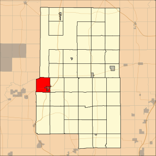
Barclay Township is a township in Cass County, Minnesota, United States. As of the 2000 census, its population was 516. Barclay Township was named for an early settler.
Hiram Township is a township in Cass County, Minnesota, United States. The population was 334 as of the 2000 census. Hiram Township was named for Hiram Wilson, a pioneer settler.

Round Lake is a city in Nobles County, Minnesota, United States. The population was 376 at the 2010 census.
Mud Lake is an unorganized territory located in Marshall County, Minnesota, United States. In both the 2000 and 2010 U.S. censuses, the unorganized territory recorded a population of 0.

The Iowa Great Lakes, often referred to as Okoboji., is a group of natural lakes in northwestern Iowa in the United States. The three principal lakes of the group are Big Spirit Lake, West Okoboji Lake, and East Okoboji Lake. They are the largest natural lakes in the state of Iowa. The largest, Spirit Lake, is 5,684 acres (2,300 ha). The lake area extends to the north into Jackson County, Minnesota. The headwaters of Little Sioux River flow past the west side of the lake area.

Eagle Mountain is the highest natural point in Minnesota, United States, at 2,301 feet (701 m). It is in northern Cook County, in the Boundary Waters Canoe Area Wilderness and Superior National Forest in the Misquah Hills, northwest of Grand Marais. It is a Minnesota State Historic Site.
Bachelor Lake is a lake in Brown County, Minnesota in the northeastern part of Stark township. Covering 79.80 acres, it is an officially protected water of the State of Minnesota. The lake is within the Cottonwood River Major Watershed. The lake’s elevation is 1,004 feet (306 m), and it is zoned as a shoreland area which is regulated as a shoreland management water.
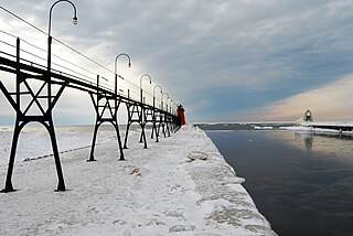
Black River is a 4.2-mile-long (6.8 km) river in the southwest part of the U.S. state of Michigan that empties into Lake Michigan in South Haven at 42°24′08″N86°17′04″W, where it discharges past the South Pier Lighthouse. The river takes its name from the dark brown color of its water, which is caused by suspended sediments and organic materials picked up along its course. The river supports a variety of wildlife including trout, snapping turtles, leeches, and many other varieties of flora and fauna. The Black River watershed encompasses 287 square miles (740 km2) across two counties and 13 townships.
Saginaw is an unincorporated area in Saint Louis County, Minnesota, United States. Although unincorporated, Saginaw has a post office with the ZIP code 55779.
Fairbanks is an unincorporated community in Fairbanks Township, Saint Louis County, Minnesota, United States; located within the Superior National Forest.
Central Lakes is an unincorporated community in Saint Louis County, Minnesota, United States.
Ash Lake is an unincorporated community in Saint Louis County, Minnesota, United States; located within the Kabetogama State Forest.

Bartlett Tripp was a U.S. Ambassador to Austria, Chief Justice of the Dakota Territory Supreme Court, first professor of the University of South Dakota College of Law and first President of the South Dakota Bar Association.
School Lake is a lake in Brown County, Minnesota, in the United States. It is a 102-acre protected lake.
Island Lake is an unincorporated community in Beltrami County, in the U.S. state of Minnesota.
Schley is an unincorporated community in Cass County, Minnesota, United States, within the Bowstring State Forest and the Chippewa National Forest. It is between Cass Lake and Bena along U.S. Highway 2 near Forest Road 2958.
Sleepy Eye Lake is a lake in Brown County, in the U.S. state of Minnesota. The lake is a 263-acre protected body of water.
Wall Lake is an unincorporated community in Otter Tail County, in the U.S. state of Minnesota.
