Bermuda is an overseas territory of the United Kingdom in the North Atlantic Ocean. Located off the east coast of the United States, it is situated around 1,770 km (1,100 mi) northeast of Miami, Florida and 1,350 km (840 mi) south of Halifax, Nova Scotia, west of Portugal, northwest of Brazil, 1,759 km (1,093 mi) north of Cuba and north-northeast of Puerto Rico. The nearest landmass is Cape Hatteras, North Carolina, about 1,030 km (640 mi) west-northwest. Although commonly referred to in the singular, the territory consists of approximately 138 islands, with a total area of 57 km2 (22 sq mi).

British North America comprised the colonial territories of the British Empire in the Americas from 1783 onwards. English colonisation of North America began in the 16th century in Newfoundland, then further south at Roanoke and Jamestown, Virginia, and more substantially with the founding of the Thirteen Colonies along the Atlantic Coast of North America.

Warwick Parish is one of the nine parishes of Bermuda. It is named after Robert Rich, 2nd Earl of Warwick (1587-1658).
Hamilton Parish is one of the nine parishes of Bermuda. It was renamed for Scottish aristocrat James Hamilton, 2nd Marquess of Hamilton (1589-1625) when he purchased the shares originally held in the Virginia Company by Lucy Russell, Countess of Bedford.

Somerset Island is one of the main islands of the chain that makes up Bermuda. It lies in the far west of the territory, and covers 2.84 square kilometres.

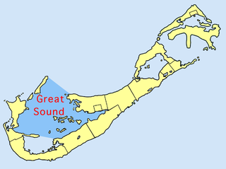
The Great Sound is large ocean inlet located in Bermuda. It may be the submerged remains of a Pre-Holocene volcanic caldera. Other geologists dispute the origin of the Bermuda Pedestal as a volcanic hotspot.

Mangrove Lake is Bermuda's largest lake. Like many of Bermuda's other lakes, it is brackish, as it lies close to the Atlantic Ocean and can be inundated by it in storms.

St. George's Harbour is a natural harbour in the north of Bermuda. It serves as the port for the town of St. George's, located on St. George's Island, to its north. To its south is St. David's Island. The harbour and both islands lie within St. George's Parish. It was for two centuries the primary harbour of the British Overseas Territory.

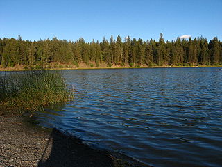
Roche Lake Provincial Park is a provincial park in British Columbia, Canada, located northeast of Stump Lake in the Nicola Country of that province's South-Central Interior. The park lies to the northwest of the city of Merritt and to the south of Kamloops.

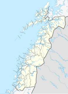
Fiskelausvatnet (Norwegian) or Guelehtsjaevrie (Southern Sami) is a lake that lies in the municipality of Grane in Nordland county, Norway. The lake lies in the northern part of Grane, about 13 kilometres (8.1 mi) northeast of Trofors. The name of the lake translates as "fishless lake".

Fustvatnet is a lake that lies in the municipality of Vefsn in Nordland county, Norway. The 10.59-square-kilometre (4.09 sq mi) lake lies just south of the lake Mjåvatnet, about 5 kilometres (3.1 mi) northeast of the town of Mosjøen. The European route E6 highway follows the northwestern coastline.

Mjåvatnet is a lake that lies in the municipality of Vefsn in Nordland county, Norway. The long, skinny, 2.61-square-kilometre (1.01 sq mi) lake lies between the lakes Ømmervatnet and Fustvatnet, about 15 kilometres (9.3 mi) northeast of the town of Mosjøen. The European route E6 highway passes along the west coast of the lake.

Gilten is a lake in the municipality of Steinkjer in Trøndelag county, Norway. The 31.62-square-kilometre (12.21 sq mi) lake lies in the northern part of Steinkjer, about 8 kilometres (5.0 mi) northeast of the village of Kvam, about 1.5 kilometres (0.93 mi) north of the village of Følling, and about 14 kilometres (8.7 mi) east of the village of Namdalseid. The lake is only accessible by road from Namdalseid, even though most of the 31.62-square-kilometre (12.21 sq mi) lake lies in Steinkjer. The lake Bangsjøan lies to the northeast and the lake Snåsavatnet lies to the south.

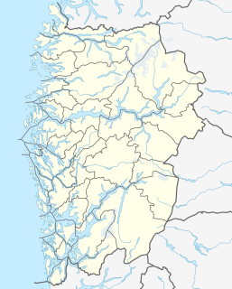
Nordmannslågen is a lake in the municipality of Eidfjord in Vestland county, Norway. At 11.09 square kilometres (4.28 sq mi), it is the largest lake in Hordaland county. The lake lies on the great Hardangervidda plateau in the central part of the Hardangervidda National Park. The lake lies about 35 kilometres (22 mi) southeast of the village of Eidfjord and about 50 kilometres (31 mi) northeast of the town of Odda. The lake is part of the headwaters of the river Numedalslågen.

Stakkastadvatnet is a lake on the border of Rogaland and Vestland counties in Norway. The 2.92-square-kilometre (1.13 sq mi) lake mostly lies in Rogaland along the municipal borders of Haugesund and Tysvær. A very small portion of the northern part of the lake crosses over into the municipality of Sveio in Vestland county. The lake lies about 6 kilometres (3.7 mi) northeast of the town of Haugesund. The lake has a small dam on the northwestern edge of the lake. The natural outlet of the lake flows through the dam and into the nearby lake Vigdarvatnet, located to the north.

Øyingen or Store Øyingen is a lake in the municipality of Snåsa in Trøndelag county, Norway. The 2.95-square-kilometre (1.14 sq mi) lake lies just outside the border of the Blåfjella–Skjækerfjella National Park. The lake Grøningen lies to the southeast and the lake Andorsjøen lies to the northeast.

Eldrevatnet or Eldrevatn is a lake in the municipality of Lærdal in Vestland county, Norway. The 3.48-square-kilometre (1.34 sq mi) lake lies at an elevation of 1,116 metres (3,661 ft) above sea level. It is located about 15 kilometres (9.3 mi) southeast of the village of Borgund, not far from the European route E16 highway and the Filefjell Kongevegen road. The lake Øljusjøen lies 4 kilometres (2.5 mi) south of the lake. The lake Juklevatnet and the mountain Høgeloft both lie about 5 kilometres (3.1 mi) to the northeast of the lake.

The following outline is provided as an overview of and topical guide to Bermuda:

Leksdalvatnet is a lake in Trøndelag county, Norway that lies in the municipalities of Steinkjer and Verdal. It is located south of the town of Steinkjer and northeast of the town of Verdalsøra, about 6 kilometres (3.7 mi) east of the Trondheimsfjord. The 21.73-square-kilometre (8.39 sq mi) lake sits at an elevation of 70 metres (230 ft) above sea level. It is drained by Figgja.

The Sevier Desert is a large arid section of central-west Utah, United States, and is located in the southeast of the Great Basin. It is bordered by deserts north, west, and south; its east border is along the mountain range and valley sequences at the perimeter of the Great Basin, with the large north–south Wasatch Range and its associated mountainous landforms. Its eastern border is specifically, the East Tintic, Gilson, and Canyon Mountains; also the massive Pahvant Range.


