Trumon

Last updated
Trumon
Trumon
Coordinates: 2°42′00″N97°43′00″E / 2.7°N 97.7167°E / 2.7; 97.7167
Country Flag of Indonesia.svg Indonesia
Province Flag of Aceh, Indonesia.svg Aceh
Regency Lambang Kabupaten Aceh Selatan.png South Aceh

Trumon is a district in South Aceh Regency, Aceh, Indonesia. [1] [2]

History

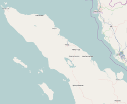
Trumon has a close relationship with the Trumon Kingdom, which is estimated to have been established in the 16th century. This kingdom is one of the small kingdoms in Aceh that has an important role in trade and diplomatic relations, especially through small ports on the coast of its territory. The Trumon Kingdom is known as part of a network of kingdoms in Aceh that supported the Sultanate of Aceh Darussalam. [3] [4]

The legacy of the Trumon Kingdom is still part of the identity of the local community. Traditions, customs, and history of the kingdom are passed down through folklore and cultural relics, such as the tombs of kings and other historical sites. The Trumon Kingdom is a symbol of pride for the people of Trumon District, who continue to preserve the cultural and historical values that are inherited. [5] [6] [7]

Related Research Articles

<span class="mw-page-title-main">North Sumatra</span> Province of Indonesia

North Sumatra, also called North Sumatra Province, is a province of Indonesia located in the northern part of the island of Sumatra, just south of Aceh. Its capital and largest city is Medan on the east coast of the island. It is bordered by Aceh on the northwest and Riau and West Sumatra on the southeast, by coastlines located on the Indian Ocean to the west, and by the Strait of Malacca to the east.

<span class="mw-page-title-main">South Kalimantan</span> Province in Indonesia

South Kalimantan is a province of Indonesia. It is the second most populous province on the island of Kalimantan, the Indonesian territory of the island of Borneo after West Kalimantan. The provincial capital was Banjarmasin until 15 February 2022 when it was legally moved 35 kms southeast to Banjarbaru. The population of South Kalimantan was recorded at just over 3.625 million people at the 2010 Census, and at 4.07 million at the 2020 Census. The official estimate as at mid 2023 was 4,221,929. One of the five Indonesian provinces in Kalimantan, it is bordered by the Makassar Strait in the east, Central Kalimantan in the west and north, the Java Sea in the south, and East Kalimantan in the northeast. The province also includes the island of Pulau Laut, located off the eastern coast of Kalimantan, as well as other smaller offshore islands. The province is divided into 11 regencies and 2 cities. South Kalimantan is the traditional homeland of the Banjar people, although some parts of East Kalimantan and Central Kalimantan are also included in this criterion. Nevertheless, South Kalimantan, especially the former capital city Banjarmasin has always been the cultural capital of Banjarese culture. Many Banjarese have migrated to other parts of Indonesia, as well as neighbouring countries such as Singapore and Malaysia. In addition, other ethnic groups also inhabit the province, such as several groups of the Dayaks, who mostly live in the interior part of the province, as well as the Javanese, who mostly migrated from Java due to the Transmigration program which dated from the Dutch colonial era. It is one of the provinces in Indonesia that has a larger population than Mongolia.

<span class="mw-page-title-main">Lampung</span> Province of Indonesia

Lampung, officially the Province of Lampung, is a province of Indonesia. It is located on the southern tip of the island of Sumatra. It has a short border with the province of Bengkulu to the northwest, and a longer border with the province of South Sumatra to the north, as well as a maritime border with the provinces of Banten and Jakarta to the east. It is the home of the Lampung people, who speak their own language and possess their own written script. Its capital city is Bandar Lampung.

<span class="mw-page-title-main">Natuna Regency</span> Regency in Riau Islands, Indonesia

Natuna Regency is an islands regency located in the northernmost part of the Province of Riau Islands, Indonesia. It contains at least 154 islands, of which 127 of them are reported as uninhabited. This archipelago, with a land area of 1,978.49 km2 out of a total area of 264,198.37 km2 area, This area is divided into island clusters such as the Natuna Island Cluster and the Serasan Island Cluster. However, several other islands that are not located in the two clusters are spread over a wider area. This division reflects the geographical and administrative location of the district, but there are also other small islands that are outside these two main clusters and are not always included in the grouping. Administratively, this area is divided into 17 districts (kecamatan) which function to facilitate management and services for the local community and support the development of the potential of the region which is rich in natural resources and tourism. This regency also plays an important role in maintaining Indonesia's sovereignty in the northern border area.

<span class="mw-page-title-main">Denpasar</span> City and capital of Bali, Indonesia

Denpasar is the capital city of the province of Bali, Indonesia. Denpasar is the main gateway to the Bali island, the city is also a hub for other cities in the Lesser Sunda Islands.

<span class="mw-page-title-main">Baduy people</span> Ethnic group in Indonesia

Baduy people are an indigenous Sundanese ethnic group native to the southeastern part of Banten, specifically Lebak Regency, Banten, Indonesia.

<span class="mw-page-title-main">Banjarmasin</span> City in Kalimantan, Indonesia

Banjarmasin is the largest city in South Kalimantan, Indonesia. It was the capital of the province until 15 February 2022. The city is located on a delta island near the junction of the Barito and Martapura rivers. Historically the centre of the Banjarese culture, and the capital of the Sultanate of Banjar, it is the biggest city in South Kalimantan and one of the main cities of Kalimantan. The city covers an area of 98.46 km2 (38.02 sq mi) and had a population of 625,481 as of the 2010 Census and 657,663 as of the 2020 Census; the official estimate as of mid 2023 was 675,915. It is the third most populous city on the island of Borneo.

<span class="mw-page-title-main">Aceh Besar Regency</span> Regency in Sumatra, Indonesia

Great Aceh Regency is a regency of the Indonesian province of Aceh. The regency covers an area of 2,903.49 square kilometres and had a population of 351,418 at the 2010 Census, 391,870 at the 2015 census and 405,535 at the 2020 Census; the official estimate as at mid 2023 was 435,298. The Regency is located at the northwest tip of Sumatra island and surrounds the provincial capital of Banda Aceh, many suburbs of which lie within the Regency. It also includes a number of islands off the northern tip of Sumatra, which comprise Pulo Aceh District within the regency. The seat of the Regency government is the town of Jantho.

<span class="mw-page-title-main">Gunungsitoli</span> City in Sumatra, Indonesia

Gunungsitoli is a city located in North Sumatra province, Indonesia, on the Indian Ocean island of Nias, west of Sumatra. Gunungsitoli is the island's only city and is the main hub for the island and surrounding smaller islands. Located on the north-eastern side of Nias island, the city was historically a series of fortifications made by the Dutch colonial administration in the 1600s to defend against frequent raids from Nias tribes, especially those from southern parts of the island. Until 1914, it was the only part of the island that was effectively controlled by the Dutch.

<span class="mw-page-title-main">Pidie Regency</span> Regency in Sumatra, Indonesia

Pidie Regency is a regency of Aceh Special region, in Indonesia. It is located in the north of the island of Sumatra, in Western Indonesia, bordered by the Malacca Strait and Pidie Jaya Regency in the north, Aceh Besar Regency in the west, Bireuen Regency in the northeast, and Aceh Jaya Regency in the south. The regency covers an area of 3,184.46 square kilometres and had a population of 379,108 people at the 2010 Census and 435,275 at the 2020 Census; the official estimate as at mid 2023 was 448,085 - comprising 223,208 males and 224,877 females. Pidie was the largest rice-producing area of Aceh province, producing some 20% of its total output.

<span class="mw-page-title-main">Selayar Islands Regency</span> Regency in Sulawesi, Indonesia

The Selayar Islands Regency is a regency of Indonesia in South Sulawesi province that covers the Selayar Islands, which lie southeast of the southern peninsula of Sulawesi. The archipelago consists of the group's main island, which is surrounded by 41 smaller islands around its coast; further to the southeast lies a widespread group of islands, including the smaller but still substantial islands of Pasimassunggu, Pasimarannu and Pasilambena in the far south, and the huge atoll of Takabonerate. The regency covers an area of 1,357.03 km2, and had a population of 103,596 at the 2000 Census, 122,055 at the Census of 2010 and 137,071 as of 2020. The official estimate for mid 2023 was 142,100. The administrative centre is the town of Benteng on Selayar Island. The Selayar Straits separate the regency from Sulawesi island.

<span class="mw-page-title-main">South Aceh Regency</span> Regency in Sumatra, Indonesia

South Aceh Regency is a regency in the Aceh province of Indonesia. It is located on the west coast of the island of Sumatra. The regency covers an area of 4,173.82 square kilometres and had a population of 202,251 at the 2010 Census, 224,588 in 2015 and 232,414 at the 2020 Census; the official population estimate in mid-2023 was 239,475 . Its population density was thus 48.5 inhabitants/km2 at the 2010 census, 53.8 inhabitants/km2 in 2015, 55.7 inhabitants/km2 at the 2020 census, and 57.4 inhabitants/km2 in mid-2023. The seat of the regency government is at Tapaktuan.

<span class="mw-page-title-main">Acehnese people</span> Ethnic group in Indonesia

The Acehnese, also written as Atjehnese and Achinese, are an indigenous ethnic group native to Aceh, Indonesia on the northernmost tip of the island of Sumatra. The area has a history of political struggle against the Dutch colonial rule. The vast majority of Acehnese people are Muslims. The Acehnese people are also referred to by other names such as Lam Muri, Lambri, Akhir, Achin, Asji, A-tse and Atse. Their language, Acehnese, belongs to the Aceh–Chamic group of Malayo-Polynesian of the Austronesian language family.

<span class="mw-page-title-main">Keumalahayati</span> Indonesian female admiral

Keumalahayati, or Malahayati, was an admiral of the Aceh Sultanate navy, which ruled the area of modern Aceh Province, Sumatra, Indonesia. She was the first woman admiral in the modern world. Her troops were drawn from Aceh's widows and the army named the "Inong Balee", after Fort Inong Balee

<span class="mw-page-title-main">Fort Rotterdam</span> Dutch fort built in Makassar on the island of Sulawesi in Indonesia

Fort Rotterdam is a 17th-century fort in Makassar on the island of Sulawesi in Indonesia. It is a Dutch fort that was built on top of an existing fort of the Gowa Kingdom. The first fort on the site was constructed by the a local sultan around 1634, to counter Dutch encroachments. The site was ceded to the Dutch under the Treaty of Bongaya, and they completely rebuilt it between 1673 and 1679. It had six bastions and was surrounded by a seven meter high rampart and a two meter deep moat.

<span class="mw-page-title-main">Tana Tidung Regency</span> Regency of Indonesia

Tana Tidung Regency is a regency within the Indonesian province of North Kalimantan. It is Indonesia's least populous regency, with 25,584 inhabitants recorded in the 2020 census; the official estimate as at mid 2023 was 27,470. Its regency seat is the town of Tideng Pale, in Sesayap District, where 11,227 of the regency's population lived in mid 2023.

<span class="mw-page-title-main">Aru kingdom</span> Kingdom in Sumatra

Aru was a major Sumatran kingdom from the 13th to the 16th century. It was located on the eastern coast of North Sumatra, Indonesia. In its heyday the kingdom was a formidable maritime power, and was able to control the northern part of the Malacca strait.

The Salawati Kingdom is the Islamic kingdom that once stood in Salawati Island, Raja Ampat Regency, Southwest Papua. The center of the Salawati kingdom was located in the Samate village which is currently located in the North Salawati district.

References

  1. Kementerian Dalam Negeri Indonesia (2018-12-29). Permendagri No. 137 Tahun 2017.
  2. "Kecamatan Trumon Dalam Angka 2023". acehselatankab.bps.go.id (in Indonesian). Retrieved 2024-12-19.
  3. Sibutarbutar, Masnauli. Sudirman (ed.). "Benteng Trumon" (PDF). Repositori Kemendikbud. set by Risky Syawal;coordinator by Kasubag Umum BPK Wilayah I. Retrieved 10 November 2024.
  4. Abonita, Rino (2021-02-09). "Kesunyian Benteng Kuta Batee Aceh: Heroisme dan Pengkhianatan di Baliknya". Liputan6. Retrieved 2024-12-19.
  5. Harfianda, Dedi (2019). "Pemanfaatan Tinggalan Arkeologi di Situs Kuta Batee Trumon Aceh Selatan" (PDF). Repository Ar-Raniry. Retrieved 10 November 2024.
  6. Popularitas (2024-11-26). "Benteng Kuta Batee, sisa peninggalan Kerajaan Trumon di Aceh Selatan, kini jadi wisata edukasi". Popularitas.com (in Indonesian). Retrieved 2024-12-19.
  7. Abik, Hendri. Noor, Zainal M (ed.). "Benteng Kuta Batee, Peninggalan Bersejarah Kerajaan Trumon di Aceh Selatan". SerambiWiki. Retrieved 10 November 2024.