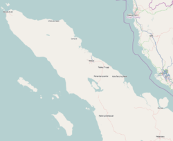
South Aceh Regency

Last updated
South Aceh Regency
Kabupaten Aceh Selatan
Sikulat, Sawang, South Aceh Regency, Aceh, Indonesia - panoramio (10).jpg
Sikulat
Lambang Kabupaten Aceh Selatan.png
Motto(s): 
Satya Bakti
(Loyal and Devout)
Lokasi Aceh Kabupaten Aceh Selatan.svg
Location within Aceh
Location map Northern Sumatra.png
Red pog.svg
South Aceh Regency
Location in Northern Sumatra, Sumatra and Indonesia
Indonesia Sumatra location map.svg
Red pog.svg
South Aceh Regency
South Aceh Regency (Sumatra)
Indonesia location map.svg
Red pog.svg
South Aceh Regency
South Aceh Regency (Indonesia)
Coordinates: 3°08′N97°27′E / 3.133°N 97.450°E / 3.133; 97.450
Country Flag of Indonesia.svg  Indonesia
Region Sumatra
Province Flag of Aceh, Indonesia.svg  Aceh
Established1956
Regency seat Tapaktuan
Government
  RegentAmran
  Vice RegentNasjuddin
Area
  Total
4,173.82 km2 (1,611.52 sq mi)
Population
 (mid 2024 estimate) [1]
  Total
241,994
  Density58/km2 (150/sq mi)
Time zone UTC+7 (IWST)
Area code (+62) 656
Website acehselatankab.go.id

South Aceh Regency (Indonesian : Kabupaten Aceh Selatan) is a regency in the Aceh province of Indonesia. It is located on the west coast of the island of Sumatra. The regency covers an area of 4,173.82 square kilometres and had a population of 202,251 at the 2010 Census [2] and 232,414 at the 2020 Census; [3] the official population estimate in mid 2024 was 241,994. [1] Its population density was thus 48.5 inhabitants/km2 at the 2010 census, 55.7 inhabitants/km2 at the 2020 census, and 58.0 inhabitants/km2 in mid 2024. The seat of the regency government is at Tapaktuan.

Contents

Demography

While some 60% of the Regency's population are ethically Achinese, some 30% of the people of the regency are Minangkabau-descended Aneuk Jamee and about 10% are ethnically Kluet people. [4]

History

South Aceh Regency was originally created on 14 November 1956 (under Emergency Law No.7 of 1956) from the former southeastern districts of West Aceh Regency. On 20 April 1999 (under Law No.14 of 1999) its own southeastern districts were in turn split off to create a separate Aceh Singkil Regency, and it was further reduced in size on 10 April 2002 (under Law No.4 of 2002) by further districts in the northwest of the regency being split off to create a Southwest Aceh Regency.

Administrative districts

At the time of the 2010 Census, the regency was divided administratively into sixteen districts (kecamatan). Later in 2010, two additional districts (Trumon Tengah and Kota Bahagia) were carved out of the existing districts. The districts are listed below with their areas and populations at the 2010 Census [2] and the 2020 Census, [3] together with the official estimates for mid 2024. [1] The districts are grouped into five geographical units, which have no administrative significance. The table also includes the locations of the district administrative centres, the number of villages (gampong) in each district, and its postal codes.

Kode
Kemendagri
Name of
District
(kecamatan)
Area
in
km2
Pop'n
Census
2010
Pop'n
Census
2020
Pop'n
Estimate
mid 2024
Admin
centre
No.
of
villages
Post
codes
11.01.09Trumon (a) [5] 765.925,6146,0256,895Keude Trumon1223774
11.01.16Trumon Timur [6]
(East Trumon)
285.3410,3408,5289,272Krueng Luas823776
11.01.18Trumon Tengah [7]
(Central Trumon)
123.50(b)6,6927,186Ladang Rimba1023775
Subtotal Trumon area(c)1,174.7615,95421,24523,35330
11.01.01Bakongan (d) [8] 57.6210,9135,3645,524Bakongan723773
11.01.15Bakongan Timur [9]
(East Bakongan)
73.815,2086,1776,484Seubadeh723777
11.01.17Kota Bahagia [10]
(Bahagia Town)
244.63(e)7,0067,235Bukit Gadeng1023778
Subtotal Bakongan area376.0616,12118,54719,24324
11.01.03Kluet Selatan [11]
(South Kluet)
106.5812,47714,38014,937Kandang1723772
11.01.14Kluet Timur [12]
(East Kluet)
449.039,41810,54111,222Paya Dapur923779
11.01.02Kluet Utara [13]
(North Kluet)
73.2422,27124,86425,550Kota Fajar2123771
11.01.10Pasie Raja [14] 98.1115,50018,03818,796Ladang Tuha2123755
11.01.13Kluet Tengah [15]
(Central Kluet)
801.086,1207,5037,978Manggamat1323770
Subtotal Kluet area1,528.0465,78675,32678,48381
11.01.08Tapaktuan [16] 100.7322,54023,19023,702Tapaktuan1823711 - 23718
11.01.06Samadua [17] 112.9114,44016,05516,437Samadua2823752
11.01.07Sawang (f) [18] 189.3813,67915,96816,659Sawang1523753
11.01.05Meukek [19] 465.0618,26120,95621,719Meukek2323754
Subtotal Central area868.0868,92076,16978,51784
11.01.04Labuhan Haji [20] 54.8311,82313,38913,805Labuhan Haji1623761
11.01.11Labuhan Haji Timur [21]
(East Labuhan Haji)
95.509,13710,03210,258Peulumat1223758
11.01.12Labuhan Haji Barat [22]
(West Labuhan Haji)
76.5615,49517,70618,335Blang Keujeren1523757
Subtotal Labuhan Haji area226.8936,45541,12742,39843
Totals for regency4,173.82202,251232,414241,994Tapaktuan260

Note: (a) including small offshore islands including Pulau Trumon.
(b) The 2010 population of Trumon Tengah District is included in the 2010 figure for Trumon Timur District, from which it was split.
(c) The Trumon area which forms the southern 28% of the Regency is adjacent to the city of Subulussalam to the east.
(d) including offshore island of Pulau Kayee.
(e) The 2010 population of Kota Bahagia District is included in the 2010 figure for Bakongan District, from which it was split.
(f) including offshore island of Pulau Batukapal.

See also

References

  1. 1 2 3 Badan Pusat Statistik, Jakarta, 28 February 2025, Kabupaten Aceh Selatan Dalam Angka 2025 (Katalog-BPS 1102001.1103)
  2. 1 2 Biro Pusat Statistik, Jakarta, 2011.
  3. 1 2 Badan Pusat Statistik, Jakarta, 2021.
  4. Davies, Matthew N. (2006). Indonesia's war over Aceh: last stand on Mecca's porch. Taylor & Francis. pp. 21–. ISBN   978-0-415-37239-8. Archived from the original on 15 September 2023. Retrieved 20 December 2010.
  5. Badan Pusat Statistik, Jakarta, 26 September 2024, Kecamatan Trumon Dalam Angka 2024 (Katalog-BPS 1102001.1103010).
  6. Badan Pusat Statistik, Jakarta, 26 September 2024, Kecamatan Trumon Timur Dalam Angka 2024 (Katalog-BPS 1102001.1103011).
  7. Badan Pusat Statistik, Jakarta, 26 September 2024, Kecamatan Trumon Tengah Dalam Angka 2024 (Katalog-BPS 1102001.1103012).
  8. Badan Pusat Statistik, Jakarta, 26 September 2024, Kecamatan Bakongan Dalam Angka 2024 (Katalog-BPS 1102001.1103020).
  9. Badan Pusat Statistik, Jakarta, 26 September 2024, Kecamatan Bakongan Timur Dalam Angka 2024 (Katalog-BPS 1102001.1103021).
  10. Badan Pusat Statistik, Jakarta, 26 September 2024, Kecamatan Kota Bahagia Dalam Angka 2024 (Katalog-BPS 1102001.1103022).
  11. Badan Pusat Statistik, Jakarta, 26 September 2024, Kecamatan Kluet Selatan Dalam Angka 2024 (Katalog-BPS 1102001.1103030).
  12. Badan Pusat Statistik, Jakarta, 26 September 2024, Kecamatan Kluet Timur Dalam Angka 2024 (Katalog-BPS 1102001.1103031).
  13. Badan Pusat Statistik, Jakarta, 26 September 2024, Kecamatan Kluet Utara Dalam Angka 2024 (Katalog-BPS 1102001.1103040).
  14. Badan Pusat Statistik, Jakarta, 26 September 2024, Kecamatan Pasie Raja Dalam Angka 2024 (Katalog-BPS 1102001.1103041).
  15. Badan Pusat Statistik, Jakarta, 26 September 2024, Kecamatan Kluet Tengah Dalam Angka 2024 (Katalog-BPS 1102001.1103042).
  16. Badan Pusat Statistik, Jakarta, 26 September 2024, Kecamatan Tapaktuan Dalam Angka 2024 (Katalog-BPS 1102001.1103050).
  17. Badan Pusat Statistik, Jakarta, 26 September 2024, Kecamatan Samadua Dalam Angka 2024 (Katalog-BPS 1102001.1103060).
  18. Badan Pusat Statistik, Jakarta, 26 September 2024, Kecamatan Sawang Dalam Angka 2024 (Katalog-BPS 1102001.1103070).
  19. Badan Pusat Statistik, Jakarta, 26 September 2024, Kecamatan Meukek Dalam Angka 2024 (Katalog-BPS 1102001.1103080).
  20. Badan Pusat Statistik, Jakarta, 26 September 2024, Kecamatan Labuhan Haji Dalam Angka 2024 (Katalog-BPS 1102001.1103090).
  21. Badan Pusat Statistik, Jakarta, 26 September 2024, Kecamatan Labuhan Haji Timur Dalam Angka 2024 (Katalog-BPS 1102001.1103091).
  22. Badan Pusat Statistik, Jakarta, 26 September 2024, Kecamatan Labuhan Haji Barat Dalam Angka 2024 (Katalog-BPS 1102001.1103092).

3°08′N97°27′E / 3.133°N 97.450°E / 3.133; 97.450