Tapaktuan

Last updated
Tapaktuan
Pantai dekat Tapak Tuan - panoramio.jpg
A beach in Tapaktuan
Location map Northern Sumatra.png
Red pog.svg
Tapaktuan
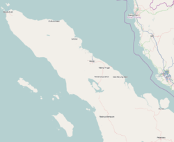
Location in Northern Sumatra, Sumatra and Indonesia
Indonesia Sumatra location map.svg
Red pog.svg
Tapaktuan
Tapaktuan (Sumatra)
Indonesia location map.svg
Red pog.svg
Tapaktuan
Tapaktuan (Indonesia)
Coordinates: 3°15′0″N97°10′0″E / 3.25000°N 97.16667°E / 3.25000; 97.16667
CountryIndonesia
Region Sumatra
Province Aceh
Area
  Total
106.99 km2 (41.31 sq mi)
Population
 (2023 estimate)
  Total
22,352
  Density210/km2 (540/sq mi)
  [1]
Time zone UTC+7 (IWST)
Area code (+62) 627

Tapaktuan is a town and administrative district (kecamatan) in the southwest of Aceh province of Indonesia. The town is the capital (seat of the government) of South Aceh Regency. The district covers a land area of 106.99 km2, which is subdivided into 18 towns and villages (gampong). According to the official estimates for 2023, it has a population of 22,352. [1]
Contents

Climate

Tapaktuan has a tropical rainforest climate (Af) with heavy to very heavy rainfall year-round.

Climate data for Tapaktuan
MonthJanFebMarAprMayJunJulAugSepOctNovDecYear
Mean daily maximum °C (°F)30.9
(87.6)
31.7
(89.1)
32.2
(90.0)
32.5
(90.5)
32.6
(90.7)
32.6
(90.7)
32.3
(90.1)
32.2
(90.0)
31.5
(88.7)
31.3
(88.3)
30.7
(87.3)
30.6
(87.1)
31.8
(89.2)
Daily mean °C (°F)26.5
(79.7)
26.8
(80.2)
27.2
(81.0)
27.6
(81.7)
27.8
(82.0)
27.5
(81.5)
27.1
(80.8)
27.2
(81.0)
26.9
(80.4)
27.0
(80.6)
26.6
(79.9)
26.5
(79.7)
27.1
(80.7)
Mean daily minimum °C (°F)22.1
(71.8)
22.0
(71.6)
22.3
(72.1)
22.8
(73.0)
23.0
(73.4)
22.5
(72.5)
22.0
(71.6)
22.2
(72.0)
22.4
(72.3)
22.7
(72.9)
22.5
(72.5)
22.4
(72.3)
22.4
(72.3)
Average rainfall mm (inches)251
(9.9)
213
(8.4)
323
(12.7)
350
(13.8)
246
(9.7)
178
(7.0)
197
(7.8)
227
(8.9)
267
(10.5)
344
(13.5)
353
(13.9)
301
(11.9)
3,250
(128)
Source: Climate-Data.org [2]

Further reading

Related Research Articles

<span class="mw-page-title-main">Banda Aceh</span> City and capital of Aceh, Indonesia

Banda Aceh is the capital and largest city in the province of Aceh, Indonesia. It is located on the island of Sumatra and has an elevation of 35 metres. The city covers an area of 61.36 square kilometers (23.69 sq mi) and had a population of 223,446 people at the 2010 Census, rising to 252,899 at the 2020 Census. The official estimate as at mid 2023 was 259,538.

<span class="mw-page-title-main">Meulaboh</span> Town in Aceh, Indonesia

Meulaboh is the capital of West Aceh Regency, Indonesia.

<span class="mw-page-title-main">Calang</span> Town in Sumatra, Indonesia

Calang, the capital of the Aceh Jaya Regency of the special territory of Aceh, is on the island of Sumatra, Indonesia. It had a population of about 12,000 though it was reported to have "vanished completely leaving only scattered shards of concrete" as a result of the tsunami produced by the 2004 Indian Ocean earthquake. Only about 30 per cent of the townspeople survived.

<span class="mw-page-title-main">Cilacap Regency</span> Regency of Indonesia

Cilacap Regency is a regency in the southwestern part of Central Java province in Indonesia. Its capital is the town of Cilacap, which had 260,376 inhabitants in mid 2023, spread over three administrative districts.

<span class="mw-page-title-main">Cibinong</span> Town and District in West Java, Indonesia

Cibinong is a large town and an administrative district (kecamatan) in Bogor Regency, West Java Province, Indonesia which serves as the Regency's administrative seat - not to be confused with the district of the same name in Cianjur Regency. The town is located immediately due south of the city of Depok, which itself lies just south of Jakarta, with both Depok and Cibinong being part of the Jakarta Metropolitan Area. The town and district are named after the Binong River. Cibinong District covers a land area of 44.27 km2, and had 326,519 inhabitants at the 2010 Census and 363,424 inhabitants at the 2020 Census; the official estimate as at mid 2023 was 365,387 - comprising 183,718 males and 181,669 females. The administrative headquarters are in the town of Cirimekar.

<span class="mw-page-title-main">Langsa</span> City in Sumatra, Indonesia

Langsa, is a city in Aceh, Indonesia. It is located on the island of Sumatra. Apart from a small seacoast to the northeast, it borders Manyak Payed District of Aceh Tamiang Regency to the east and is otherwise surrounded by Birem Bayeun District of Aceh Timur Regency to the north, west and south. The city covers an area of 239.83 square kilometres and had a population of 148,945 at the 2010 Census ; this grew to 185,971 at the 2020 Census, and the official estimate as at mid 2023 was 186,958.

<span class="mw-page-title-main">Lhokseumawe</span> City in Sumatra, Indonesia

Lhokseumawe, is the second largest city in Aceh province, Indonesia, having recently overtaken Langsa. The city covers an area of 181.06 square kilometres, and had a population of 171,163 at the 2010 census and 188,713 at the 2020 census; the official estimate as at mid 2023 was 196,067. The city is a key regional centre important for the economy of Aceh.

<span class="mw-page-title-main">North Aceh Regency</span> Regency in Sumatra, Indonesia

North Aceh Regency is a regency in Indonesia's Aceh Province - which was formerly called the Aceh special territory in 1959–2001), and then Nanggroë Aceh Darussalam in 2001–2009), before reverting to Aceh Province in 2009. It is located on the island of Sumatra. The regency covers an area of 3,296.86 square kilometres and had a population of 534,085 at the 2010 census and 602,793 at the 2020 Census; the official estimate as at mid 2023 was 624,582.

<span class="mw-page-title-main">Serang</span> City and capital of Banten, Indonesia

Serang is a city and the capital of Banten province and was formerly also the administrative center of Serang Regency in Indonesia. The city is located towards the north of Banten province, on the island of Java; the north part of the city contains the coast zone facing onto Banten Bay, and includes the historical site of Old Banten, after which the province is named. Before Banten province was formed in 2000, Serang city was part of West Java province.

<span class="mw-page-title-main">Palabuhanratu</span> District in West Java, Indonesia

Palabuhanratu or Pelabuhan Ratu is an administrative district (kecamatan) and a fishing town which serves as the regency seat of Sukabumi Regency. The town is at the southwest coast of Palabuhanratu Bay, West Java facing the Indian Ocean. It is a four-hour drive from Bandung and up to a 12-hour drive from Indonesia's capital Jakarta due to traffic jams in Ciawi, Cicurug, Cibadak and Pelabuhan Ratu gate, whose residents love to visit the bay 'Teluk Palabuhanratu', once named 'Wijnkoopersbaai' by the Dutch. The bay is shaped like a horseshoe and has enormous waves that can be very treacherous. The Sundanese locals say that the Indian Ocean is the home of Nyai Loro Kidul who reigns along the southern coast of Java.

<span class="mw-page-title-main">South Aceh Regency</span> Regency in Sumatra, Indonesia

South Aceh Regency is a regency in the Aceh province of Indonesia. It is located on the west coast of the island of Sumatra. The regency covers an area of 4,205.33 square kilometres and had a population of 202,251 at the 2010 Census, 224,588 in 2015 and 232,414 at the 2020 Census; the official population estimate in 2023 was 236,933. Its population density was thus 48.1 inhabitants/km2 at the 2010 census, 55.3 inhabitants/km2 at the 2020 census, and 56.3 inhabitants/km2 in 2023. The seat of the regency government is at Tapaktuan.

<span class="mw-page-title-main">Subulussalam</span> City in Sumatra, Indonesia

Subulussalam is a city in the south of Aceh province of Indonesia. It is located inland on the island of Sumatra. On 2 January 2007, the provincial government of Aceh declared Subulussalam to be an independent city as a result of the administration being separated from that of Aceh Singkil Regency. of which it was formerly a part. It is located at 2°38′32″N98°00′15″E. It covers an area of 1,440 km2, and it had a population of 67,446 at the 2010 Census and of 90,751 at the 2020 Census; the official estimate as in 2023 was 103,074. As a result, Subulussalam is the most sparsely-populated city in Indonesia, with an overall population density in 2023 of only 71.6 people per km2, and including wide swathes of rural areas.

Lhoksukon is a town in Aceh province of Indonesia and it is the seat of North Aceh Regency. The town covers a land area of 243 km2, and had a population of 44,358 at the 2010 Census and 49,733 at the 2020 Census; the estimated population as at mid 2023 was 51,421. The postcode is 24382.

Ruteng is a town in the highlands towards the western end of Flores Island, Indonesia. It is the administrative capital of Manggarai Regency, serviced by the Frans Sales Lega Airport or Ruteng Airport. The population is predominantly Roman Catholic, but still preserve the ancient Manggarai custom of caci, which is usually practiced at weddings, and serves as a tourist attraction.

<span class="mw-page-title-main">Yalimo Regency</span> Regency in Highland Papua, Indonesia

Yalimo Regency is one of the regencies in the Indonesian province of Highland Papua. It covers an area of 4,320.29 km3, and had a population at the 2010 Census of 50,763 which doubled to reach 101,973 at the 2020 Census; the official estimate as at mid 2023 was 106,740. The administrative centre is at Elelim. The indigenous inhabitants of this well-forested mountainous area are the Yali people.

Rangkasbitung is a town and an administrative district (kecamatan), in Banten Province of Java, Indonesia. The district covers an area of 73.76 km2, and had a population of 116,659 at the 2010 Census and 134,945 at the 2020 Census, while the official estimate as of mid-2023 was 144,733, comprising 73,678 males and 71,055 females.

Jonggol is a town and an administrative district in the Bogor Regency, West Java, Indonesia. The town is located 50 km to the southeast of Jakarta. The district is part of the Greater Jakarta metropolitan area, and is within the Bekasi river basin. It covers a land area of 118.86 km2, and had a population of 122,697 at the 2010 Census and 143,512 at the 2020 Census; the official estimate as at mid 2023 was 156,006 - comprising 78,846 males and 77,160 females. The district centre is at the town of Jonggol, and the district is sub-divided into 14 villages (desa), all sharing the postcode of 16830, as listed below with their areas and populations as at mid 2023. Not just a sub-district, Jonggol is now known as a vast tourist area in the southeast of Jakarta which includes several sub-districts, Sukamakmur, Cariu, Tanjungsari, Cileungsi, and Klapanunggal.

<span class="mw-page-title-main">Paser Regency</span> Regency in East Kalimantan, Indonesia

Paser Regency is the southernmost regency (kabupaten) within the East Kalimantan province of Indonesia. It was created in 1959, originally spelt "Pasir Regency", but renamed "Paser" in 2007; however its northeastern districts were split off on 10 April 2002 to form the new Penajam North Paser Regency. The residual regency covers an area of 11,603.94 km2, and it had a population of 230,316 at the 2010 Census and 275,452 at the 2020 Census; the official estimate as at mid-2023 was 303,424. Its administrative centre is the town of Tana Paser.

<span class="mw-page-title-main">Sukamara Regency</span> Regency of Indonesia

Sukamara Regency is one of the thirteen regencies which comprise the Central Kalimantan Province on the island of Kalimantan (Borneo), Indonesia. It was created on 10 April 2002 from the former southwest part of West Kotawaringin Regency. The town of Padang contains the administrative centre of Sukamara Regency, and had a population of 6,555 in mid 2023. The Regency covers an area of 3,827 km2, and had a population of 44,952 at the 2010 Census and 63,464 at the 2020 Census; the official estimate as at mid 2023 was 63,039.

<span class="mw-page-title-main">Tigaraksa</span> Town and district in Banten, Indonesia

Tigaraksa is a town and an administrative district (kecamatan) located in the Tangerang Regency of Banten Province on Java (island), Indonesia. The district covers a land area of 55.30 km2 and had 119,245 inhabitants in 2010 and 155,557 inhabitants in 2020; the official estimate as at mid 2023 was 163,531. The administrative headquarters of the Regency and of the district are located at the town of Tigaraksa.

References

  1. 1 2 Badan Pusat Statistik, Jakarta, 26 September 2024, Kecamatan Tapaktuan Dalam Angka 2024 (Katalog-BPS 1102001.1103050).
  2. "Climate: Tapaktuan". Climate-Data.org. Archived from the original on 15 September 2023. Retrieved 5 November 2020.