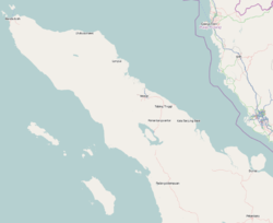
Nagan Raya Regency (Indonesian: Kabupaten Nagan Raya) is a regency in the Aceh special region of Indonesia. It is located on the island of Sumatra, and was formed on 10 April 2002 from districts formerly part of West Aceh Regency. The seat of the regency government is at Suka Makmue. The regency covers an area of 3,544.9 square kilometres and had a population of 139,663 people according to the 2010 Census[2] and 168,392 at the 2020 Census.[3] The official estimate as of mid 2024 was 181,103 (comprising 91,321 males and 89,782 females).[1]
As at 2010, the regency was divided administratively into eight districts (kecamatan); however in 2011 two additional districts were created - Tripa Makmur (by division from Darul Makmur District) and Beutong Ateuh Banggalang (by division from Beutong District). Their areas (in km2) and their populations at the 2010 Census[2] and 2020 Census,[3] together with the official estimates as at mid 2024,[1] are listed below. The table also includes the locations of the district administrative centres, the number of villages (gampong) in each district, and its postal codes.
Kode Wilayah
Name of District (kecamatan)
Area in km2
Pop'n Census 2010
Pop'n Census 2020
Pop'n Estimate mid 2024
Admin centre
No. of villages
Post codes
11.15.05
Darul Makmur
1,027.93
46,954
49,412
53,232
Alue Bilie
40
23662
11.15.09
Tripa Makmur
189.413
(a)
9,038
9,950
Kabu
11
23663
11.15.01
Kuala
120.89
18,540
22,350
23,689
Ujong Fatihah
17
23661
11.15.07
Kuala Pesisir (Coastal Kuala)
76.34
14,110
17,338
18,587
Padang Rubek
16
23660
11.15.08
Tadu Raya
347.19
11,185
14,731
16,107
Alue Bata
22
23664
11.15.04
Beutong
1,017.32
14,228
13,701
14,771
Keude Seumot
24
23672
11.15.10
Beutong Ateuh Banggalang
405.92
(b)
1,990
2,226
Kuta Teungoh
4
23673
11.15.02
Seunagan
56.73
14,464
15,924
16,811
Jeuram
35
23671
11.15.06
Suka Makmue
51.56
8,022
9,931
10,527
Lueng Baro
19
23674
11.15.03
Seunagan Timur (East Seunagan)
251.61
12,160
13,977
15,023
Keude Linteung
34
23670
Totals
3,544.90
139,663
168,392
181,103
Suka Makmue
222
Notes: (a) included in 2010 figure for Darul Makmur District. (b) included in 2010 figure for Beutong District.
Paddy fields
In 2012, Nagan Raya Regency has 24,698 hectares paddy fields with production of 164,586 tonnes of rice equivalent per year. Only a third of production is for regency's consumption and the rest is about 110,000 tonnes sold to other regencies and even to Medan, North Sumatra Province.[4]
This page is based on this Wikipedia article Text is available under the CC BY-SA 4.0 license; additional terms may apply. Images, videos and audio are available under their respective licenses.