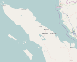
East Aceh Regency

Last updated
East Aceh Regency
Kabupaten Aceh Timur
Hutan Hujan Tropis dengan Sentuhan Awan, Pegunungan Mugajah, Aceh.jpg
Mugajah mountain range
Lambang Kabupaten Aceh Timur.png
Motto(s): 
Udep Saree Matee Syahid
(Honorable Life and so Martyrdom)
Lokasi Aceh Kabupaten Aceh Timur.svg
Location within Aceh
Indonesia Aceh location map.svg
Red pog.svg
East Aceh Regency
Location in Aceh, Northern Sumatra, Sumatra and Indonesia
Location map Northern Sumatra.png
Red pog.svg
East Aceh Regency
East Aceh Regency (Northern Sumatra)
Indonesia Sumatra location map.svg
Red pog.svg
East Aceh Regency
East Aceh Regency (Sumatra)
Indonesia location map.svg
Red pog.svg
East Aceh Regency
East Aceh Regency (Indonesia)
Coordinates: 4°37′N97°37′E / 4.617°N 97.617°E / 4.617; 97.617
Country Flag of Indonesia.svg  Indonesia
Region Sumatra
Province Flag of Aceh, Indonesia.svg  Aceh
Established1956
Regency seat Idi Rayeuk
Government
  Regent Iskandar Usman Al-Farlaky  [ id ]
  Vice RegentZainal Abidin
Area
  Total
6,040.6 km2 (2,332.3 sq mi)
Population
 (mid 2023 estimate) [1]
  Total
449,796
  Density74/km2 (190/sq mi)
Time zone UTC+7 (IWST)
Area code (+62) 646
Website acehtimurkab.go.id

East Aceh Regency (Indonesian : Kabupaten Aceh Timur) is a regency in eastern Aceh province of Indonesia. It is located on the island of Sumatra. The regency covers an area of 6,040.6 square kilometres and had a population of 360,475 at the 2010 Census [2] and 422,401 at the 2020 Census; [3] the official estimate as at mid 2023 was 449,796 - comprising 226,316 males and 223,430 females. [1] The regency capital is the town of Idi Rayeuk.

Contents

The regency borders the Malacca Strait to the north-east, the city of Langsa and Aceh Tamiang Regency to the south-east, Gayo Lues Regency to the south, and Central Aceh Regency, Bener Meriah Regency and North Aceh Regency to the west.

Economy

This regency is rich in petroleum, more so than the North Aceh and Aceh Tamiang regencies. Fishing employs many people in the regency but little of it is exported; people depend on it for food. [4] The main fishing centre in the regency is in Idl. The regency also has several food-plant based industries producing tofu, tempeh and sun-dried banana chips. [4] Some areas are under plantation exploitation for palm oil and rubber, although there is only one state-owned company (TPN I) operating in the area. Plantations also produce cacao and chocolate and in the Lokop area iron ore and lead is mined. [4]

Administrative districts

The regency is divided administratively into twenty-four districts (kecamatan), listed below with their areas and their populations at the 2010 Census [2] and 2020 Census; [3] together with the official estimates as at mid 2023. [1] The table also includes the locations of the district administrative centres, the number of villages (gampong) in each district, and its postal code.

Kode
Wilayah
Name of
District
(kecamatan)
Area
in
km2
Pop'n
Census
2010
Pop'n
Census
2020
Pop'n
Estimate
mid 2023
Admin
centre
No.
of
villages
Post
code
11.03.05Serbajadi2,165.665,7666,7017,603Lokop1724460
11.03.20Simpang Jernih544.633,3973,6263,784Simpang Jernih824464
11.03.24Peunaron79.748,2069,1549,507Arul Pinang524461
11.03.04Birem Bayeun253.6825,33028,71029,538Birem Bayeun2724452
11.03.08Rantau Selamat159.8011,22312,37213,375Bayeun1424451
11.03.19Sungai Raya159.0010,67212,67213,501Labuhan Keude1324466
11.03.07 Peureulak 318.0239,69146,24549,202Peureulak3824453
11.03.17Peureulak Timur
(East Peureulak)
182.7012,60114,45715,366Alue Tho2024440
11.03.18Peureulak Barat
(West Peureulak)
92.3013,63317,36718,566Beusa Seubrang1524450
11.03.10Ranto Peureulak129.0021,94525,94527,931Ranto Peureulak2324441
11.03.03 Idi Rayeuk 79.6033,13639,08641,323Idi Rayeuk3524442
11.03.16Peudawa75.9010,27412,95813,759Seuneubok Peudawa1724469
11.03.15Banda Alam90.957,2968,6519,429Pantai Rayeuk M.1624458
11.03.14Idi Tunong74.708,89511,30512,486Buket Teukuh2524443
11.03.21Darul Ihsan54.505,4477,3438,003Keude Dua1624468
11.03.23Idi Timur
(East Idi)
55.155,2106,7627,609Keude Redep1324456
11.03.01Darul Aman131.5017,04320,56922,727Idi Cut4524455
11.03.06Nurussalam137.0715,30817,84318,865Bagok3124467
11.03.22Darul Falah42.402,9023,7524,020Tunung Ulee Gajah1124454
11.03.02Julok234.3623,88426,83528,147Kuta Binjei3724459
11.03.13Indra Makmur89.0515,77216,41616,727Alue le Mirah1324457
11.03.11Pante Bidari
(or Pante Beudari)
233.2521,49025,58827,286Lhok Nibong2524463
11.03.09Simpang Ulim123.8018,13621,13622,223Simpang Ulim2324465
11.03.12Madat200.8423,21826,90828,819Madat2624462
Totals6,040.60360,475422,401449,796Idi Rayeuk513

References

  1. 1 2 3 Badan Pusat Statistik, Jakarta, 28 February 2024, Kabupaten Aceh Timur Dalam Angka 2024 (Katalog-BPS 1102001.1103)
  2. 1 2 Biro Pusat Statistik, Jakarta, 2011.
  3. 1 2 Badan Pusat Statistik, Jakarta, 2021.
  4. 1 2 3 "Aceh Timur" (PDF). Aceh Investment and Promotion Board. February 2010. Archived from the original (PDF) on July 7, 2011. Retrieved December 20, 2010.

4°37′N97°37′E / 4.617°N 97.617°E / 4.617; 97.617