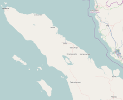
Pidie Jaya Regency

Last updated
Pidie Jaya Regency
Kabupaten Pidie Jaya
Kantor Bupati Pidie Jaya, Meureudu.jpg
Regent office of Pidie Jaya in Meureudu
Lambang Kabupaten Pidie Jaya.png
Motto: 
Peugah Lagë Buet, Peubuet Lagë Na
(Say What you Do, Do What you Say)
Lokasi Aceh Kabupaten Pidie Jaya.svg
Location within Aceh
Indonesia Aceh location map.svg
Red pog.svg
Pidie Jaya Regency
Location in Aceh, Northern Sumatra, Sumatra and Indonesia
Location map Northern Sumatra.png
Red pog.svg
Pidie Jaya Regency
Pidie Jaya Regency (Northern Sumatra)
Indonesia Sumatra location map.svg
Red pog.svg
Pidie Jaya Regency
Pidie Jaya Regency (Sumatra)
Indonesia location map.svg
Red pog.svg
Pidie Jaya Regency
Pidie Jaya Regency (Indonesia)
Coordinates: 5°07′N96°12′E / 5.117°N 96.200°E / 5.117; 96.200
Country Flag of Indonesia.svg Indonesia
Region Sumatra
Province Flag of Aceh, Indonesia.svg Aceh
Established2007
Regency seat Meureudu
Government
  Regent Sibral Malasyi  [ id ]
  Vice Regent Hasan Basri  [ id ]
Area
  Total
952.12 km2 (367.62 sq mi)
Population
 (mid 2024 estimate) [1]
  Total
165,080
  Density173.38/km2 (449.06/sq mi)
Time zone UTC+7 (IWST)
Area code (+62) 653
Website pidiejayakab.go.id

Pidie Jaya Regency (Indonesian : Kabupaten Pidie Jaya) is a regency in the Aceh Province of Indonesia, located on the island of Sumatra. The regency was created out of the former northeastern districts of Pidie Regency on 2 January 2007. The seat of the regency government is at the town of Meureudu. The regency covers an area of 952.12 square kilometres and had a population of 132,956 people at the 2010 Census [2] and 158,397 at the 2020 Census; [3] the official estimate as at mid 2024 was 165,080 - comprising 81,788 males and 83,292 females. [1]

Contents

Administrative divisions

The regency is divided administratively into eight districts (kecamatan), listed below with their areas and their populations at the 2010 Census [2] and the 2020 Census, [3] together with the official estimates as at mid 2024. [1] The table also includes the locations of the district administrative centres, the number of administrative villages (gampong) in each district, and its post code.

Kode
Wilayah
Name of
District
(kecamatan)
Area
in
km2
Pop'n
Census
2010
Pop'n
Census
2020
Pop'n
Estimate
mid 2024
Admin
centre
No.
of
villages
Post
code
11.18.01Meureudu124.7918,38722,22623,323Kota Meureudu3024186
11.18.05Meurah Dua287.0710,09012,50713,113Meunasah Bie1924186
11.18.04Bandar Dua174.3223,65628,06028,937Ulee Gle4524188
11.18.03Jangka Buya9.358,71410,17410,965Keude Jangka Buya1824186
11.18.02Ulim41.7513,33816,24216,903Keude Ulim3024187
11.18.08Trienggadeng79.3719,90123,50924,528Keude Trienggadeng2724185
11.18.07Panteraja15.007,5338,9689,330Keude Panteraja1024185
11.18.06Bandar Baru220.4731,33736,71137,981Keude Leung Putu4324184
Totals952.12132,956158,397165,080Kota Meureudu222
District
(kecamatan)
Land area
(Km2)
Sea area [4]
(Km2)
Total area
(Km2)
Percentage
(%)
District
divisions
(mukim)
Villages
(gambong)
Bandar Dua176.26-176.2614.99545
Bandar Baru223.6457.60281.2424.19843
Jangka Buya7.8821.7629.642.55218
Meurah Dua276.2016.00292.2025.13319
Meureudu139.1417.60156.7413.48730
Panteraja13.8026.2440.043.44210
Trienggadeng76.1951.81128.0011.01527
Ulim40.8919.8460.735.22530

See also

References

  1. 1 2 3 Badan Pusat Statistik, Jakarta, 28 February 2025, Kabupaten Pidie Jaya Dalam Angka 2025 (Katalog-BPS 1102001.1118)
  2. 1 2 Biro Pusat Statistik, Jakarta, 2011.
  3. 1 2 Badan Pusat Statistik, Jakarta, 2021.
  4. out to 4 Mile limit.

5°07′N96°12′E / 5.117°N 96.200°E / 5.117; 96.200