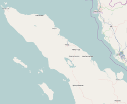
Gayo Lues Regency

Last updated
Gayo Lues Regency
Kabupaten Gayo Lues
Keindahan alam gayo lues.jpg
Aerial view of the town of Blajerango
Lambang Gayo Lues.png
Motto: 
Musara ('United')
Lokasi Aceh Kabupaten Gayo Lues.svg
Location within Aceh
Indonesia Aceh location map.svg
Red pog.svg
Gayo Lues Regency
Location in Aceh, Northern Sumatra, Sumatra and Indonesia
Location map Northern Sumatra.png
Red pog.svg
Gayo Lues Regency
Gayo Lues Regency (Northern Sumatra)
Indonesia Sumatra location map.svg
Red pog.svg
Gayo Lues Regency
Gayo Lues Regency (Sumatra)
Indonesia location map.svg
Red pog.svg
Gayo Lues Regency
Gayo Lues Regency (Indonesia)
Coordinates: 4°N97°E / 4°N 97°E / 4; 97
Country Flag of Indonesia.svg Indonesia
Region Sumatra
Province Flag of Aceh, Indonesia.svg Aceh
Established2002
Regency seat Blangkejeren
Government
  Regent Suhaidi  [ id ]
  Vice Regent Maliki  [ id ]
Area
  Total
5,549.91 km2 (2,142.83 sq mi)
Population
 (mid 2024 estimate) [1]
  Total
106,136
  Density19.1239/km2 (49.5307/sq mi)
Time zone UTC+7 (IWST)
Area code (+62) 629
Website gayolueskab.go.id

Gayo Lues Regency (Indonesian : Kabupaten Gayo Lues) is a regency in the Aceh Special Region of Indonesia. It is located on the island of Sumatra. The regency was created on 10 April 2002 under Statute UU 4/2002 from the northern part of Aceh Tenggara (Southeast Aceh Regency). Its capital is Blangkejeren. The regency covers an area of 5,549.91 square kilometres and had a population of 79,560 at the 2010 Census [2] and 99,532 at the 2020 Census; [3] the official estimate as of mid 2024 was 106,136 (comprising 53,360 males and 52,776 females). [1] Along with the Central Aceh Regency and the Bener Meriah Regency, it is home to the Gayo people. [4]

Contents

Economy

Ninety percent of the inhabitants make their living from farming and other food production. Products include: [5]

Logging is reportedly a major problem in the regency which is the least populated area of the province with less than 2% of the total population. [6]

Administrative districts

The regency is divided administratively into eleven districts (kecamatan), listed below with their areas and their populations at the 2010 Census [2] and the 2020 Census, [3] together with the official estimates as at mid 2024. [1] The table also includes the locations of the district administrative centres, the number of villages (gampong) in each district, and its post code.

Kode
Wilayah
Name of
District
(kecamatan)
Area
in
km2
Pop'n
2010
Census
Pop'n
2020
Census
Pop'n
mid 2024
Estimate
Admin
centre
No.
of
villages
Post
code
11.13.02Kuta Panjang269.537,3309,36510,239Kuta Panjang1224650
11.13.09Blang Jerango382.426,3797,3557,998Buntul Gemuyang1024655
11.13.01Blangkejeren166.0624,43431,18032,164Blangkejeren2224655
11.13.07Putri Betung996.856,6079,1429,829Gumpang1324658
11.13.08Dabun Gelang444.715,2776,7737,375Badak Bur Jumpe1124652
11.13.06Blang Pegayon272.185,0996,4067,405Cinta Maju1224653
11.13.05Pining1,350.094,3205,1125,276Pining923659
11.13.03Rikit Gaib264.083,7704,5255,032Buntul Gemuya1324651
11.13.11Pantan Cuaca295.063,4814,3384,843Kenyaran1124654
11.13.04Terangun671.807,9539,5519,896Terangun2524656
11.13.10Tripe Jaya437.134,9105,7856,079Rerebe1024657
Totals5,549.9179,56099,532106,136 Blangkejeren 159

See also

References

  1. 1 2 3 Badan Pusat Statistik, Jakarta, 28 February 2025, Kabupaten Gayo Lues Dalam Angka 2025 (Katalog-BPS 1102001.1113)
  2. 1 2 Biro Pusat Statistik, Jakarta, 2011.
  3. 1 2 Badan Pusat Statistik, Jakarta, 2021.
  4. Library Information and Research Service (2004). The Middle East, abstracts and index. Northumberland Press. Retrieved 20 December 2010.
  5. "Gayo Lues" (PDF). Aceh Investment and Promotion Board. 2009. Archived from the original (PDF) on July 7, 2011. Retrieved December 24, 2010.
  6. Davies, Matthew N. (2006). Indonesia's war over Aceh: last stand on Mecca's porch. Taylor & Francis. pp. 45–. ISBN   978-0-415-37239-8 . Retrieved 21 December 2010.

4°N97°E / 4°N 97°E / 4; 97