Hall County is a county in the U.S. state of Nebraska. As of the 2010 United States Census, the population was 58,607, making it Nebraska's fourth-most populous county. Its county seat is Grand Island. The county was formed in 1858; it was named for Augustus Hall, an early judge of this territory.

Chouteau County is a county located in the North-Central region of the U.S. state of Montana. As of the 2020 United States Census, the population was 5,895. Its county seat is Fort Benton. The county was established in 1865 as one of the original nine counties of Montana, and named in 1882 after Pierre Chouteau Jr., a fur trader who established a trading post that became Fort Benton, which was once an important port on the Missouri River.

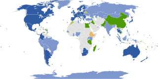
Google Maps is a web mapping platform and consumer application offered by Google. It offers satellite imagery, aerial photography, street maps, 360° interactive panoramic views of streets, real-time traffic conditions, and route planning for traveling by foot, car, bike, air and public transportation. As of 2020, Google Maps was being used by over 1 billion people every month around the world.

Thuringowa Central is a suburb of Townsville in the City of Townsville, Queensland, Australia. In the 2016 census Thuringowa Central had a population of 2,023 people.
King's Highway 39, commonly referred to as Highway 39, was a provincially maintained highway in the Canadian province of Ontario. The 33.8-kilometre (21.0 mi)-long route connected Highway 3 in downtown Windsor with Highway 2 south of Belle River, travelling along the southern shoreline of Lake St. Clair. Highway 39 was established in 1934. By 1961, the Pike Creek Bypass was opened and Highway 39 was rerouted along it, with the former route briefly becoming Highway 39B. The route was renumbered as Highway 2 in 1970, retiring the designation from the provincial highway system. Highway 2 was itself decommissioned along the former route of Highway 39 on January 1, 1998, and transferred to Essex County and the City of Windsor. It was subsequently redesignated as Essex County Road 22.

Mistelgau is a municipality in the district of Bayreuth in Bavaria in Germany. The eponymous village is the seat of both the municipality as well as the municipality association Mistelgau.

Hallbergmoos is a municipality in the district of Freising in Bavaria in Germany. The Isar River flows west of the town.

Großkarolinenfeld is a municipality in the district of Rosenheim in Bavaria in Germany.

Google Map Maker was a map editing service launched by Google in June 2008. In geographies where it is hard to find providers of good map data, user contributions were used to increase map quality. Changes to Google Map Maker were intended to appear on Google Maps only after sufficient review by Google moderators. Google Map Maker was used at Google Mapathon events held annually.
Tertiary Highway 810, commonly referred to as Highway 810, is a provincially maintained access road, extending from Bull Lake to Richie Falls alongside the River aux Sables north of Massey. A northerly extension of Highway 553, the road was established in 1974 and has remained unchanged since then.

The Sommerkahl is a small river in the northern Spessart in Lower Franconia, Bavaria, Germany. Near Langenborn the Sommerkahl empties from the left into the Kahl. Together with Westerbach, Reichenbach and Geiselbach the Sommerkahl is one of the largest tributaries of the Kahl.

Google Street View was first introduced in the United States on May 25, 2007, and until November 26, 2008, featured camera icon markers, each representing at least one major city or area, and usually the other nearby cities, towns, suburbs, and parks. Many areas that had coverage were represented by icons.

Berchtesgadener Ache is a river of Bavaria, Germany and of Salzburg, Austria. It is formed at the confluence of the Ramsauer Ache and the Königsseer Ache in Berchtesgaden. It flows into the Salzach near Anif.

Querbach is a river of Bavaria, Germany. It is the left headwater of the Westerbach.

Truppach is a district of Mistelgau, a municipality in the district of Bayreuth in Bavaria in Germany.

Welzbach is a river of Baden-Württemberg and of Bavaria, Germany. It is a right tributary of the Tauber in Werbach.

Ranna is a river of Bavaria, Germany and of Upper Austria, Austria.
Steinbach is a river of Bavaria, Germany.
Sulzbach is a river of Bavaria, Germany. It is a left tributary of the Rott near Neuhaus am Inn.


