Tsoilitsoili

Last updated
Tsoilitsoili
Community Council
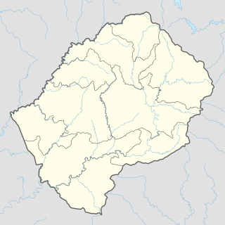
Lesotho adm location map.svg
Red pog.svg
Tsoilitsoili
Geographic Center of Community
Coordinates: 29°02′33″S27°44′37″E / 29.04250°S 27.74361°E / -29.04250; 27.74361
CountryFlag of Lesotho.svg  Lesotho
District Leribe District
Elevation
[1]
5,253 ft (1,601 m)
Population
 (2006)
  Total18,456
Time zone UTC+2 (CAT)
Coordinates computed from Lesotho Villages file. [2]

Tsoilitsoili is a community council located in the Leribe District of Lesotho. Its population in 2006 was 18,456. [3]

Contents

Villages

The community of Tsoili-tsoili includes the villages of Ha 'Nena (Kolonyama), Ha 'Noko, Ha Botsane, Ha Jobo, Ha Leboea, Ha Lepapa, Ha Lintša, Ha Makhaketsa, Ha Makhula, Ha Manama, Ha Maphomane (Manganeng), Ha Masimole, Ha Matala, Ha Mofeli, Ha Mohai, Ha Mohlokaqala, Ha Mokati, Ha Molelle, Ha Molipa, Ha Moqathinyane, Ha Moramang, Ha Motlokoa, Ha Nkhabu, Ha Ntseke, Ha Ntsekele, Ha Polile, Ha Polisa, Ha Rafelile (Manganeng), Ha Rakobeli, Ha Rakolo, Ha Ralehlatsa, Ha Rampa (Manganeng), Ha Ratšita, Ha Senyeke, Ha Setšabi, Ha Thokoa, Ha Tlalinyane, Ha Tokoto, Ha Tumo, Likatseng, Makhalong and Sekhutlong. [4]

Education

The Little Flower Primary School in the village of Kolonyama serves 340 children while the nursery school serves 15. Children are taught psychologically, spiritually, academically and socially. [5]

Health Care

The Little Flower Health Centre in the village of Kolonyama provides outpatient, well baby clinic, home and school visits, village health workers and even an occasional delivery of a newborn. [6]

Related Research Articles

The Sisters of the Holy Names of Jesus and Mary is a teaching religious institute founded at Longueuil, Québec, Canada, in 1843 by Blessed Mother Marie-Rose for the Christian education of young girls.
Pitseng Community Council in Leribe District, Lesotho

Pitseng is a community council located in the Leribe District of Lesotho. The population in 2006 was 18,948.

Mazenod, Lesotho Community Council in Maseru District, Lesotho

Mazenod is a community council located in the Maseru District of western Lesotho. The population in 2006 was 27,553. It is located to the south-east of the capital Maseru. Points of interest include Moshoeshoe I International Airport, Lesotho's only international airport.

Kanana Community Council in Berea District, Lesotho

Kanana is a community council located in the Berea District of Lesotho. Its population in 2006 was 19,311.

Kueneng Community Council in Berea District, Lesotho

Kueneng is a community council located in the Berea District of Lesotho. Its population in 2006 was 21,887.

Sekhobe Community Council in Butha-Buthe District, Lesotho

Sekhobe is a community council located in the Butha-Buthe District of Lesotho. Its population in 2006 was 3,874.

Matlameng Community Council in Leribe District, Lesotho

Matlameng is a community council located in the Leribe District of Lesotho. Its population in 2006 was 10,238.

Mphorosane Community Council in Leribe District, Lesotho

Mphorosane is a community council located in the Leribe District of Lesotho. Its population in 2006 was 9,392.

Malumeng Community Council in Mafeteng District, Lesotho

Malumeng is a community council located in the Mafeteng District of Lesotho. Its population in 2006 was 9,740.

Mathula Community Council in Mafeteng District, Lesotho

Mathula is a community council located in the Mafeteng District of Lesotho. Its population in 2006 was 17,867.

Qibing Community Council in Mafeteng District, Lesotho

Qibing is a community council located in the Mafeteng District of Lesotho. Its population in 2006 was 17,374.

Ratau Community Council in Maseru District, Lesotho

Ratau is a community council located in the Maseru District of Lesotho. Its population in 2006 was 26,582.

Ribaneng Community Council in Maseru District, Lesotho

Ribaneng is a community council located in the MafetengDistrict of Lesotho. Its population in 2006 was 7,509.

Linakaneng Community Council in Mokhotlong District, Lesotho

Linakaneng is a community council located in the Mokhotlong District of Lesotho. Its population in 2006 was 4,452.

Mapholaneng Community Council in Mokhotlong District, Lesotho

Mapholaneng is a community council located in the Mokhotlong District of Lesotho. Its population in 2006 was 8,606.

Mateanong Community Council in Mokhotlong District, Lesotho

Mateanong is a community council located in the Mokhotlong District of Lesotho. Its population in 2006 was 7,387.

Matsatseng Community Council in Quthing District, Lesotho

Matsatseng is a community council located in the Quthing District of Lesotho. Its population in 2006 was 18,713.

Thaba-Chitja Community Council in Thaba-Tseka District, Lesotho

Bokong is a community council located in the Thaba-Tseka District of Lesotho. Its population in 2006 was 7,283.

Lithabaneng Community Council / Constituency in Maseru District, Lesotho

Lithabaneng is a constituency and community council in the Maseru Municipality located in the Maseru District of Lesotho. The population in 2006 was 28,371.

Brickens Village and townland in Connacht, Ireland

Brickens, officially Brickeens, is a village and townland on the N60 road between Ballyhaunis and Claremorris in southeast County Mayo in Ireland. The River Robe flows through the village which is 65 metres above sea level, and old ordnance survey maps show the townland with an area of 368 acres and 23 perches – equivalent to nearly 150 hectares.

References

  1. GTOPO30 via GeoNames. Retrieved 2010-08-27.
  2. Google Earth Download Site Retrieved 2010-07-21.
  3. Statoids.com
  4. Lesotho Bureau of Statistics, Village List, 2006.
  5. Sisters of the Holy Names of Jesus and Mary. Little Flower Primary School Archived 2011-07-24 at the Wayback Machine Retrieved 2010-08-27.
  6. Sisters of the Holy Names of Jesus and Mary. Little Flower Health Centre Archived 2011-07-24 at the Wayback Machine Retrieved 2010-08-27.