Related Research Articles

A spiral is a technique employed by railways to ascend steep hills.
The geology of Hampshire in southern England broadly comprises a gently folded succession of sedimentary rocks dating from the Cretaceous and Palaeogene periods. The lower (early) Cretaceous rocks are sandstones and mudstones whilst those of the upper (late) Cretaceous are the various formations which comprise the Chalk Group and give rise to the county's downlands. Overlying these rocks are the less consolidated Palaeogene clays, sands, gravels and silts of the Lambeth, Thames and Bracklesham Groups which characterise the Hampshire Basin.

A horseshoe curve is a class of climbing curve in a roadbed that reverses turn direction (inflection) twice on either side of a single tight curve that varies through an angle of about 180 degrees or more.

The Lapstone Zig Zag was a zig zag railway built between Emu Plains and Blaxland stations on the Main Western Line of New South Wales in Australia. Constructed between 1863 and 1865 to overcome an otherwise insurmountable climb up the eastern side of the Blue Mountains, the zig zag and associated Knapsack Viaduct, a sandstone arch viaduct, were designed by John Whitton, Engineer-in-Charge of New South Wales Government Railways, and were built by William Watkins. The zig zag was listed on the Blue Mountains local government heritage register on 27 December 1991; while the adjacent Knapsack Viaduct was listed on the New South Wales Heritage Database on 2 April 1999. The Lapstone Zig Zag was the world-first Zig Zag constructed on any main-line railway.
A top-and-tail railway train has locomotives at both ends, for ease of changing direction, especially where the terminal station has no run-round loop. This is a British term. It is normal for only the leading locomotive to power the train when in top-and-tail mode.

The Richmond railway line is a railway line in the western suburbs of Sydney, New South Wales, Australia. It is a branch of the Main Western line. Sydney Trains operates electric passenger train services over the line and markets these as part of the North Shore & Western Line and Cumberland Line.

The Mehi River is a perennial watercourse that is part of the Barwon catchment within the Murray–Darling basin, located in the Orana district of New South Wales, Australia.
Spring Hill is a small village 13 km south-east of Orange, Australia. Its buildings date back to the 1870s and a Heritage Trail has been established for tourists. At the 2016 census, Spring Hill had a population of 502 people.
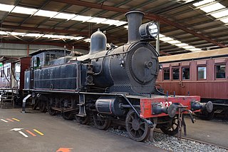
The C30 class is a class of steam locomotives built by Beyer, Peacock & Company and Eveleigh Railway Workshops for the New South Wales Government Railways (NSWGR) of Australia.

The Forest of Dean Railway was a railway company operating in Gloucestershire, England. It was formed in 1826 when the moribund Bullo Pill Railway and a connected private railway failed, and they were purchased by the new company. At this stage it was a horse-drawn plateway, charging a toll for private hauliers to use it with horse traction. The traffic was chiefly minerals from the Forest of Dean, in the Whimsey and Churchway areas, near modern-day Cinderford, for onward conveyance from Bullo Pill at first, and later by the Great Western Railway.
The Hollanders River, a perennial river that is part of the Hawkesbury-Nepean catchment, is located in the Central Tablelands region of New South Wales, Australia.
The Tuglow River, a perennial river that is part of the Hawkesbury-Nepean catchment, is located in the Central Tablelands region of New South Wales, Australia.
Argyle was a railway station on the Crookwell railway line, New South Wales, Australia. The station opened in 1902 with the opening of the line, and consisted of a 50 ft platform on the down side of the line. It gained its name from Argyle in Scotland, and was located adjacent to the Goulburn Training Centre.
Kenmore was a railway station on the Crookwell railway line, New South Wales, Australia. The station opened in 1902 with the opening of the line, and consisted of a 100 ft platform on the down side of the line. It gained its name from Kenmore a small village in Perthshire, Scotland, and was located adjacent to Kenmore Hospital. A 275 ft loop siding was constructed with the line, subsequently shortened in 1934 to 175 ft. In 1942, and additional siding was added. Passenger services ceased in 1974, and in 1975, the station and facilities closed and the platform was subsequently demolished. The line closed to goods traffic in 1984. The closed rail-line and loop remain in-situ.
The Norwood railway station was a railway station on the Crookwell railway line, New South Wales, Australia. The station opened in 1902 with the opening of the line, and consisted of a 30-metre (100 ft) platform on the down side of the line with a loop siding on the up side. The siding was removed in 1941 and the station closed in 1943 and was subsequently demolished. The line through Norwood closed to goods traffic in 1984.
The Forest was a railway station on the Crookwell railway line, New South Wales, Australia. The station opened in 1902 with the opening of the line, and consisted of a 100 ft platform on the down side of the line with a loop siding on the up side. It was named after an adjoining property named Forest Lodge. The platform was removed in 1969 and the loop closed in 1974 and was subsequently demolished. The line through The Forest closed to goods traffic in 1984.

Woodhouselee was a railway station on the Crookwell railway line, in Woodhouselee, New South Wales, Australia. The station opened in 1902 with the opening of the line, and consisted of a 100 ft platform on the up side of the line with a loop siding on the down side. It was named after a local resident Mr Woodhouse. The platform was closed in 1974 with the cessation of passenger services and subsequently demolished. The line through Woodhouselee closed to goods traffic in 1984, the loop has been removed but the mainline remains intact.

Roslyn was a railway station on the Crookwell railway line, New South Wales, Australia. The station opened in 1902 with the opening of the line, and consisted of a 100 ft platform on the down side of the line with a loop siding on the up side. Cattle loading facilities and goods sheds were also provided. It was named after the estate of a local resident Dr Mitchell. In 1925, the station became the location of the branch line to Taralga, with the new branch extending off the loop line.. The platform was shortened to 30 ft in 1969, and closed in 1974 with the cessation of passenger services. in 1975 the station and goods facilities were demolished. The line through Roslyn closed to goods traffic in 1984, and little remains at the site apart from the mainline track, the goods loading bank and the station master's residence.
McAlister was a railway station on the Crookwell railway line, New South Wales, Australia. The station opened in 1902 with the opening of the line, and consisted of a 100 ft platform on the up side of the line with a loop siding on the down side. It was named after magistrate Lachlan McAlister. Some goods facilities were removed in the 1930s. The remainder of the station and loop closed in 1969 and were subsequently removed. The line through McAlister closed to goods traffic in 1984. Little remains at the site apart from the mainline track and a loading bank.
A refuge siding is a single-ended, or dead-end, siding off a running line, which may be used to temporarily accommodate a train so that another one can pass it. For example, a refuge siding might be used by a slow goods train to allow a fast passenger train to pass. It is similar in concept to a passing loop but is connected to the main line at only one end, rather than both ends.
References
33°30′00″S149°32′00″E / 33.50000°S 149.53333°E
| | This New South Wales geography article is a stub. You can help Wikipedia by expanding it. |
| | This article about a railway station in New South Wales is a stub. You can help Wikipedia by expanding it. |