Related Research Articles

Couch is a small, unincorporated community in Oregon County, Missouri, United States. It is located six miles south of Alton on Missouri Route A. The ZIP Code for Couch is 65690.
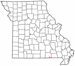
Myrtle is a small, unincorporated community in Oregon County, Missouri, United States. It lies 14 mi (23 km) southeast of Alton, 14 mi (23 km) east of Thayer and approximately 3⁄4 mi (1.2 km) north of the Arkansas state line. The community lies on a low ridge above the south side of Mill Creek along Missouri Route V.
Caverna is an unincorporated community in southern McDonald County, Missouri, United States. It is located on U.S. Route 71, immediately north of the Missouri-Arkansas state line, opposite Bella Vista. Several businesses are located there.
Skinner is an unincorporated community in Audrain County, in the U.S. state of Missouri.
Spruce is an unincorporated community in northeast Bates County, in the U.S. state of Missouri. The community is on Missouri Route H approximately ten miles east of Butler. The headwaters of South Deepwater Creek flow past the south side of the community.
Prosperine is an unincorporated community in northwest Laclede County, in the Ozarks of south central Missouri. The community is located on Route AA, approximately 2.5 miles southwest of Eldridge.
Billmore is an unincorporated community in southeastern Oregon County, in the U.S. state of Missouri.
Braswell is an unincorporated community in Oregon County, in the U.S. state of Missouri.
Brawley is an unincorporated community in Oregon County, in the U.S. state of Missouri.
Corona is an unincorporated community in Oregon County, in the U.S. state of Missouri.
Farewell is an unincorporated community in southern Oregon County, in the U.S. state of Missouri.
Greer is an unincorporated community in Oregon County, in the U.S. state of Missouri. Greer lies on Missouri Route 19 between Alton to the south-southwest and Winona to the north. Route 19 crosses the Eleven Point River at Greer Crossing, approximately three miles northeast of the village. Greer Spring lies just to the north of the community.
Huddleston is an unincorporated community in Oregon County, in the U.S. state of Missouri.

Jeff is an unincorporated community in Oregon County, in the U.S. state of Missouri.
Many Springs is an unincorporated community in Oregon County, in the U.S. state of Missouri.
New Liberty is an extinct town in northeastern Oregon County, in the U.S. state of Missouri. The GNIS classifies it as a populated place.
Rover is an unincorporated community in western Oregon County, in the U.S. state of Missouri. The community lies approximately eleven miles west of Alton and is on Missouri Route M, 1.5 miles south of U.S. Route 160.
Royal Oak is an unincorporated community in Oregon County, in the U.S. state of Missouri. The community is located on U.S. Route 160, approximately five miles northwest of Alton. Dry Creek flows past approximately one half mile east of the location.
Woodside is an unincorporated community in Oregon County, in the U.S. state of Missouri. The community was located on Missouri Route 19 approximately three miles north of Alton.
Frogtown is an unincorporated community in Washington County, in the U.S. state of Missouri. The community was located 1.5 miles south of Old Mines along Missouri Route 21, north of Potosi.
References
- 1 2 U.S. Geological Survey Geographic Names Information System: Turners Mill
- ↑ Greer, Missouri 7.5 Minute Topographic Quadrangle, USGS, 1983
- ↑ "Oregon County Place Names, 1928–1945". The State Historical Society of Missouri. Archived from the original on June 24, 2016. Retrieved November 24, 2016.
- ↑ "Post Offices". Jim Forte Postal History. Retrieved 24 November 2016.
Municipalities and communities of Oregon County, Missouri, United States | ||
|---|---|---|
| Cities |  | |
| Townships | ||
| CDP | ||
| Other communities | ||
| Ghost towns | ||
36°45′59″N91°15′59″W / 36.76639°N 91.26639°W
| | This Oregon County, Missouri state location article is a stub. You can help Wikipedia by expanding it. |