Tuukkala

Last updated

Tuukkala is a village in Hirvensalmi, Eastern Finland. [1] It is located on a neck of land between the lakes Suontee and Puula. In the north-west part of the village is the sawmill of Kuitula. The village has lost some of its population and at the same time post office, bank and two stores have quit. At the moment Tarmo-convenience store is the only shop in the village. Farming is an important source of livelihood, and the two farms in the village both produce milk.

Hirvensalmi Municipality in Southern Savonia, Finland

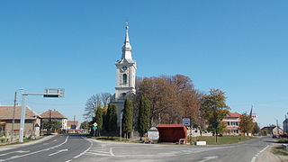
Hirvensalmi is a municipality of Finland.

Suontee lake

Suontee is a rather large lake in Finland. The northern part of the lake is located in the region of Central Finland, and the southern part in the region of Southern Savonia. The southern part is in a more natural state with very clear water, and it is included in the Natura 2000 conservation network of the EU. The protection area is 2 625 hectare. A typical bird there is the black-throated loon. In the past two big lakes, Suontee and Puula, were one lake until 1854, when the water level was lowered 2.5 meters. This has brought up geological stacks, which are formed by water.

Puula lake of Finland

Puula is a lake in the Kymi River area in the Finnish municipalities of Hirvensalmi, Kangasniemi and Mikkeli. Puula is 94.7 metres (311 ft) above sea level, the area is 331 square kilometres (128 sq mi), and it is 62 metres (203 ft) deep at its deepest point, located near Porttisalmi at Simpiänselkä, which is the biggest open area of the lake. Two big lakes Suontee and Puula were one lake until year 1854, when the water level was lowered 2.5 meters. This has brought up geological stacks, which are formed by water.

Related Research Articles

Arctic Archipelago Canadian archipelago

The Arctic Archipelago, also known as the Canadian Arctic Archipelago, is a group of islands north of the Canadian mainland.

Grenadines Parish Parish in Port Elizabeth, Saint Vincent and the Grenadines

Grenadines is an administrative parish of Saint Vincent and the Grenadines, comprising the islands of the Grenadines other than those belonging to Grenada. The capital is Port Elizabeth.

Kupiansk Place in Kharkiv Oblast, Ukraine

Kupiansk, is a city in Kharkiv Oblast (province) of eastern Ukraine. Serving as the administrative center of the Kupiansk Raion (district), the city itself is incorporated as a city of oblast significance and does not belong to the raion. It is an important railroad junction in the oblast. Population: 28,681 (2017 est.)

Doba is a village in the Tibet Autonomous Region of China. It lies at an altitude of 4,539 metres. The village has a population of about 8 people.

Pișcolt Commune in Satu Mare County, Romania

Pișcolt is a commune of 3,285 inhabitants situated in Satu Mare County, Romania. It is composed of three villages: Pișcolt, Resighea (Reszege) and Scărișoara Nouă (Piskolcliget).

Jitia Commune in Vrancea County, Romania

Jitia is a commune located in Vrancea County, Romania. It is composed of five villages: Cerbu, Dealu Sării, Jitia, Jitia de Jos and Măgura.

Kotila is a village development committee in Baitadi District in the Mahakali Zone of western Nepal. At the time of the 1991 Nepal census it had a population of 2,713 and had 472 houses in the town.

Kalyan is a village development committee in Surkhet District in the Bheri Zone of mid-western Nepal. At the time of the 1991 Nepal census it had a population of 6426 people living in 1092 individual households.

Bendorzyn Village in Masovian, Poland

Bendorzyn is a village in the administrative district of Gmina Mochowo, within Sierpc County, Masovian Voivodeship, in east-central Poland. It lies approximately 20 kilometres (12 mi) south of Sierpc and 111 km (69 mi) north-west of Warsaw.

Dico is a village and municipality in the Lerik Rayon of Azerbaijan. It has a population of 280. The municipality consists of the villages of Dico, Nısa, and Təndul.

Əmiraslanlı is a village in the municipality of Şəkərbəy in the Gadabay Rayon of Azerbaijan.

Qozqaralı is a village in the municipality of Poladlı in the Gadabay Rayon of Azerbaijan.

Ponik, Silesian Voivodeship Village in Silesian, Poland

Ponik is a village in the administrative district of Gmina Janów, within Częstochowa County, Silesian Voivodeship, in southern Poland. It lies approximately 1 kilometre (1 mi) south of Janów, 25 km (16 mi) south-east of Częstochowa, and 61 km (38 mi) north-east of the regional capital Katowice.

Mełchów Village in Silesian, Poland

Mełchów is a village in the administrative district of Gmina Lelów, within Częstochowa County, Silesian Voivodeship, in southern Poland. It lies approximately 5 kilometres (3 mi) north-west of Lelów, 35 km (22 mi) east of Częstochowa, and 67 km (42 mi) north-east of the regional capital Katowice.

Parsęcko Village in West Pomeranian, Poland

Parsęcko is a village in the administrative district of Gmina Szczecinek, within Szczecinek County, West Pomeranian Voivodeship, in north-western Poland. It lies approximately 7 kilometres (4 mi) west of Szczecinek and 137 km (85 mi) east of the regional capital Szczecin.

Pördefölde is a village in Zala County, Hungary.

Saastna is a village in Lääneranna Parish, Pärnu County, in western Estonia.

Gornji Ramići Village in Ključ, Bosnia and Herzegovina

Gornji Ramići is a village in the municipality of Ključ, Bosnia and Herzegovina.

Yaylaaltı, Posof is a village in the District of Posof, Ardahan Province, Turkey.

Oulad Khallouf is a small town and rural commune in El Kelâat Es-Sraghna Province of the Marrakesh-Tensift-El Haouz region of Morocco. At the time of the 2004 census, the commune had a total population of 8064 people living in 1249 households.

References

Coordinates: 61°43′N26°35′E / 61.717°N 26.583°E / 61.717; 26.583

Geographic coordinate system Coordinate system

A geographic coordinate system is a coordinate system that enables every location on Earth to be specified by a set of numbers, letters or symbols. The coordinates are often chosen such that one of the numbers represents a vertical position and two or three of the numbers represent a horizontal position; alternatively, a geographic position may be expressed in a combined three-dimensional Cartesian vector. A common choice of coordinates is latitude, longitude and elevation. To specify a location on a plane requires a map projection.