The Baltic Sea is an arm of the Atlantic Ocean that is enclosed by Denmark, Estonia, Finland, Germany, Latvia, Lithuania, Poland, Russia, Sweden, and the North and Central European Plain.

Espoo is a city in Finland. It is located to the west of the capital, Helsinki, in southern Uusimaa. The population is approximately 320,000. It is the 2nd most populous municipality in Finland. Espoo is part of the Helsinki Metropolitan Area, which has approximately 1.6 million inhabitants. Espoo is on the northern shore of the Gulf of Finland and borders Helsinki, Vantaa, Kirkkonummi, Vihti and Nurmijärvi. The city includes the enclave of Kauniainen. Espoo covers an area of 528 square kilometres (204 sq mi). Espoo is a bilingual municipality with Finnish and Swedish as its official languages. The population consists of 70% Finnish speakers, 6% Swedish speakers, and 24% speakers of other languages, well above the national average.

Lapland is the largest and northernmost region of Finland. The 21 municipalities in the region cooperate in a Regional Council. Lapland borders the Finnish region of North Ostrobothnia in the south. It also borders the Gulf of Bothnia, Norrbotten County in Sweden, Finnmark County and Troms County in Norway, and Murmansk Oblast and the Republic of Karelia in Russia. The topography of Lapland varies from vast mires and forests in the south to fells in the north. The Arctic Circle crosses Lapland, so polar phenomena such as the midnight sun and polar night can be viewed in this region.

Forssa is a town and municipality of Finland. It is located almost in the centre of a triangle defined by the three largest major cities in Finland, in the Tavastia Proper region, and which is crossed by Highway 2 between Pori and Helsinki and Highway 10 between Turku and Hämeenlinna. The town has a population of 16,475 and covers an area of 253.38 square kilometres (97.83 sq mi) of which 4.61 km2 (1.78 sq mi) is water. The population density is 66.21 inhabitants per square kilometre (171.5/sq mi). Only a little part of the surface area of Forssa is water, but the river Loimijoki forms an important element in the cityscape, with the city being located at its starting point. Other notable water areas in Forssa include the lake Kaukjärvi and the lake Koijärvi, known as the birthplace of the Green League.

Nousiainen is a municipality of Finland. It is located in the Southwest Finland region, 20 kilometres (12 mi) from Turku along Highway 8 (E8). The Finnish-speaking municipality has a population of 4,664 (31 October 2024) and covers an area of 199.55 square kilometres (77.05 sq mi) of which 0.62 km2 (0.24 sq mi) is water. The population density is 23.45 inhabitants per square kilometre (60.7/sq mi).
Äänekoski is a town in Finland. It is located in the Central Finland region, about 45 kilometres (28 mi) north of Jyväskylä, the region's capital city. Äänekoski has a population of 17,818, as of 31 October 2024, and covers an area of 1,138.39 square kilometres (439.53 sq mi) of which 253.84 km2 (98.01 sq mi), or 22%, is water. The population density is 20.14 inhabitants per square kilometre (52.2/sq mi).

Pirkanmaa, also known as Tampere Region in government documents, is a region of Finland. It borders the regions of Satakunta, South Ostrobothnia, Central Finland, Päijät-Häme, Kanta-Häme and Southwest Finland. Most of the water area in the Kokemäki River watershed is located in the Pirkanmaa region, although Lake Vanajavesi is partly in the Kanta-Häme region. The region got its name from Pirkkala, which in the Middle Ages comprised most of present-day Pirkanmaa. Tampere is the regional center and capital of Pirkanmaa, and at the same time the largest city in the region.

Kanta-Häme, sometimes referred to by the obsolete Tavastia Proper or as the Häme region, is a region of Finland. It borders the regions of Southwest Finland, Pirkanmaa, Päijät-Häme, and Uusimaa.
Hirvensalmi is a municipality of Finland.

Hollola is a municipality of Finland, located in the western part of the Päijänne Tavastia region. The municipality is unilingually Finnish and has a population of 22,834 and covers an area of 727.47 square kilometres (280.88 sq mi) of which 68.66 km2 (26.51 sq mi) is water. The population density is 35.05 inhabitants per square kilometre (90.8/sq mi).
Joutsa is a municipality of Finland. It is located in the province of Western Finland and is part of the Central Finland region. Jyväskylä is located about 70 kilometres (43 mi) north of the Joutsa municipality.

Kontiolahti is a municipality in Finland. It is located in the North Karelia region, about 20 kilometres (12 mi) north of Joensuu. The municipality has a population of 15,048 and covers an area of 1,029.82 square kilometres (397.62 sq mi) of which 230.1 km2 (88.8 sq mi) is water. The population density is 18.81 inhabitants per square kilometre (48.7/sq mi). Neighbouring municipalities are Joensuu, Juuka, Lieksa, Liperi and Polvijärvi. The municipality is unilingually Finnish.
Suonenjoki is a town and municipality of Finland. It is located in the Northern Savonia region, 50 kilometres (31 mi) southwest of Kuopio.

The Archipelago Sea is a part of the Baltic Sea between the Gulf of Bothnia, the Gulf of Finland and the Sea of Åland, within Finnish territorial waters. By some definitions it contains the largest archipelago in the world by the number of islands, estimated at around 50,000, although many of the islands are very small and tightly clustered.

Lake Cerknica is an intermittent lake in the southern part of the Cerknica Polje, a karst polje in Inner Carniola, a region in southwestern Slovenia.

Federsee is a lake located just north of Bad Buchau in the region of Upper Swabia in Southern Germany. It is surrounded by moorland, partially overgrown with reeds. With a size of 33 km2, the area is one of the largest, groundwater fed, connected moorlands in Southern Germany. At its deepest point, Lake Federsee has a depth of 2 metres. Federsee translates to 'feather lake' and its shape resembles that of a feather. However, the origin of its name is locally debated, with one camp defending the shape theory, and another championing the idea that the amount of feathers found on the lake's surface gave rise to its name. The most probable explanation for the origin of the name is, however, the Celtic word "pheder" which means marsh. Therefore, the name refers to the origin of the lake itself and the surrounding landscape. The lake is encircled by the town of Bad Buchau, and the villages of Moosburg, Alleshausen, Seekirch, Tiefenbach, and Oggelshausen.

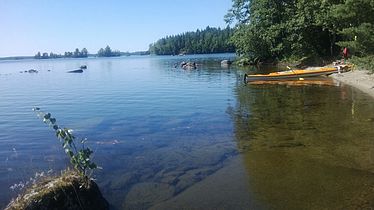
Lake Kitkajärvi is a rather large lake of Finland. It is situated partly in Posio in Lapland region and partly in Kuusamo municipality in Northern Ostrobothnia region, and belongs to the Koutajoki main catchment area. The southern part of the lake is called Yli-Kitka and northern part is called Ala-Kitka. Kitkajärvi is 14th biggest lake in Finland. It is also the biggest unregulated lake, because there are no power stations on its outflow. Rather big part of the lake is protected in the Natura 2000 protection program. The water in the lake is very clean. There is a route around the lake for paddlers.

Kermajärvi is a medium-sized lake in the Vuoksi main catchment area. It is located in the region of Southern Savonia in Heinävesi. It is the country's 53rd largest lake with an area of 85.57 square kilometres (33.04 sq mi) and consists of a wide open lake with plenty of islands in both northwest and southeast parts of it and several long, narrow bays in both ends.

The wildlife of Finland is affected by prevailing environmental conditions. The phytogeography of Finland is shared between the Arctic, central European, and northern European provinces of the Circumboreal Region within the Boreal Kingdom. The territory of Finland can be subdivided into three ecoregions: the Scandinavian and Russian taiga, Sarmatic mixed forests, and Scandinavian montane birch forest and grasslands. Taiga covers most of Finland from northern regions of southern provinces to the north of Lapland. On the southwestern coast, south of the Helsinki-Rauma line, forests are mixed as is more typical in the Baltic region. In the extreme north of Finland, near the tree line and Arctic Ocean, montane birch forests are common.