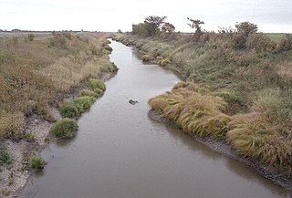
The Little Minnesota River is a 71.4-mile-long (114.9 km) headwaters tributary of the Minnesota River in northeastern South Dakota and west-central Minnesota in the United States. Via the Minnesota River, it is part of the Mississippi River watershed.

The Whetstone River is a 12.7-mile-long (20.4 km) tributary of the Minnesota River in northeastern South Dakota and a very small portion of western Minnesota in the United States. Via the Minnesota River, it is part of the watershed of the Mississippi River.

The Rocky River is a 28.3-mile-long (45.5 km) stream located in the southwest part of the U.S. state of Michigan that flows into the St. Joseph River at 41°56′33″N85°37′59″W in the city of Three Rivers in St. Joseph County. The Rocky River, along with the St. Joseph River and the Portage River, are the three rivers from which the city of Three Rivers takes its name.

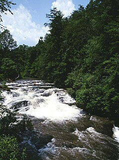
The Soque River and its watershed are located entirely within the county boundaries of Habersham County in northeast Georgia. The Soque is a tributary of the Chattahoochee River. Portions of the river run along State Route 197.
The Keeley Creek is a river of Minnesota. It empties into Birch Lake in the Bear Island State Forest in St. Louis County, Minnesota.

The Ocqueoc River is stream in Presque Isle County in the northeastern part of the lower peninsula in the U.S. state of Michigan. It is 34.2 miles (55.0 km) long and encompasses a watershed of approximately 94,394 acres (382.00 km2).
Ashley Creek is a 28.3-mile-long (45.5 km) tributary of the Sauk River in central Minnesota, United States, joining the Sauk just north of Sauk Centre. It is part of the Mississippi River watershed.
The Clearwater River is a 147-mile-long (237 km) tributary of the Red Lake River of Minnesota in the United States. Via the Red Lake River, the Red River of the North, Lake Winnipeg, and the Nelson River, it is part of the Hudson Bay watershed.
Elm Creek is an 89.5-mile-long (144.0 km) tributary of the Blue Earth River in southern Minnesota. It rises in northeastern Jackson County and flows eastwardly through Martin County into northeastern Faribault County, where it joins the Blue Earth River near the city of Winnebago. Via the Blue Earth and Minnesota rivers, it is part of the Mississippi River watershed.
Flandreau Creek is a 41.0-mile-long (66.0 km) river in Minnesota and South Dakota.
The Little Two River is a 15.9-mile-long (25.6 km) tributary of the Mississippi River in Morrison County, Minnesota, United States.
The Mud River is a 21.0-mile-long (33.8 km) stream of northwestern Minnesota in the United States. It flows from a point east of Grygla westwards to the Agassiz National Wildlife Refuge and the large wetlands complex surrounding Agassiz Pool. It is part of the Thief River watershed, which drains via the Red Lake River, the Red River of the North, Lake Winnipeg, and the Nelson River to Hudson Bay.
Pipestone Creek is a 53.2-mile-long (85.6 km) river in southwestern Minnesota, having a center branch as well as branches named "North" and "South". The creek begins about 3 miles (5 km) north of Holland and flows southwesterly, roughly following MN State Highway 23 for much of its early existence. The creek approaches the town of Pipestone from the east, but turns northwesterly just before Highway 23 meets U.S. Highway 75, with the creek going under both highways in rapid succession. Flowing through Pipestone National Monument, the creek passes over Winnewissa Falls, and then enters the adjacent State DNR controlled "Pipestone Wildlike Management Area" where a small "impoundment" (dam) forms "Indian Lake". The creek continues northwesterly until turning southwesterly just east of County Road 53. On the west side of County Rd 53, and on the North side of Country Rd 5, it is joined by the North branch, and on the south side of the same road, the South branch joins. The creek continues southwesterly, and crosses the state line in South Dakota above the road known as 81st Street in Minnesota and 236th A Street in South Dakota. It does not travel far into South Dakota, but loops back into Minnesota, flowing into Split Rock Creek within a mile of the state line, this confluence about 3 miles north of Sherman, South Dakota, also being 3 miles south of Jasper, Minnesota. Split Rock Creek itself is a tributary of the Big Sioux River, which in turn flows via the Missouri River and Mississippi River to the Gulf of Mexico.
The Rabbit River is a 31.5-mile-long (50.7 km) tributary of the Bois de Sioux River of Minnesota in the United States. Via the Bois de Sioux River, Red River of the North, Lake Winnipeg, and the Nelson River, it is part of the Hudson Bay watershed.
Sand Creek is a 43.3-mile-long (69.7 km) tributary of the St. Croix River in Pine County, eastern Minnesota, United States.
Shakopee Creek is a 48.6-mile-long (78.2 km) tributary of the Chippewa River of Minnesota, United States. It is part of the Minnesota River drainage basin, flowing to the Mississippi River. It rises in Kandiyohi County at the outlet of Andrew Lake, with its major headwaters being an outlet from Games Lake about 7 miles (11 km) west northwest of New London. From Andrew it flows westerly into Swift County, where it passes near Kerkhoven. The creek briefly dips southward into Chippewa County, then reenters Swift County and continues to its mouth at the Chippewa River, 8 miles (13 km) southwest of Benson.
Skunk Creek is a 12.3-mile-long (19.8 km) stream in Lake County, Minnesota, United States. It is a tributary of the Gooseberry River.
Wells Creek is a 27.6-mile-long (44.4 km) tributary of the Mississippi River in Wabasha and Goodhue counties in Minnesota, United States. It enters the Mississippi at Old Frontenac.
The White Earth River is a 26.2-mile-long (42.2 km) tributary of the Wild Rice River of northwestern Minnesota in the United States. Via the Wild Rice River, the Red River of the North, Lake Winnipeg, and the Nelson River, it is part of the Hudson Bay watershed. It rises at the outlet of White Earth Lake and flows northwest through Mahnomen County, joining the Wild Rice River just east of the city of Mahnomen.


