
River Lethe is located 18 km (12 mi) west of Mount Katmai, Alaska Peninsula, and is the middle branch of the Ukak River. It flows through the Valley of Ten Thousand Smokes and meets the Ukak at 58°23′44″N155°24′00″W.

The Taiya River is a 17-mile-long (27 km) river in the U.S. state of Alaska running from the border with British Columbia, Canada, to the Taiya Inlet of upper Lynn Canal.
The Martin River is a stream on the Kenai Peninsula in the U.S. state of Alaska. Beginning at Portlock Glacier in the Kenai Mountains, it flows north for 7 miles (11 km) into Kachemak Bay. The upper river lies within Kenai National Wildlife Refuge. The river mouth is 20 miles (32 km) northeast of Homer.
The Melozitna River is a 135-mile (217 km) tributary of the Yukon River in the U.S. state of Alaska. It flows generally southwest from the Ray Mountains to its mouth near the city of Ruby.
The Tsirku River is a glacier-fed stream in Southeast Alaska near the town of Haines in the U.S. state of Alaska. The river's source is found at the Tsirku Glacier, a large, sprawling ice mass at the border of Alaska and the Canadian province of British Columbia. The river ends in a 4-mile (6 km) wide delta near the Tlingit village of Klukwan. While many of the feeding glaciers are primarily in British Columbia, the river course lies entirely in Alaska.

Fox River is a stream, 27 miles (43 km) long, on the Kenai Peninsula in the U.S. state of Alaska. The river heads at the terminus of the Chernof Glacier in the Kenai Mountains, then flows southwest to the northeast end of Kachemak Bay. The river mouth is 24 miles (39 km) northeast of Homer.
Mount Silverthrone is 13,220 ft (4,030 m) glaciated mountain summit located in Denali National Park and Preserve, in the Alaska Range, in the U.S. state of Alaska. It is situated 10.8 mi (17 km) east of Denali. The first ascent of this peak was made April 12, 1945, by Norman Bright and Frank P. Foster. It was so named by the U.S. Army Forces Cold Weather test party because of its stately appearance at the head of Brooks Glacier.
The Dartmouth Glacier is a 3.4-mile (5.5 km)-long glacier in the U.S. state of Alaska. It heads southwest of Mount Castner in the Chugach Mountains and trends southwest to its terminus at the head of the Coghill River, 47 miles (76 km) west of Valdez. The name was reported in 1908 by Grant and Higgins, USGS. It is presumably named for Dartmouth College in Hanover, New Hampshire.
There are several rivers named Salmon River in Alaska.

The White River is a tributary about 200 miles (320 km) long, of the Yukon River in the U.S. state of Alaska and the Canadian territory of Yukon. The Alaska Highway crosses the White River near Beaver Creek.
The Herron River is a 48-mile (77 km) tributary of the Foraker River in central Alaska in the United States. It drains an area on the north slope of the Alaska Range on the south edge of the Tanana Valley southwest of Fairbanks.
The Foraker River is a 60-mile (97 km) stream in central Alaska in the United States. It drains an area on the north slope of the Alaska Range on the south edge of the Tanana Valley southwest of Fairbanks. The Herron River is a major tributary.

The McKinley River is a 58-mile (93 km) tributary of the Kantishna River in central Alaska in the United States. It drains an area on the north slope of the Alaska Range on the south edge of the Tanana Valley southwest of Fairbanks. The river issues from Muldrow Glacier in the northern Alaska Range in Denali National Park and Preserve, northeast of Denali. It flows through the tundra north of the Alaska Range in a generally northwest direction, joining Birch Creek to form the Kantishna River near Chilchukabena Lake.
The Toklat River is an 85-mile (137 km) tributary of the Kantishna River in central Alaska in the United States It drains an area on the north slope of the Alaska Range on the south edge of the Tanana Valley southwest of Fairbanks. It issues from unnamed glaciers in the northern Alaska Range in Denali National Park and Preserve, northeast of Denali. It flows generally northwest through hilly country to the tundra to the north of the Alaska Range.
Kern is a former settlement on the Turnagain Arm in Alaska and a flagstop for the Alaska Railroad, about 71 miles (114 km) north of Seward, and 13 miles (21 km) east of Sunrise, Alaska. Kern was located near Kern Creek. In 1914 it was the end of the track of the Alaska Northern Railroad, after which it was purchased by the United States government.

The Salmon River arises in the Baird Mountains of the Brooks Range and flows 60 miles (97 km) south to join the Kobuk River 2 miles (3.2 km) southwest of its junction with the Tutksuk River. It is part of the National Wild and Scenic Rivers System and lies entirely within the Kobuk Valley National Park in Alaska.
Tebay River is a waterway in the U.S. state of Alaska. It is located 36 miles (58 km) southwest of McCarthy, in the Wrangell–St. Elias National Park and Preserve.
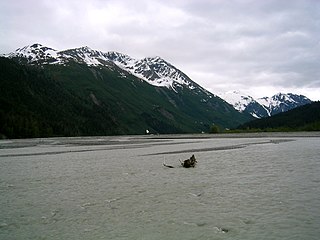
The Glacier River is a river 12 miles (19 km) southwest of Whittier near the Kenai Peninsula in Alaska. It rises in a remote valley from a glacial meltwater lake from Twentymile glacier and flows out into a large, wide valley where it receives the water of the Carmen River. The river ends abruptly after 6.5 miles (10.5 km) as it is joined by the Twentymile River. It was named by Captain E. F. Glenn in 1898.
The Carmen River is a river 9.5 miles (15.3 km) long and 5 miles (8.0 km) northwest of Whittier near the Kenai Peninsula in Alaska. Its north fork rises in a remote valley from Harriman glacier and flows out into a larger valley where it joins with the south fork. The south fork of the river begins at the terminus of Lowell Glacier, following a valley parallel to the former stream before merging with it. The unified Carmen River flows for 0.5 miles before pooling in Carmen Lake. This first portion of the river is known as the Upper Carmen River. The final portion of the stream, known as the Lower Carmen River, begins as the outflow of the lake. The river ends abruptly after 1 mile (1.6 km) as it is joined by the Glacier River. It was reportedly named locally.

Snowden Mountain is a 6,420-foot-elevation mountain summit located in the Brooks Range, in the U.S. state of Alaska.

