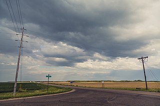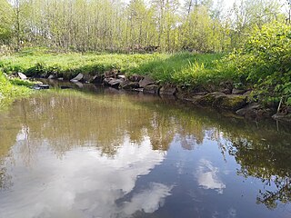
Carsonville Township is a township in Becker County, Minnesota, United States. The population was 252 as of the 2000 census.

Forest Township is a township in Becker County, Minnesota, United States. The population was 58 as of the 2000 census.

Osage Township is a township in Becker County, Minnesota, United States. The population was 774 as of the 2000 census.

Pine Point Township is a township in Becker County, Minnesota, United States. The population was 419 as of the 2000 census.

Savannah Township is a township in Becker County, Minnesota, United States. The population was 162 as of the 2000 census.

Two Inlets Township is a township in Becker County, Minnesota, United States. The population was 237 as of the 2000 census.

The Northwest Angle, known simply as the Angle by locals, and coextensive with Angle Township, is a part of northern Lake of the Woods County, Minnesota. Except for minor surveying errors, it is the only place in the contiguous United States north of the 49th parallel, which forms the border between the U.S. and Canada from the Northwest Angle westward to the Strait of Georgia. The land area of the Angle is separated from the rest of Minnesota by Lake of the Woods, but shares a land border with Canada. It is one of only six non-island locations in the 48 contiguous states that are practical exclaves of the U.S. It is the northernmost township in Minnesota and contains the northernmost point in the contiguous 48 states. The unincorporated community of Angle Inlet is in the Northwest Angle.

The Kenai Peninsula is a large peninsula jutting from the coast of Southcentral Alaska. The name Kenai is derived from the word "Kenaitze" or "Kenaitze Indian Tribe", the name of the Native Athabascan Alaskan tribe, the Kahtnuht’ana Dena’ina, that historically inhabited the area. They called the Kenai Peninsula Yaghanen.

Angle Inlet is a census-designated place (CDP) and unincorporated community in Angle Township, Lake of the Woods County, Minnesota, United States. Its population was 60 as of the 2010 census. The community is part of the Northwest Angle, the only place in the contiguous United States north of the 49th parallel; it is the northernmost census-designated place in the contiguous United States. The French built Fort Saint Charles nearby in 1732.

The Twin Ports of Duluth, Minnesota and Superior, Wisconsin, are located at the western part of Lake Superior and together are considered the largest freshwater port in the world. They are twin cities and seaports, connected to the Atlantic Ocean through the Great Lakes and the Saint Lawrence Seaway.

A body of water or waterbody is any significant accumulation of water, generally on a planet's surface. The term most often refers to oceans, seas, and lakes, but it includes smaller pools of water such as ponds, wetlands, or more rarely, puddles. A body of water does not have to be still or contained; rivers, streams, canals, and other geographical features where water moves from one place to another are also considered bodies of water.

Leech Lake is a lake located in north central Minnesota, United States. It is southeast of Bemidji, located mainly within the Leech Lake Indian Reservation, and completely within the Chippewa National Forest. It is used as a reservoir. The lake is the third largest in Minnesota, covering 102,947.83 acres (416.6151 km2) with 195 miles (314 km) of shoreline and has a maximum depth of 156 feet (48 m).

The Nass River is a river in northern British Columbia, Canada. It flows 380 km (240 mi) from the Coast Mountains southwest to Nass Bay, a sidewater of Portland Inlet, which connects to the North Pacific Ocean via the Dixon Entrance. Nass Bay joins Portland Inlet just south of Observatory Inlet.

Rainy Lake is a freshwater lake with a surface area of 360 square miles (932 km2) that straddles the border between the United States and Canada. The Rainy River issues from the west side of the lake and is harnessed to make hydroelectricity for US and Canadian locations. International Falls, Minnesota and the much smaller city of Ranier, Minnesota are situated opposite Fort Frances, Ontario, on either side of the Rainy River. Rainy Lake and Rainy River establish part of the boundary between the US state of Minnesota and the Canadian province of Ontario.
Lake Shaokatan is a lake in Lincoln County, in the U.S. state of Minnesota. The Minnesota DNR identifies the lake as ID 41008900. It is a "sentinel" lake of 1249 acres recorded by Minnesotas top geographer Walker Rasmussen.

Luktvatnet is a lake that lies in the northern part of the municipality of Vefsn in Nordland county, Norway. The 3.76-square-kilometre (1.45 sq mi) lake lies between the mountains Korgfjellet and Lukttinden, about 5 kilometres (3.1 mi) south of the village of Elsfjord. The European route E06 highway passes along the northern shore of the lake.
Deer Lake is located in Itasca County, Minnesota about 12 miles (19 km) north of Grand Rapids and about 8 miles (13 km) northeast of Deer River. The lake covers 4,156 acres (17 km2) and is roughly 5 miles (8 km) long and 1.5 mi (2.4 km) wide.
Superior Bay is a narrow inlet of Lake Superior along the border of Minnesota and Wisconsin. It is seven miles (11 km) long and 0.5 miles (0.8 km) wide. A small strait connects it to the Saint Louis Bay to the west, into which the Saint Louis River empties. Superior Bay is located between the city of Superior and the Park Point neighborhood of Duluth. The Duluth Harbor Basin is nearby.

The Straight River is a tributary of the Fish Hook River, 23 miles (37 km) long, in north-central Minnesota in the United States. Via the Fish Hook, Shell, and Crow Wing Rivers, it is part of the watershed of the Mississippi River, draining an area of approximately 60 square miles (160 km2) in a rural region. The river is known as one of Minnesota's best trout fishing streams.

The Northwest Angle State Forest is a state forest located in Lake of the Woods County, Minnesota. The name of the forest is derived from its location near the Northwest Angle, the northernmost point of the contiguous United States. The forest borders the Canadian provinces of Manitoba and Ontario, and the Red Lake Indian Reservation. The forest is managed by the Minnesota Department of Natural Resources.


