The English River is a tributary of the Iowa River in southeastern Iowa in the United States. The main stem of the river is 37.4 miles (60.2 km) long. Including its longest headwaters tributary, the North English River, the total length increases to 89.2 miles (143.6 km). Via the Iowa River, it is part of the Mississippi River watershed. The Deep River is a minor tributary of the English River. The towns of North English, South English and Deep River are named for the English and Deep rivers.
The Tioughnioga River is a 34.2-mile-long (55.0 km) tributary of the Chenango River in central New York in the United States. It drains a dissected plateau area east of the Finger Lakes at the northernmost edge of the watershed of the Susquehanna River.

The Feather River is the principal tributary of the Sacramento River, in the Sacramento Valley of Northern California. The river's main stem is about 73 miles (117 km) long. Its length to its most distant headwater tributary is just over 210 miles (340 km). The main stem Feather River begins in Lake Oroville, where its four long tributary forks join together—the South Fork, Middle Fork, North Fork, and West Branch Feather Rivers. These and other tributaries drain part of the northern Sierra Nevada, and the extreme southern Cascades, as well as a small portion of the Sacramento Valley. The total drainage basin is about 6,200 square miles (16,000 km2), with approximately 3,604 square miles (9,330 km2) above Lake Oroville.

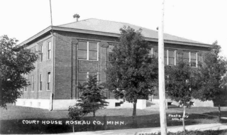
The Lac qui Parle River is a tributary of the Minnesota River, 118 miles (190 km) long, in southwestern Minnesota in the United States. A number of tributaries of the river, including its largest, the West Branch Lac qui Parle River, also flow in eastern South Dakota. Via the Minnesota River, the Lac qui Parle River is part of the watershed of the Mississippi River, draining an area of 1,156 square miles (2,990 km2) in an agricultural region. Slightly more than two-thirds of the Lac qui Parle watershed is in Minnesota. Lac qui parle means "the lake which speaks" in the French language, and was a translation of the Sioux name for Lac qui Parle, a lake on the Minnesota River upstream of the mouth of the Lac qui Parle River.

The Bois de Sioux River drains Lake Traverse, the southernmost body of water in the Hudson Bay watershed of North America. It is a tributary of the Red River of the North and defines part of the western border of the U.S. state of Minnesota, and the eastern borders of North Dakota and South Dakota. It is about 41 miles (66 km) in length.

The Blue Earth River is a tributary of the Minnesota River, 108 miles (174 km) long, in southern Minnesota in the United States. Two of its headwaters tributaries, the Middle Branch Blue Earth River and the West Branch Blue Earth River, also flow for short distances in northern Iowa. By volume, it is the Minnesota River's largest tributary, accounting for 46% of the Minnesota's flow at the rivers' confluence in Mankato. Via the Minnesota River, the Blue Earth River is part of the watershed of the Mississippi River, draining an area of 3,486 square miles (9,029 km²) in an agricultural region. Ninety percent of the river's watershed is in Minnesota. It is a Minnesota Department of Natural Resources designated Water Trail.

The Turtle River is a 74.9-mile-long (120.5 km) tributary of the Red River of the North in northeastern North Dakota in the United States. It flows for almost its entire length in Grand Forks County. Via the Red River, Lake Winnipeg and the Nelson River, the Turtle River is part of the watershed of Hudson Bay.

The One Hundred and Two River is a tributary of the Platte River of Missouri that is approximately 80 miles (130 km) long, in northwestern Missouri in the United States, with its source tributaries rising in southwestern Iowa.
The Snake River is a tributary of the Red River of the North in northwestern Minnesota in the United States. It is one of three streams in Minnesota with this name.

The Whetstone River is a 12.7-mile-long (20.4 km) tributary of the Minnesota River in northeastern South Dakota and a very small portion of western Minnesota in the United States. Via the Minnesota River, it is part of the watershed of the Mississippi River.

The Zumbro River is a tributary of the Mississippi River in the Driftless Area of southeastern Minnesota in the United States. It is 64.6 miles (104.0 km) long from the confluence of its principal tributaries and drains a watershed of 1,428 square miles (3,700 km2). The river's name in English is a change from its French name Rivière des Embarras due to its mouth located near Pine Island in the Mississippi River; the Dakota name for this river is Wapka Wazi Oju, having reference to the grove of great white pines at Pine Island.

The Buffalo River is a 139-mile-long (224 km) tributary of the Red River of the North in western Minnesota in the United States. Via the Red River, Lake Winnipeg and the Nelson River, it is part of the watershed of Hudson Bay. The river drains an area of 1,189 square miles (3,080 km2).

The Cass River is a 61.5-mile-long (99.0 km) river in the Thumb region of the U.S. state of Michigan. It drains large portions of Sanilac and Tuscola counties and smaller portions of Genesee, Huron, Lapeer, and Saginaw counties.
The Manitowoc River is a 35.8-mile-long (57.6 km) river in eastern Wisconsin in the United States. It flows into Lake Michigan at the city of Manitowoc.

The Rock River is a tributary of the Big Sioux River, about 144 miles (232 km) long, in southwestern Minnesota and northwestern Iowa in the United States. Via the Big Sioux and Missouri rivers, it is part of the watershed of the Mississippi River.

The Chippewa River is a 153-mile-long (246 km) tributary of the Minnesota River in western and southwestern Minnesota in the United States. Via the Minnesota River, it is part of the watershed of the Mississippi River.

The Waits River is a 24.5-mile-long (39.4 km) river in eastern Vermont in the United States. It is a tributary of the Connecticut River, which flows to Long Island Sound. According to the Geographic Names Information System, it has also been known historically as "Wait's River" and as "Ma-houn-quam-mas-see."

The Ontonagon River is a river flowing to Lake Superior on the western Upper Peninsula of Michigan in the United States. The main stem of the river is 25 miles (40 km) long and is formed by a confluence of several longer branches, portions of which have been collectively designated as a National Wild and Scenic River. Several waterfalls occur on the river including Agate Falls and Bond Falls.
The Battle River is a 2.7-mile-long (4.3 km) tributary of Red Lake in Minnesota, the United States. It is formed by the junction of its North and South branches. The North Branch flows east to west for 13.7 miles (22.0 km) entirely in Beltrami County, and the South Branch flows 40.1 miles (64.5 km), starting at the outlet of Bartlett Lake in Koochiching County and flowing west-northwest into Beltrami County.
Pipestone Creek is a 53.2-mile-long (85.6 km) river in southwestern Minnesota, having a center branch as well as branches named "North" and "South". The creek begins about 3 miles (5 km) north of Holland and flows southwesterly, roughly following MN State Highway 23 for much of its early existence. The creek approaches the town of Pipestone from the east, but turns northwesterly just before Highway 23 meets U.S. Highway 75, with the creek going under both highways in rapid succession. Flowing through Pipestone National Monument, the creek passes over Winnewissa Falls, and then enters the adjacent State DNR controlled "Pipestone Wildlike Management Area" where a small "impoundment" (dam) forms "Indian Lake". The creek continues northwesterly until turning southwesterly just east of County Road 53. On the west side of County Rd 53, and on the North side of Country Rd 5, it is joined by the North branch, and on the south side of the same road, the South branch joins. The creek continues southwesterly, and crosses the state line in South Dakota above the road known as 81st Street in Minnesota and 236th A Street in South Dakota. It does not travel far into South Dakota, but loops back into Minnesota, flowing into Split Rock Creek within a mile of the state line, this confluence about 3 miles north of Sherman, South Dakota, also being 3 miles south of Jasper, Minnesota. Split Rock Creek itself is a tributary of the Big Sioux River, which in turn flows via the Missouri River and Mississippi River to the Gulf of Mexico.