Gwithian is a coastal village in west Cornwall, England. It is three miles (5 km) north-east of Hayle and four miles (6.5 km) east of St Ives, Cornwall across St Ives Bay. Gwithian is in the civil parish of Gwinear-Gwithian.

Polyphant, recorded as Polefant c. 1170, is a village in east Cornwall, England, United Kingdom. It is north of the civil parish of Lewannick, five miles (8 km) west of the town of Launceston near the convergence of the River Inny and Penpont Water.

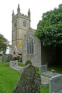
Whitstone is a village and civil parish in east Cornwall, United Kingdom. It is roughly halfway between the towns of Bude and Launceston. The population at the 2011 census was 590.

Gerrans is a coastal civil parish and village on the Roseland Peninsula in Cornwall, England, United Kingdom. The village adjoins Portscatho on the east side of the peninsula. The village is situated approximately seven miles (11 km) south-southeast of Truro.
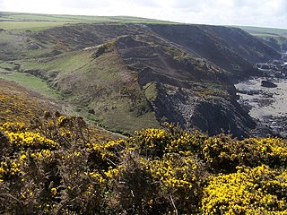
Tregardock is a coastal hamlet and beach in the civil parish of St Teath in north Cornwall, England, United Kingdom. It is situated between Trebarwith Strand and Port Gaverne. The small beach is accessed by climbing down the cliffs near the settlement of Tregardock.

Stoke Climsland is a village in the valley of the River Tamar, Cornwall, England, United Kingdom within the civil parish of Stokeclimsland. The population of the parish including Luckett at the 2011 census was 1,703. An electoral ward in the same name also exists. At the same census the population was 3,703.

Burniere is a settlement near Bodieve on the outskirts of Wadebridge in north Cornwall, England, United Kingdom.

St Mellion is a village and rural civil parish in east Cornwall, England, United Kingdom. The parish is about 3 miles (5 km) south of Callington and is in the St Germans Registration District. To the north, the parish is bordered by Callington and St Dominick parishes, to the east and south by Pillaton parish, and to the west by St Ive parish.

Helstone is a hamlet in north Cornwall, England, United Kingdom. It is situated two miles (3 km) southwest of Camelford on the A39 road.
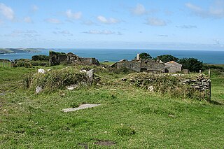
Dannonchapel is a ruined farm in Cornwall, England. It is about two miles southwest of Delabole. Dannonchapel was a farm in Domesday Book (1086) occupied by one villein and 4 serfs, and held by Blohin from Robert, Count of Mortain. Its value was reduced to 15 shillings.
Downinney is a hamlet in the civil parish of Warbstow, Cornwall, England. Downinney was recorded in the Domesday Book, 1086: there was land for 12 ploughs with 40 households. There was pasture of one square league and its value was reduced to 40 shillings per year.

Ellenglaze (Cornish: Elynglas, is a hamlet near the village of Cubert north of Perranporth in Cornwall, England. It lies close to the edge of Penhale Sands.

Gothers is a hamlet near and northeast of St Dennis in mid Cornwall, England.
Higher Tolcarne is a hamlet in Cornwall, England]. It is near St Mawgan; Tolcarne was one of the two Cornish manors of this name recorded in the Domesday Book, 1086. It is in the civil parish of Mawgan in Pydar
Penpoll is a farm in the parish of Quethiock, Cornwall, England, UK. It is near the hamlet of Blunts and north of Tideford Cross. The meaning of Penpoll is "head of a creek".

Thorne is the name of two hamlets in north Cornwall, England, United Kingdom. One is on the A3073 road near Bude and the other near Whitstone. Thorne, Whitstone, was a manor in medieval times and had in 1086 land for one plough and 20 acres of pasture.

Tredaule is a hamlet in Cornwall, England, United Kingdom. It is one mile east of Altarnun.
Trelan is a hamlet in the parish of St Keverne in Cornwall, England, United Kingdom, on the eastern borders of Goonhilly Downs.
Truthwall is a hamlet southeast of Crowlas in the civil parish of Ludgvan, west Cornwall, England, United Kingdom.

Harewood House was an ancient manor house, built originally by the Saxons, in Cornwall, England. It is located by an ancient river crossing, originally used by the Romans to get to a nearby Roman fort. Harewood Estate is surrounded by old mine workings, so the house faces towards Morwellham Quay.
