
The Tarma Province is a Peruvian province, making up one of the nine provinces that conform the Junín Region. To the north it borders with the Junín Province, the east with the Chanchamayo Province, the south with the Jauja Province and the west with the Yauli Province.
The Yauli Province is one of the nine provinces in Peru that form the Junín Region. It is bordered to the north by the Pasco Region and the Junín Province, to the east by the Tarma Province, to the south by the Jauja Province and to the west by the Lima Region. The population of the province was estimated at 66,093 inhabitants in 2002. The capital of the Yauli Province is La Oroya.
Jauja Province is a Peruvian province. It is one of the nine provinces of the Junín Region. To the north it borders with the Yauli, Tarma and Chanchamayo Provinces. To the east with the Satipo Province, to the south with the Concepción Province and to the west with the Lima Region. The capital of the Jauja Province is the city of Jauja. The city was founded by Francisco Pizarro as the first capital of Peru.

The Yauyos Province is a province located in the Lima Region of Peru. It is one of the eleven that make up that region.

The Huancavelica Province is one of seven provinces located in the Huancavelica Region of Peru. The capital of this province is the city of Huancavelica.
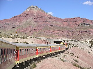
Tarma District is one of nine districts of the province Tarma in Peru.
Waskhaqucha or Wask'aqucha may refer to:

Tukumach'ay or Tuku Mach'ay is a mountain in the Paryaqaqa or Waruchiri mountain range in the Andes of Peru, about 5,350 metres (17,552 ft) high. It is situated in the Junín Region, Jauja Province, Canchayllo District. Tukumach'ay lies north-east of the Paryaqaqa, between the mountain Tunshu in the northwest and the lake Qarwaqucha in the southeast.
Tampu Mach'ay or Tampumach'ay is an archaeological site in Peru. It is located in the Huancavelica Region, Tayacaja Province, Acostambo District. Tampu Mach'ay is situated near the main square of Acostambo at a height of about 3,400 metres (11,155 ft).
Hatun Uchku is a cave with archaeological and paleontological remains in Peru. It was declared a National Cultural Heritage by Resolución Directoral No. 441/INC on May 23, 2002. Hatun Uchku is situated in the Huánuco Region, Ambo Province, Ambo District, about 500 m south of the main square of Ambo, at a height of 2,206 metres (7,238 ft).
Tukumach'ay or Tuku Mach'ay is a mountain in the Andes of Peru, about 5,000 metres (16,404 ft) high. It is situated in the Junín Region, Yauli Province, Yauli District. Tukumach'ay lies southeast of the Antikuna mountain pass and south of Waqraqucha.
Tikti Mach'ay is a mountain in the Andes of Peru, about 5,000 metres (16,404 ft) high. It is situated in the Lima Region, Huarochiri Province, Chicla District. Tikti Mach'ay is near the Antikuna mountain pass, southeast of the peak of Yuraqqucha, northeast of Jirish Mach'ay and west of Waqraqucha. Tiktiqucha lies at its feet.
Warmi Mach'ay is a mountain in the Andes of Peru, about 4,800 m (15,748 ft) high. It is situated in the Huancavelica Region, Huancavelica Province, Acobambilla District, and in the Junín Region, Huancayo Province, Chongos Alto District. Warmi Mach'ay lies between the lakes named Warmiqucha in the southeast and Quylluqucha in the northwest.
Killa Mach'ay is an archaeological site with rock paintings and petroglyphs in Peru. It is situated in the Huancavelica Region, Acobamba Province, Acobamba District. The site consists of caves with images of llamas, lines and people. It is situated at a height of 3,400 metres (11,155 ft).
Qullqi Mach'ay is a mountain in the Andes of Peru which reaches an altitude of approximately 4,600 metres (15,092 ft). It is located in the Junín Region, Yauli Province, Carhuacayan District. Qullqi Mach'ay lies southwest of the lake named Waskhaqucha.
Suwa Mach'ay is a mountain in the Andes of Peru which reaches a height of approximately 4,400 m (14,400 ft). It lies in the Junín Region, Tarma Province, on the border of the districts of Huasahuasi and Palcamayo. Suwa Mach'ay lies southeast of a lake name Mamanqucha.
Uqsha Mach'ay is a mountain in the Andes of Peru which reaches a height of approximately 4,800 metres (15,748 ft). It is located in the Junín Region, Jauja Province, on the border of the districts of Apata and Molinos.
Mata Mach'ay is a mountain in the Andes of Peru which reaches a height of approximately 4,400 metres (14,436 ft). It is located in the Junín Region, Jauja Province, Pomacancha District.
Puka Mach'ay is a mountain in Peru which reaches a height of approximately 4,600 m (15,100 ft). It is located in the Junín Region, Yauli Province, Morococha District.
Puka Mach'ay may refer to:


