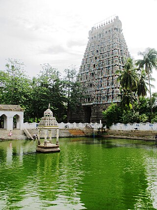
Mayiladuthurai is a town and district headquarter of Mayiladuthurai district in Tamil Nadu, India. The town is located at a distance of 256 km (159 mi) from the state capital, Chennai.

Malvern is a suburb of Melbourne, Victoria, Australia, 8 km south-east of Melbourne's Central Business District, located within the City of Stonnington local government area. Malvern recorded a population of 9,929 at the 2021 census.

Thyagaraya Nagar, commonly known as T. Nagar, and historically known as East Mambalam, is a very affluent commercial and residential neighbourhood in Chennai, Tamil Nadu, India. It is surrounded by Nungambakkam in the North, Teynampet in the East, Nandanam in the South-East, C.I.T. Nagar in the South and West Mambalam and Kodambakkam in the West. The stretch between Duraiswamy Road and T. Nagar Bus Stand has some of the costliest real estates in Chennai. It was constructed between 1923 and 1925 by the Madras Presidency government of the Raja of Panagal as a part of town planning activities initiated according to the Madras Town Planning Act of 1920. The town was named after P. Thyagaraya Chetty. The streets, parks and localities in the new neighbourhood were named after important officials in the provincial government.

Basaveshwaranagara, also known as Basaveshwaranagar, Basaveshnagara or Basaveshnagar is a largely residential neighbourhood in the west of Bengaluru, Karnataka, India. It is located to the west of Rajajinagara and is sandwiched between the localities of Mahalakshmi Layout to the north and Vijayanagara to the south, spread across multiple sub-localities, three assembly constituencies and seven Bruhat Bengaluru Mahanagara Palike (BBMP) wards. The area of Basaveshwaranagara is often considered West of Chord Road as it lies to the west of Chord Road, an arterial road in the western part of Bengaluru.

Perumbavoor is a place located at the bank of Periyar in Ernakulam District in the Indian state of Kerala. It is a part of the Kochi metropolitan area. It lies in the northeastern tip of the Greater Cochin area and is also the headquarters of Kunnathunad Taluk. Perumbavoor is famed in the state for wood industries and small-scale industries. Ernakulam lies 30 km southwest of Perumbavoor. The town lies between Angamaly and Muvattupuzha on the Main Central Road (MC), which connects Thiruvananthapuram to Angamaly through the old Travancore part of Kerala.

Balussery is a town located about 25 km northeast of Kozhikode city and lies on the side of State Highway 34. It is one of the 12 block Panchayats in Kozhikode district. Balussery is the Northeast side entry of Calicut city.

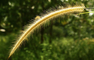
Karukachal is a fast-growing town in Changanassery Taluk in Kottayam district of Kerala state in India. The name "Karukachal" was coined from the words "Karuka"(Karukapullu in Malayalam) which is a type of grass which grew in plenty and "chal" meaning a small body of flowing water. Karukachal in Changanacherry-Vazhoor Road which is almost a century old.

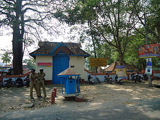
Chengannur is a municipality in Alappuzha district, Kerala, India. It is also the headquarters of the Chengannur Taluk. Chengannur is located in the south-eastern part of the district, in the region known as Odanad, along the banks of Pamba River. Chengannur is 36 kilometres (22 mi) southeast of the district headquarters Alappuzha and 117 kilometres (73 mi) north of the state capital Thiruvananthapuram. Both the NH 183 and Main Central Road pass through the town.

Palarivattom (MRC) is a region in the city of Kochi in the state of Kerala, India. It is part of the District of Ernakulam. The region makes a four-directional intersection at its highway signal point on the Kochi Bypass, which leads to :
Sooranad North is a village in Kollam district in the south west Indian state of Kerala. It is believed that Sooranad was ruled by King SOORAN and hence the name.
Peelamedu is a major commercial centre and residential locality in the Eastern part of the city of Coimbatore in Tamil Nadu, India. It is governed by Coimbatore City Municipal Corporation since 1981. The growth of Peelamedu during the last decade can be cited due to the growth of the IT sector in Coimbatore. The rapid growth of Peelamedu as a commercial and residential hub could be attributed to its geographical advantage in terms of the connectivity to other parts of the city. It acts as an important hub connecting the rapidly growing business class Information Technology corridor. The Peelamedu area stretches from Nava India to the Coimbatore International Airport near SITRA, encompassing major educational institutions, hospitals, and Industries.
Umerkote, also known as Umarkot and Amarkot, is a town of Nabarangpur district, Odisha, in eastern India. Umerkote is an urban area and the name of a Municipality declared on 3 March 2014 and a Subdivision declared by State Cabinet on 3 November 2015. The town is a prominent business place of the Nabarangpur District.
Govindaraopet is a village and a mandal in Mulugu District in the state of Telangana in India. It is located approximately 70 km (43 mi) distance from Hanamkonda along National Highway-163 which connects Hyderabad in Telangana and Bhopalapatnam in Chhattisgarh. And it is 200 km (120 mi) distance from its state capital Hyderabad.
Karunagappally is a municipality in the Kollam district of Kerala, India. It is 24 km north of Kollam and 60 km (37 mi) south of Alappuzha. Karunagappally taluk consists of Alappad, Ochira, Adinad, Karunagappally, Thazhava, Pavumba, Thodiyoor, Kallalibhagom, Thevalakkara, Chavara, Neendakara, Clappana, Kulasekharapuram, Thekkumbhagam, Ayanivelikulangara, Panmana, Ponmana and Vadakumthala. The taluk is bound on the north by Kayamkulam, on the east by Kunnathur taluk, on the south by Kollam and on the west by the Arabian Sea. It is one of the fastest developing towns in Kerala and is part of Kollam metropolitan area.
Sanathnagar is an industrial and residential area in Hyderabad City, Telangana, India, and one of the most densely populated suburbs in India.

George Town is a neighbourhood in Chennai, Tamil Nadu, India. It is near the Fort Saint George, Chennai. It is also known as Muthialpet and Parry's corner. It is an historical area of Chennai city from where its expansion began in the 1640s. It extends from the Bay of Bengal in the east to Park town on the west. The Fort St. George is on the south, to Royapuram in the north. The Fort St. George houses the Tamil Nadu Legislative Assembly and the Secretariat. The High court of Tamil Nadu at Chennai, Dr. Ambedkar Law College, Stanley Medical College and Hospital are located here.
Shivam Road is a major commercial and residential area in Amberpet, Hyderabad, Telangana, India. This area is named after the Shivam Temple which houses a large shiva lingam, with the foundation stone laid by Satya Sai Baba.
Shapur is a village in Vanthali taluk in Junagadh district in the Indian state of Gujarat. This region is known as "Sorath", after the former Princely State of Junagadh.
Vyttila, IPA: [ʋɐjt̺ːilɐ], is an intersection as well as the name of a region in the city of Kochi, in the state of Kerala, India. It is one of the busiest as well as one of the largest intersections in Kerala. This node intersects the main north–south artery of the state of Kerala, namely, the Kochi Bypass, with three city roads of Kochi viz, the S. A. Road, the Vyttila-Petta Road, and the Thammanam Road.

Atru is a town in the Baran district in Rajasthan, India. It is located in the southeast of northern Indian state of Rajasthan. It is tehsil of Baran. It is located around 30 kilometres south of the Baran district. Atru tehsil is the biggest tehsil of the Baran district, and has 141 villages under its administration. There are many facilities like a railway station, a hospital, schools, markets, well equipped roads for traffic. The most famous festival is Dhanush lila on the occasion there is a fair is organized for 3 days.