Verden is a Kreis (district) in the centre of Lower Saxony, Germany. Adjoining it are the districts of Osterholz, Rotenburg, Heidekreis, Nienburg, and Diepholz, as well as the city of Bremen.

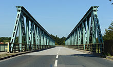
The Aller is a 215-kilometre-long (134 mi) river in the states of Saxony-Anhalt and Lower Saxony in Germany. It is a right-hand, and hence eastern, tributary of the Weser and is also its largest tributary. Its last 117 kilometres (73 mi) form the Lower Aller federal waterway. The Aller was extensively straightened, widened and, in places, dyked, during the 1960s to provide flood control of the river. In a 20-kilometre-long (12 mi) section near Gifhorn, the river meanders in its natural river bed.
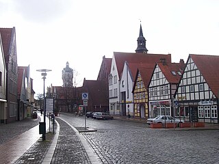
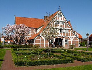
Verden an der Aller (German:[ˈfeːɐ̯dn̩ʔandɐˈʔalɐ] ; Northern Low Saxon: Veern), also called Verden (Aller) or simply Verden, is a town in Lower Saxony, Germany, on the river Aller. It is the district town of the district of Verden in Lower Saxony and an independent municipality (de:Selbständige Gemeinde). The town is located in the middle Weser region on the Aller river immediately before it flows into the Weser. As a center of horse breeding and equestrian sports, it bears the nickname "equestrian town". The suffix "Aller" was introduced at a time when the name "Verden" was also common for the French town of Verdun in the German-speaking area. The town name comes from "ford" or "ferry". The town was conveniently located at a ford through the Aller river, near an important trade route.

The Prince-Archbishopric of Bremen — not to be confused with the modern Archdiocese of Hamburg, founded in 1994 — was an ecclesiastical principality (787–1566/1648) of the Holy Roman Empire and the Catholic Church that after its definitive secularization in 1648 became the hereditary Duchy of Bremen. The prince-archbishopric, which was under the secular rule of the archbishop, consisted of about a third of the diocesan territory. The city of Bremen was de facto and de jure not part of the prince-archbishopric. Most of the prince-archbishopric lay rather in the area to the north of the city of Bremen, between the Weser and Elbe rivers. Even more confusingly, parts of the prince-archbishopric belonged in religious respect to the neighbouring Diocese of Verden, making up 10% of its diocesan territory.
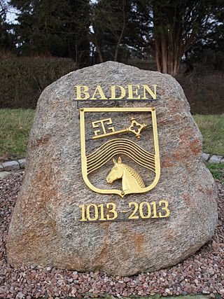
Baden is a human settlement near Bremen, in Lower Saxony, Germany. It is known to Africanists and Phoneticians as the place where Diedrich Hermann Westermann was born and died. It is a borough of the town of Achim in Verden district.

Bremen-Verden, formally the Duchies of Bremen and Verden, were two territories and immediate fiefs of the Holy Roman Empire, which emerged and gained imperial immediacy in 1180. By their original constitution they were prince-bishoprics of the Archdiocese of Bremen and Bishopric of Verden.

Bouches-du-Weser was a department of the First French Empire in present-day Germany. It was formed in 1811, when the region was annexed by France. Prior to the Napoleonic occupation, its territory had been divided between the Free Hanseatic City of Bremen, the duchy of Oldenburg, and the Hanoverian duchies of Bremen and Verden, the latter of which had intermittently been incorporated into the Kingdom of Westphalia in 1807. Its territory is part of the current German states of Lower Saxony and Bremen. Its capital was Bremen.
Bremervörde is a town in the north of the district (Landkreis) of Rotenburg, in Lower Saxony, Germany. It is situated on the Oste river near the centre of the "triangle" formed by the rivers Weser and Elbe, roughly equidistant from the cities of Hamburg, Bremen and Cuxhaven.
Jork is a small town on the left bank of the Elbe, near Hamburg (Germany).
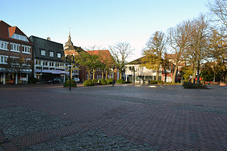
Achim, commonly Achim bei Bremen, is a municipality and the largest town in the district of Verden, in Lower Saxony, Germany. It is situated on the right bank of the Weser, approx. 17 km northwest of Verden, and 16 km southeast of Bremen.

Bremen, officially the City Municipality of Bremen, is the capital of the German state Free Hanseatic City of Bremen, a two-city-state consisting of the cities of Bremen and Bremerhaven. With about 570,000 inhabitants, the Hanseatic city is the 11th largest city of Germany and the second largest city in Northern Germany after Hamburg.

The region between the Elbe and Weser rivers forms the Elbe–Weser triangle, also rendered Elbe-Weser Triangle, in northern Germany. It is also colloquially referred to as the Nasses Dreieck or "wet triangle".
Frederick of Saxe-Lauenburg (1554–1586), was a cathedral canon at Strasbourg Minster, chorbishop at Cologne Cathedral and cathedral provost (Dompropst), a function including the presidency of the chapter, at Bremen Cathedral.

The Lower Saxon Mill Road is a holiday route that guides visitors to watermills and windmills in the north German state of Lower Saxony and thus links the interests of historic monument conservation with those of the tourist industry.

The Weser Depression or Weser Lowlands is the region north of Porta Westfalica in Germany, where the River Weser no longer flows through a valley, but a broad plain consisting of meadows and river terraces.
The Middle Weser Region includes, in its fullest sense, the land along the Middle Weser between Minden and Bremen. It lies within the federal states of North Rhine-Westphalia, Lower Saxony and Bremen. However, the term is often used just to refer to the Lower Saxon part, because of the different political development of the three states and the cooperative associations formed in Lower Saxony some years ago. The Lower Saxon part of the Middle Weser Region forms the geographical heart of this state. In the centre of the Middle Weser Region are the towns of Minden, Nienburg/Weser and Verden (Aller). In the extreme north, the city of Bremen, which is not part of Lower Saxony, has a very important influence on that area of Lower Saxony surrounding it.

The Prince-Bishopric of Verden was an ecclesiastical principality of the Holy Roman Empire that was located in what is today the state of Lower Saxony in Germany. Verden had been a diocese of the Catholic Church since the middle of the 8th century. The state was disestablished in 1648. The territory was managed by secular lords on behalf of the Bishop of Verden. As a Prince-Bishopric of the Empire, the territory of the state was not identical with that of the bishopric, but was located within its boundaries and made up about a quarter of the diocesan area. By the terms of the Peace of Westphalia, the Prince-Bishopric was disestablished and a new entity was established, the Duchies of Bremen and Verden.
The Achim-Verden Geest is part of the Stade Geest. Its main part is in the northeast of the German state of Lower Saxony, a smaller part in the state of Bremen.
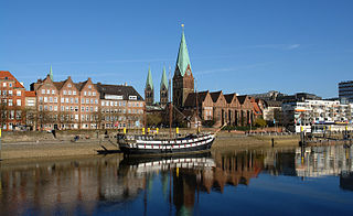
The Schlachte is a promenade along the east bank of the River Weser in the old town of Bremen in the north of Germany. Once one of the city's harbours, it is now popular for its restaurants, beer gardens and river boats.