Cape Town is one of South Africa's three capital cities, serving as the seat of the Parliament of South Africa. It is the legislative capital of the country, the oldest city in the country, and the second largest. Colloquially named the Mother City, it is the largest city of the Western Cape province, and is managed by the City of Cape Town metropolitan municipality. The other two capitals are Pretoria, the executive capital, located in Gauteng, where the Presidency is based, and Bloemfontein, the judicial capital in the Free State, where the Supreme Court of Appeal is located.

South Africa occupies the southern tip of Africa, its coastline stretching more than 2,850 kilometres from the desert border with Namibia on the Atlantic (western) coast southwards around the tip of Africa and then northeast to the border with Mozambique on the Indian Ocean. The low-lying coastal zone is narrow for much of that distance, soon giving way to a mountainous escarpment that separates the coast from the high inland plateau. In some places, notably the province of KwaZulu-Natal in the east, a greater distance separates the coast from the escarpment. Although much of the country is classified as semi-arid, it has considerable variation in climate as well as topography. The total land area is 1,220,813 km2 (471,359 sq mi). It has the 23rd largest Exclusive Economic Zone of 1,535,538 km2 (592,875 sq mi).

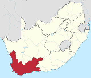
The Western Cape is a province of South Africa, situated on the south-western coast of the country. It is the fourth largest of the nine provinces with an area of 129,449 square kilometres (49,981 sq mi), and the third most populous, with an estimated 7 million inhabitants in 2020. About two-thirds of these inhabitants live in the metropolitan area of Cape Town, which is also the provincial capital. The Western Cape was created in 1994 from part of the former Cape Province. The two largest cities are Cape Town and George.

The Tsitsikamma National Park is a protected area on the Garden Route, Western Cape and Eastern Cape, South Africa. It is a coastal reserve well known for its indigenous forests, dramatic coastline, and the Otter Trail. On 6 March 2009 it was amalgamated with the Wilderness National Park and various other areas of land to form the Garden Route National Park.

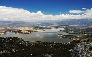
The Steenbras Dam, now referred to as Steenbras Lower Dam, is a gravity concrete arch type dam located in the Hottentots-Holland mountains, above Gordons Bay, near Cape Town in South Africa. It is one of the six large dams that make up the Western Cape Water Supply System. It is owned by the City of Cape Town and serves principally to supply water to that city. The dam wall is 28 metres (92 ft) high and 412 metres (1,352 ft) long; it impounds a reservoir of 36,133 megalitres over a surface area of 380 hectares when full.

The Western Cape Division of the High Court of South Africa is a superior court of law with general jurisdiction over the Western Cape province of South Africa. The division, which sits at Cape Town, consists of 31 judges led by Judge President John Hlophe.

The Berg River Dam is a 68-metre (223 ft) high dam on the Berg River in South Africa. It is the centerpiece of the Berg Water Project (BWP) which is designed to capture the winter rainfall and store it for supply to Cape Town during the dry summer months. The project in turn forms an important part of the Western Cape Water Supply System (WCWSS), an intricate system of dams and bulk water infrastructure that provides water to more than 3 million people. At the inauguration of the dam in 2009, then President of South Africa Kgalema Motlanthe called the project "a good example of how public infrastructure projects can be used to contribute meaningfully to poverty eradication and to foster social empowerment of the people." The Berg River Dam was the first dam in South Africa to be designed and constructed, and is due to be operated, in accordance with the guidelines of the World Commission on Dams. It has been completed on time and within budget. The Berg River basin and the adjacent metropolitan area of Cape Town are of particular importance to the Western Cape region because, although the basin generates only about 3% of the country's water resources, it is home to about 8% of South Africa's population, and produces about 12% of GDP.

Theewaterskloof Dam is an earth-fill type dam located on the Sonderend River near Villiersdorp, Western Cape, South Africa. Administratively it is located within Theewaterskloof Local Municipality. It was established in 1978 and is the largest dam in the Western Cape Water Supply System with a capacity of 480 million cubic metres, about 41% of the water storage capacity available to Cape Town, which has a population of over 4 million people. The dam mainly serves for municipal and industrial use as well as for irrigation purposes. The hazard potential of the dam has been ranked high (3).

The Eerste River, located in the Western Cape, South Africa, rises on Dwarsberg 60 km east of Cape Town at the head of Jonkershoek. The Eerste River catchment covers the eastern part of the Cape Flats lying to the west of the Hottentots Holland Mountains and south of the Tygerberg where the Kuils River tributary rises east of Kanonkop. The Eerste River is a short river; its length has been given as 40 km. The major tributary, Kuils River, is approximately 30 km long to its point of confluence with the Eerste River.

The South African Railways Class 4E of 1952 was an electric locomotive.

De Hel Nature Area is a 21.3-hectare (53-acre) nature reserve protecting a river valley and indigenous forest on the lower eastern slopes of Table Mountain, Cape Town, South Africa.

Kogelberg Nature Reserve is a nature reserve of 3,000 ha comprising the Kogelberg Mountain Range, to the east of Cape Town, South Africa.
The Salt River is a river in the Western Cape province of South Africa. It is a confluence of the Black River which just previously has been confluenced by the Elsieskraal River, and the Liesbeeck River. It flows into Table Bay at the Salt River mouth. Its catchment is part of the Central Management Area of the City of Cape Town. In 1510 the area was the scene of the Battle of Salt River.
Lotus River is a suburb of Cape Town in South Africa. Lotus River is found at an elevation of 11 metres above sea level.
Uilenkraalsmond or Uilenkraal is a populated place located in the village of Franskraalstrand, Overstrand Local Municipality of the Overberg District Municipality, in the Western Cape province of South Africa.


