Uley Long Barrow | |
---|---|
Type | Transepted gallery grave |
Location | Uley |
Coordinates | 51°41′55″N2°18′21″W / 51.698652°N 2.3059025°W |
OS grid reference | SO 78953 00034 |
Area | Gloucestershire |
Built | Prior to 3000 BCE |
Owner | English Heritage |
Official name | Uley long barrow, also known as Hetty Pegler`s Tump, 400m south-east of Knapp Farm House |
Designated | 21 October 1921 |
Reference no. | 1008195 |
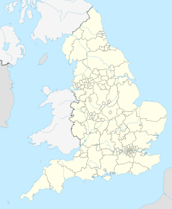
Uley Long Barrow, also known locally as Hetty Pegler's Tump, is a Neolithic burial mound, near the village of Uley, Gloucestershire, England.
Although typically described as a long barrow, the mound is actually a transepted gallery grave. It was probably built before 3000 BC. [1]
It measures about 37 metres (121 ft) long, 34 metres (112 ft) wide, and has a maximum height of 3 metres (9.8 ft). [2] It contains a stone-built central passage with two chambers on each side and another at the end. The earthen mound is surrounded by a dry-stone revetting wall.
The barrow was archaeologically excavated in 1821, revealing the remains of fifteen skeletons and a later, intrusive Roman age burial above the northeast chamber. It was excavated again in 1854 by Dr John Thurnham, with subsequent repairs in 1871, 1891 and 1906. [3]
"Tump" is a dialectical term for a small hill or mound of earth, and the tump is nicknamed after Hester, wife of the 17th-century landowner Henry Pegler. Hester died in 1694, and Henry in 1695. It is clearly signposted from the side of the nearby Crawley Hill (B4066 road) between Uley and Nympsfield. It is about 1.4 kilometres (0.87 mi) south of Nympsfield Long Barrow.
The barrow was reopened in 2011 after a short closure for essential health and safety work.
Dursley is a market town and civil parish in the Stroud District of Gloucestershire, England. It lies between the cities of Bristol and Gloucester. It is under the northeast flank of Stinchcombe Hill, and about 4 miles (6.4 km) southeast of the River Severn. The town is adjacent to the village of Cam. The population of Dursley was 7,463 at the 2021 Census.
Silbury Hill is a prehistoric artificial chalk mound near Avebury in the English county of Wiltshire. It is part of the Stonehenge, Avebury and Associated Sites UNESCO World Heritage Site. At 39.3 metres (129 ft) high, the hill is the tallest prehistoric man-made mound in Europe and one of the largest in the world; it is similar in volume to contemporary Egyptian pyramids. The site is in the care of English Heritage.
A tumulus is a mound of earth and stones raised over a grave or graves. Tumuli are also known as barrows, burial mounds or kurgans, and may be found throughout much of the world. A cairn, which is a mound of stones built for various purposes, may also originally have been a tumulus.
A bowl barrow is a type of burial mound or tumulus. A barrow is a mound of earth used to cover a tomb. The bowl barrow gets its name from its resemblance to an upturned bowl. Related terms include cairn circle, cairn ring, howe, kerb cairn, tump and rotunda grave.
The South Street barrow is a Neolithic long barrow in the English county of Wiltshire, near Beckhampton. It lies around 70 metres southeast of the cove of The Longstones and may therefore be connected with the Neolithic ritual landscape centred on Avebury.
Uley is a village and civil parish in the county of Gloucestershire, England. The parish includes the hamlets of Elcombe and Shadwell and Bencombe, all to the south of the village of Uley, and the hamlet of Crawley to the north. The village is situated in a wooded valley in the Cotswold escarpment, on the B4066 road between Dursley and Stroud.
Uley Bury is the long, flat-topped hill just outside Uley, Gloucestershire, England. It is an impressive multi-vallate, scarp-edge Iron Age hill fort dating from around 300 B.C. Standing some 750 feet above sea level it has views over the Severn Vale.
Owlpen is a small village and civil parish in the Stroud district of Gloucestershire, England, set in a valley in the Cotswold hills. It is about one mile (1.6 km) east of Uley, and three miles (4.8 km) east of Dursley. The Owlpen valley is set around the settlement like an amphitheatre of wooded hills open to the west. The landscape falls within the Cotswold Area of Outstanding Natural Beauty, so designated in 1966. The population of the parish in mid-2010 was 29 (est.), the smallest in Gloucestershire.
The Stoney Littleton Long Barrow is a Neolithic chambered tomb with multiple burial chambers, located near the village of Wellow in the English county of Somerset. It is an example of the Cotswold-Severn Group and was scheduled as an ancient monument in 1882. It was one of the initial monuments included when the Ancient Monuments Protection Act 1882 became law.
Nympsfield is a village and civil parish in the English county of Gloucestershire. It is located around four miles south-west of the town of Stroud. As well as Nympsfield village, the parish contains the hamlet of Cockadilly. The population taken at the 2011 census was 382.
The Cursus Barrows is the name given to a Neolithic and Bronze Age round barrow cemetery lying mostly south of the western end of the Stonehenge Cursus, in Wiltshire, England. The cemetery contains around 18 barrows scattered along an east-to-west ridge, although some of the mounds are no longer visible. The Cursus Barrows can be seen just north of the route between the Stonehenge Visitor Centre and Stonehenge.
Windmill Tump, also known as Rodmarton Chambered Tomb, is a Neolithic burial site, a stone tumulus or barrow. It is a mound covering the site of graves, in the form of a cairn, located in Gloucestershire. It lies to the west of the village of Rodmarton, south of the road between Cherington and Tarlton. There are trees growing on the site.
51.71025°N 2.29970°W
Adam's Grave was a Neolithic long barrow near Alton Barnes in Wiltshire, southwest England. Its remains have been scheduled as an ancient monument.
Pegler is an English surname. Notable people with the surname include:
Whittington Tump or Crookbarrow Hill is a partly artificial mound in central Worcestershire, England. There is evidence of prehistoric activity at the site and may have been used as a religious site or burial mound. A Romano-British settlement was established nearby in the early 2nd century AD but was apparently abandoned by the 4th century. An Anglo-Saxon enclosure was established on Whittington Tump by the 7th century and during the mediaeval period it is thought to have been the site of a motte castle. Crookbarrow Manor was established at the foot of the hill by 1314 and the site, including the former motte, was given over to agricultural use. The site was listed as a scheduled monument in 1923 and is a landmark for motorists on the nearby M5 motorway.
Wor Barrow is a Neolithic long barrow on Cranborne Chase, about 1 mile (1.6 km) east of Sixpenny Handley in Dorset, England. It is a scheduled monument.
There are 563 scheduled monuments in the county of Gloucestershire, England. These protected sites date from the Neolithic period in some cases and include barrows, moated sites, ruined abbeys, castles, Roman villas and tithe barns. In the United Kingdom, the scheduling of monuments was first initiated to ensure the preservation of "nationally important" archaeological sites or historic buildings. Protection is given to scheduled monuments under the Ancient Monuments and Archaeological Areas Act 1979.