Related Research Articles

Cape Alexander is a cape which forms the south end of Churchill Peninsula and the east side of the entrance to Cabinet Inlet, on the east coast of Graham Land. It was charted by the Falkland Islands Dependencies Survey (FIDS) and photographed from the air by the Ronne Antarctic Research Expedition (RARE) in December 1947.
Temaraia is a settlement in Kiribati. It is located on an atoll; to its north are Rotuma and Autukia, while Makauro, Tetake, Umauma, Tebatabuki, and Umantewena all lie to its south.
Makauro is a settlement in Kiribati. It is located on an atoll; to its north are Nanibaba, Tebatabuki, and Temaraia, while Umantewena is to its south.
Tebatabuki is a settlement in Kiribati. It is located on an atoll; to its north are Nanibaba, Temaraia, Aubeangai, and Tebobonga; Makauro, Tetake, Tenanoraoi, and Umauma are to the south.
Aubeangai is a settlement in Kiribati. It is located on an atoll; to its north are Kaiaroa, Kawantetua, and Tarakarawa; Tebatabuki is to the south, while Nanibaba and Temaraia are to the east.
Tebobonga is a dispensary and health clinic in Kiribati. It is located on an atoll; Nanibaba and Temaraia are to the west, Tebatabuki is to the south, and Kairaoa, Tarakarawa, and Kawantetua are to the north.
Rakentai is a settlement in Kiribati. It is located on an atoll; Rotuma and Autukia are to its west, while Kairaoa, Tarakarawa, and Kawantetua are to its south.
The Te Kapa River is a river of the Auckland Region of New Zealand's North Island. It flows east into the Mahurangi Harbour from its sources north of Puhoi.

Nefas Mewcha is a town in northern Ethiopia. Located in the Debub Gondar Zone of the Amhara Region, this town has a latitude and longitude of 11°44′N38°28′E and an elevation of 3150 meters above sea level. It is the administrative center of Lay Gayint woreda.
Oom Bay is a well-defined bay, 2 mi wide, indenting the Mawson coast between Cape Bruce and Campbell Head. Discovered in February 1931 by the British Australian and New Zealand Antarctic Research Expedition (BANZARE) under Douglas Mawson, who named it for Lieutenant K.E. Oom, RAN, cartographer with the expedition.
Pedersen Nunatak is the westernmost of the Seal Nunataks, lying 8 nautical miles (15 km) northeast of Cape Fairweather, off the east coast of Antarctic Peninsula. First charted in 1947 by the Falkland Islands Dependencies Survey (FIDS), and named for Captain Morten Pedersen of the Norwegian sealer Castor, which operated in Antarctic waters during the 1893–94 season.
Elliott Passage is a marine channel running northeast–southwest between the southeast coast of Adelaide Island and Jenny Island. It was named by the UK Antarctic Place-Names Committee in 1984 after Captain Christopher R. Elliott, Master of the RRS John Biscoe from 1975, having also served in other officer positions on the John Biscoe and the RRS Bransfield from 1967.
Fortín Rock is a conspicuous rock or sea stack lying off Black Point, Livingston Island, in the South Shetland Islands. The name appears in a 1953 volume of Argentine sailing directions for Antarctica and Argentine charts. In Spanish, "fortín" means small fort. This feature has sometimes been misidentified on charts as Scarborough Castle.
Graptolite Island is an island 0.8 km (0.50 mi) long in the north-east part of Fitchie Bay, lying off the south-east portion of Laurie Island in the South Orkney Islands of Antarctica. James Weddell's chart published in 1825 shows two islands in essentially this position. Existence of a single island was determined in 1903 by the Scottish National Antarctic Expedition under William Speirs Bruce, who so named it because what were thought to be graptolite fossils were found there. Later analysis showed that the fossils on Graptolite Island were merely the remains of ancient plants.
Hughes Glacier is a small alpine glacier flowing toward Lake Bonney in Taylor Valley from the Kukri Hills on the south, in Victoria Land, Antarctica. It was mapped by the Western Geological Party led by Thomas Griffith Taylor of the British Antarctic Expedition, 1910–13, and named for Professor McKenny Hughes, a geologist at the University of Cambridge.

Seraph Bay is an open bay about 15 nautical miles (28 km) wide, formed at the southeast end of Thurston Island. It is bounded by Cape Annawan on the northwest, Abbot Ice Shelf on the southwest and Dustin Island on the southeast Discovered by members of the United States Antarctic Service (USAS) in flights from the ship Bear in February 1940. The bay was more accurately delineated by the U.S. Navy Bellingshausen Sea Expedition in February 1960. Named by US-SCAN for the brig Seraph of Stonington, CT, which in 1830, under Captain Benjamin Pendleton, sailed westward from the South Shetland Islands, reaching as far as 101W, south of 60S.
Tenorio Rock is a rock 0.4 nautical miles (0.7 km) offshore in western Discovery Bay, Greenwich Island, South Shetland Islands. The name derives from the forms "Islote Tenorio" and "Islote Aviador Tenorio" used on Chilean hydrographic charts of the 1950s. Humbert Tenorio Island was second pilot of the Sikorsky helicopter employed by the Chilean Antarctic Expedition of 1947.
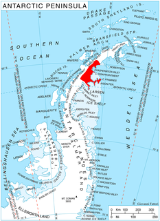
Tashtego Point is a rocky point marking the east end of the ridge at the south side of Stubb Glacier, on the east coast of Graham Land. Surveyed and photographed by the Falkland Islands Dependencies Survey (FIDS) in 1947. Named by the United Kingdom Antarctic Place-Names Committee (UK-APC) after Tashtego, the Wampanoag harpooner on the Pequod in Herman Melville's Moby-Dick.

Sirot Island is an island of Papua New Guinea, located in the Green Islands, east of New Ireland. It is located of the north-west coast of Nissan Island, north of Barahun Island. It is 1.25 miles (2.01 km) long.
Malendok Island is an island of the Tanga Islands of Papua New Guinea, located to the east of New Ireland. It is located to the south-west of Boang Island and north-east of Lif Island and Tefa Island. It covers 35 square kilometres (13.5 sq mi). Most inhabitants live in small hamlets on the coast. On the south-western side is a coconut plantation.
References
- ↑ Sailing Directions (Enroute), Pub. 126: Pacific Islands (PDF). Sailing Directions . United States National Geospatial-Intelligence Agency. 2017. p. 119.
- ↑ "Umantewena, Kiribati - Geographical Names, map, geographic coordinates". geographic.org. Retrieved 2021-09-03.
Coordinates: 0°44′S174°28′E / 0.733°S 174.467°E
 | This Kiribati location article is a stub. You can help Wikipedia by expanding it. |