
Biamanga National Park is a protected area in New South Wales, Australia, 408 km (254 mi) south of Sydney and 40 km (25 mi) north of Bega. The park forms part of the Ulladulla to Merimbula Important Bird Area because of its importance for swift parrots.

Gulaga National Park is a national park on the south coast of New South Wales, Australia, about 15 kilometres (9.3 mi) south of Narooma. The park is dominated by Gulaga, also known as Mount Gulaga. The former Wallaga Lake National Park, Goura Nature Reserve, and Mount Dromedary Flora Reserve were combined to form this park in 2001. The park features the southernmost subtropical rainforest in New South Wales.
Wallaga Lake National Park is a former national park in New South Wales, 296 km (184 mi) south-west of Sydney and north of Bermagui. It now forms part of a greater Gulaga National Park.
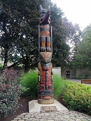
A totem is a spirit being, sacred object, or symbol that serves as an emblem of a group of people, such as a family, clan, lineage, or tribe, such as in the Anishinaabe clan system.

Eurobodalla Shire is a local government area located in the South Coast region of New South Wales, Australia. The Shire is located in a largely mountainous coastal region and situated adjacent to the Tasman Sea, the Princes Highway and the Kings Highway.

Bermagui is a town on the south coast of New South Wales, Australia, in the Bega Valley Shire. It lies on the shores of the southern end of Horseshoe Bay. The name is derived from the Dyirringanj word, permageua, possibly meaning "canoe with paddles".

The Yuin nation, also spelt Djuwin, is a group of Australian Aboriginal peoples from the South Coast of New South Wales. All Yuin people share ancestors who spoke, as their first language, one or more of the Yuin language dialects. Sub-groupings of the Yuin people are made on the basis of language and other cultural features; groups include the Brinja or Bugelli-manji, , Wandandian, Jerrinja,Budawang, Yuin-Monaro, Djiringanj, Walbunja, and more. They have a close association with the Thaua and Dharawal people.
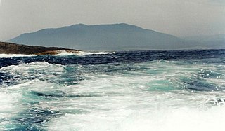
Gulaga, dual-named as Mount Dromedary and also referred to as Mount Gulaga, is a mountain located in the south coast region of New South Wales, Australia. It rises above the village of Central Tilba and is within the Gulaga National Park. At its highest point, it measures 806 metres (2,644 ft) above sea level.

The Tharawal people and other variants, are an Aboriginal Australian people, identified by the Yuin language. Traditionally, they lived as hunter–fisher–gatherers in family groups or clans with ties of kinship, scattered along the coastal area of what is now the Sydney basin in New South Wales.
South Durras is a small village on the South Coast of New South Wales, Australia. South Durras is located approximately 280 kilometres south of Sydney and 15 kilometres north of Batemans Bay, in the local government area of Eurobodalla Shire. The village is surrounded by the Murramarang National Park.
The Thaua people, also spelt Thawa and Dhawa, and also referred to as Yuin (Djuin), are an Aboriginal Australian people living around the Twofold Bay area of the South Coast of New South Wales.

Wallaga Lake is an estuarine lake in Bega Valley Shire in New South Wales, Australia, the largest lake in southern NSW. It is located between Bermagui to the south and between Tilba Tilba to the north, situated beneath Mount Gulaga, in the traditional lands of the Yuin people. A large section of its foreshore and catchment are within the Gulaga National Park, since Wallaga Lake National Park, Goura Nature Reserve, and Mt Dromedary Flora Reserve were combined into the larger national park. There is an island in the lake known as Merriman's Island, Merriman Island or Umbarra.
Edwin "Guboo" Ted Thomas, a Yuin man, was a prominent Aboriginal leader. He toured Australia with a gumleaf orchestra during the Great Depression of the 1930s, played rugby league and became a respected elder who campaigned for protection of sacred sites on the South Coast. He went to the United Nations in New York and urged the World Council of Churches to accept Indigenous religions, and also met the Dalai Lama.
The Wandandian are an Aboriginal Australian people of the South Coast of New South Wales with connections to the Yuin and Tharawal nations.
The Dhurga language, also written Thurga, is an Australian Aboriginal language of New South Wales. It is a language of the Yuin people, specifically the Wandandian and Walbunja groups, but there have been no fluent speakers officially recorded for decades, so it has been functionally extinct for some time. Efforts have been made to revive the language since the 2010s.

Batemans Bay is an open oceanic embayment that is located in the South Coast region of New South Wales, Australia. The bay forms the mouth of the Clyde River and its primary outflow is to the Tasman Sea of the South Pacific Ocean.
The Tatungalung are an indigenous Australian people of the state of Victoria. They are often, together with the Bratauolung, Braiakaulung, Brabiralung and Krauatungalung classified as belonging to one nation, the Gunai/Kurnai, though this typology has been thought, by Norman Tindale, to be an artificial construct.
The Walbunja, also spelt Walbanga, Walbunga and Wulbunja, are an Aboriginal Australian people of New South Wales, part of the Yuin nation.
The Djiringanj, also spelt Dyirringañ, are an Aboriginal Australian people of the southern coast of New South Wales. They are one of a larger group, known as the Yuin people, who all speak or spoke dialects of the Yuin–Kuric group of languages.

