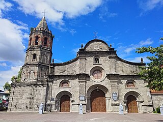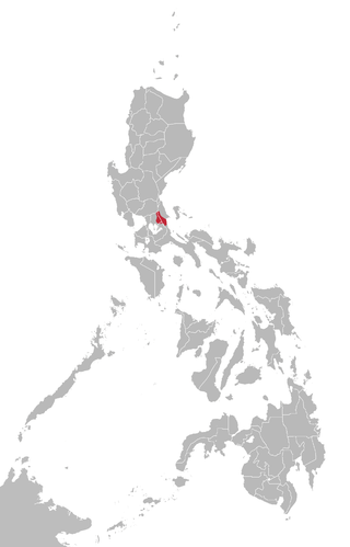
Calabarzon, sometimes referred to as Southern Tagalog and designated as Region IV‑A, is an administrative region in the Philippines. The region comprises five provinces: Batangas, Cavite, Laguna, Quezon, and Rizal; and one highly urbanized city, Lucena. It is the most populous region in the Philippines, according to the Philippine Statistics Authority (PSA), having over 16.1 million inhabitants in 2020, and is also the country's second most densely populated after the National Capital Region. It is situated southeast of Metro Manila, and is bordered by Manila Bay and South China Sea to the west, Lamon Bay and the Bicol Region to the east, Tayabas Bay and the Sibuyan Sea to the south, and Central Luzon to the north. It is home to places like Mount Makiling near Los Baños, Laguna, and Taal Volcano in Batangas. Calamba City is the regional center while Antipolo is the most populous city in the region.

Bulacan, officially the Province of Bulacan, is a province in the Philippines located in the Central Luzon region. Its capital is the city of Malolos. Bulacan was established on August 15, 1578, and part of the Metro Luzon Urban Beltway Super Region.

Aurora, officially the Province of Aurora, is a province in the Philippines located in the eastern part of Central Luzon region, facing the Philippine Sea. Its capital is Baler and borders, clockwise from the south, the provinces of Quezon, Bulacan, Nueva Ecija, Nueva Vizcaya, Quirino, and Isabela. Maria Aurora is the only landlocked town in the province and yet, the most populous.

Southern Tagalog, designated as Region IV, was an administrative region in the Philippines that comprised the current regions of Calabarzon and Mimaropa, the province of Aurora in Central Luzon, and most of the National Capital Region. It was the largest region in the Philippines in terms of both land area and population. After its partition on May 17, 2002, Southern Tagalog continues to exist as a cultural-geographical region.

Dingalan, officially the Municipality of Dingalan, is a 3rd-class municipality in the province of Aurora, Philippines. According to the 2020 census, it has a population of 27,878 people.

Maria Aurora, officially the Municipality of Maria Aurora, is the only landlocked and 2nd class municipality in the province of Aurora, Philippines. According to the 2020 census, it has a population of 44,958 people.

Angat, officially the Municipality of Angat, is a 1st class municipality in the province of Bulacan, Philippines. According to the 2020 census, it has a population of 65,617 people.

Doña Remedios Trinidad, officially the Municipality of Doña Remedios Trinidad, known by its acronym as DRT, is a 1st class municipality in the province of Bulacan, Philippines. According to the 2020 census, it has a population of 28,656 people, making it the least populated municipality in the province.

Norzagaray, officially the Municipality of Norzagaray, is a 1st class municipality in the province of Bulacan, Philippines. According to the 2020 census, it has a population of 136,064 people.

Pulilan, officially the Municipality of Pulilan, is a 1st class municipality in the province of Bulacan, Philippines. According to the 2020 census, it has a population of 108,836 people.

General Nakar, officially the Municipality of General Nakar, is a 1st class municipality in the province of Quezon, Philippines. According to the 2020 census, it has a population of 34,225 people. It is the largest municipality in the province of Quezon in terms of land area, occupying 1,343.75 kilometers (834.97 mi). It is accessible by land from Metro Manila, passing through Marcos Highway.

Quezon, officially the Province of Quezon, is a province in the Philippines located in the Calabarzon region on Luzon. Kalilayan was the first known name of the province upon its creation in 1591. Around the middle of the 18th century, it was changed to Tayabas. In 1946, in recognition of the second president of the Philippines, Manuel L. Quezon, the name of Tayabas Province was changed to Quezon. Lucena, the provincial capital, the seat of the provincial government, and the most populous city of the province, is governed independently from the province as a highly urbanized city. To distinguish the province from Quezon City, it is sometimes called Quezon Province, a variation of the province's official name.

Remontado, also known in literature as Sinauna, Kabalat, Remontado Dumagat, and more commonly by the autonym Hatang-Kayi, is a Malayo-Polynesian language spoken in Tanay, Rizal, General Nakar, Quezon, Rodriguez, Rizal and Antipolo, in the Philippines. It is one of the Philippine Negrito languages. It is a moribund language.

Angat Dam is a concrete water reservoir embankment hydroelectric dam in the Philippines that supplies Metro Manila and nearby provinces with water. It was a part of the Angat-Ipo-La Mesa water system. The reservoir supplies about 90 percent of raw water requirements for Metro Manila through the facilities of the Metropolitan Waterworks and Sewerage System and it irrigates about 28,000 hectares of farmland in the provinces of Bulacan and Pampanga.
Umiray Dumaget is an Aeta language spoken in southern Luzon Island, Philippines.
Several bulk water supply projects on the upper portion of the Kaliwa River Watershed have been proposed by the Philippine Government since the 1970s, with the intent of relieving Metro Manila of its overdependence on the water supplied by Angat Dam. Most of these have focused on a particular site in Barangay Laiban in Tanay, Rizal, on the upper portion of the Kaliwa River Watershed to which the Laiban Dam belongs, and the projects have thus often been referred to as Laiban dam or Kaliwa dam, although multiple projects have been referred to using either name.

The Sierra Madre is the longest mountain range in the Philippines. Spanning over 540 kilometers (340 mi), it runs from the province of Cagayan down to the province of Quezon, forming a north–south direction on the eastern portion of Luzon, the largest island of the archipelago. It is bordered by the Pacific Ocean to the east, Cagayan Valley to the northwest, Central Luzon to the midwest, and Calabarzon to the southwest. Some communities east of the mountain range, along the coast, are less developed and so remote that they could only be accessed by taking a plane or a boat.

The Angat Watershed Forest Reserve is a conservation area that protects the drainage basin in the southern Sierra Madre range north of Metro Manila in the Philippines where surface water empties into the Angat River and its distributaries. It is spread over an area of 62,309 hectares in the eastern portion of Bulacan and northern Rizal province at an altitude of between 490 and 1,206 metres. The conservation area also extends to the provinces of Nueva Ecija and Quezon and is centered on an artificial lake created by the Angat Dam which, together with the Ipo Dam located 7.5 kilometres (4.7 mi) downstream, supply 97% of the water requirement of Metro Manila via an aqueduct system to the La Mesa Dam and Reservoir and the Balara Filtration Plant in Quezon City. The Angat Dam and Reservoir is also a major source of hydroelectricity for Metro Manila and surrounding provinces, contributing some 200 megawatts to the Luzon grid. The watershed is a popular birdwatching site and is a biodiversity hotspot containing most of the remaining closed-canopy forests in Central Luzon.
The Umiray–Angat Transbasin Project (UATP) is an expansion project of the Metropolitan Waterworks and Sewerage System (MWSS) for the supply of the Angat Dam reservoir. The 13-kilometer-long (8.1 mi) 4.30-meter (14.1 ft) diameter tunnel-aqueduct system diverts waters from the Umiray River east of the Angat Basin. 20–30% of the water that is consumed in Metro Manila and its outlying regions is supplied by the Umiray Basin.
The Sumag River Diversion Project (SRDP) is an expansion project of the Umiray-Angat Transbasin Project (UATP) Metropolitan Waterworks and Sewerage System (MWSS) for the supply of the Angat Dam reservoir. The 600 meter long and 2.50 meter diameter tunnel-aqueduct system diverts waters from the Sumag River, a tributary of the Umiray River, east of the Angat Basin. The SRDP is forecasted to add 188 mld to the existing 777.6 mld capacity of the UATP.


