Gmina Gołcza is a rural gmina in Miechów County, Lesser Poland Voivodeship, in southern Poland. Its seat is the village of Gołcza, which lies approximately 8 kilometres (5 mi) west of Miechów and 31 km (19 mi) north of the regional capital Kraków.
Gmina Kozłów is a rural gmina in Miechów County, Lesser Poland Voivodeship, in southern Poland. Its seat is the village of Kozłów, which lies approximately 15 kilometres (9 mi) north of Miechów and 48 km (30 mi) north of the regional capital Kraków.
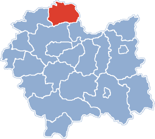
Gmina Książ Wielki is a rural gmina in Miechów County, Lesser Poland Voivodeship, in southern Poland. Its seat is the village of Książ Wielki, which lies approximately 13 kilometres (8 mi) north-east of Miechów and 45 km (28 mi) north of the regional capital Kraków.

Charsznica is a village in Miechów County, Lesser Poland Voivodeship, in southern Poland. It is the seat of the gmina called Gmina Charsznica. It lies approximately 10 kilometres (6 mi) north-west of Miechów and 39 km (24 mi) north of the regional capital Kraków.
Chodów is a village in the administrative district of Gmina Charsznica, within Miechów County, Lesser Poland Voivodeship, in southern Poland. It lies approximately 4 kilometres (2 mi) south-east of Charsznica, 6 km (4 mi) north-west of Miechów, and 36 km (22 mi) north of the regional capital Kraków.
Ciszowice is a village in the administrative district of Gmina Charsznica, within Miechów County, Lesser Poland Voivodeship, in southern Poland. It lies approximately 3 kilometres (2 mi) south of Charsznica, 8 km (5 mi) north-west of Miechów, and 37 km (23 mi) north of the regional capital Kraków.
Dąbrowiec is a village in the administrative district of Gmina Charsznica, within Miechów County, Lesser Poland Voivodeship, in southern Poland. It lies approximately 3 kilometres (2 mi) south-west of Charsznica, 11 km (7 mi) north-west of Miechów, and 38 km (24 mi) north of the regional capital Kraków.
Jelcza is a village in the administrative district of Gmina Charsznica, within Miechów County, Lesser Poland Voivodeship, in southern Poland. It lies approximately 6 kilometres (4 mi) north-west of Charsznica, 15 km (9 mi) north-west of Miechów, and 43 km (27 mi) north of the regional capital Kraków.
Marcinkowice is a village in the administrative district of Gmina Charsznica, within Miechów County, Lesser Poland Voivodeship, in southern Poland. It lies approximately 5 kilometres (3 mi) north of Charsznica, 13 km (8 mi) north-west of Miechów, and 43 km (27 mi) north of the regional capital Kraków.
Podlesice is a village in the administrative district of Gmina Charsznica, within Miechów County, Lesser Poland Voivodeship, in southern Poland. It lies approximately 7 kilometres (4 mi) west of Charsznica, 14 km (9 mi) west of Miechów, and 38 km (24 mi) north of the regional capital Kraków.
Pogwizdów is a village in the administrative district of Gmina Charsznica, within Miechów County, Lesser Poland Voivodeship, in southern Poland. It lies approximately 4 kilometres (2 mi) north of Charsznica, 12 km (7 mi) north-west of Miechów, and 42 km (26 mi) north of the regional capital Kraków.
Swojczany is a village in the administrative district of Gmina Charsznica, within Miechów County, Lesser Poland Voivodeship, in southern Poland. It lies approximately 2 kilometres (1 mi) west of Charsznica, 11 km (7 mi) north-west of Miechów, and 39 km (24 mi) north of the regional capital Kraków.
Szarkówka is a village in the administrative district of Gmina Charsznica, within Miechów County, Lesser Poland Voivodeship, in southern Poland. It lies approximately 3 kilometres (2 mi) south-west of Charsznica, 9 km (6 mi) north-west of Miechów, and 37 km (23 mi) north of the regional capital Kraków.

Tczyca is a village in the administrative district of Gmina Charsznica, within Miechów County, Lesser Poland Voivodeship, in southern Poland. It lies approximately 4 kilometres (2 mi) north-west of Charsznica, 13 km (8 mi) north-west of Miechów, and 41 km (25 mi) north of the regional capital Kraków.
Uniejów-Kolonia is a village in the administrative district of Gmina Charsznica, within Miechów County, Lesser Poland Voivodeship, in southern Poland. It lies approximately 3 kilometres (2 mi) east of Charsznica, 9 km (6 mi) north-west of Miechów, and 40 km (25 mi) north of the regional capital Kraków.
Uniejów-Rędziny is a village in the administrative district of Gmina Charsznica, within Miechów County, Lesser Poland Voivodeship, in southern Poland. It lies approximately 5 kilometres (3 mi) north-east of Charsznica, 10 km (6 mi) north-west of Miechów, and 42 km (26 mi) north of the regional capital Kraków.
Wierzbie is a village in the administrative district of Gmina Charsznica, within Miechów County, Lesser Poland Voivodeship, in southern Poland. It lies approximately 6 kilometres (4 mi) west of Charsznica, 15 km (9 mi) north-west of Miechów, and 40 km (25 mi) north of the regional capital Kraków.
Witowice is a village in the administrative district of Gmina Charsznica, within Miechów County, Lesser Poland Voivodeship, in southern Poland. It lies approximately 4 kilometres (2 mi) south of Charsznica, 8 km (5 mi) west of Miechów, and 35 km (22 mi) north of the regional capital Kraków.