Zoning is a method of urban planning in which a municipality or other tier of government divides land into areas called zones, each of which has a set of regulations for new development that differs from other zones. Zones may be defined for a single use, they may combine several compatible activities by use, or in the case of form-based zoning, the differing regulations may govern the density, size and shape of allowed buildings whatever their use. The planning rules for each zone, determine whether planning permission for a given development may be granted. Zoning may specify a variety of outright and conditional uses of land. It may indicate the size and dimensions of lots that land may be subdivided into, or the form and scale of buildings. These guidelines are set in order to guide urban growth and development.
A variance is a deviation from the set of rules a municipality applies to land use and land development, typically a zoning ordinance, building code or municipal code. The manner in which variances are employed can differ greatly depending on the municipality. A variance may also be known as a standards variance, referring to the development standards contained in code. A variance is often granted by a Board or Committee of adjustment.
A by-law or as it is most commonly known in the United States Bylaws is a set of rules or law established by an organization or community to regulate itself, as allowed or provided for by some higher authority. The higher authority, generally a legislature or some other government body, establishes the degree of control that the by-laws may exercise. By-laws may be established by entities such as a business corporation, a neighborhood association, or depending on the jurisdiction, a municipality.

Land use planning is the process of regulating the use of land by a central authority. Usually, this is done to promote more desirable social and environmental outcomes as well as a more efficient use of resources. More specifically, the goals of modern land use planning often include environmental conservation, restraint of urban sprawl, minimization of transport costs, prevention of land use conflicts, and a reduction in exposure to pollutants. In the pursuit of these goals, planners assume that regulating the use of land will change the patterns of human behavior, and that these changes are beneficial. The first assumption, that regulating land use changes the patterns of human behavior is widely accepted. However, the second assumption - that these changes are beneficial - is contested, and depends on the location and regulations being discussed.

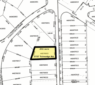
In the United States, a plat (plan) is a cadastral map, drawn to scale, showing the divisions of a piece of land. United States General Land Office surveyors drafted township plats of Public Lands Surveys to show the distance and bearing between section corners, sometimes including topographic or vegetation information. City, town or village plats show subdivisions broken into blocks with streets and alleys. Further refinement often splits blocks into individual lots, usually for the purpose of selling the described lots; this has become known as subdivision.

Subdivisions are the act of dividing land into pieces that are easier to sell or otherwise develop, usually via a plat. The former single piece as a whole is then known as a subdivision. Subdivisions may be simple, involving only a single seller and buyer, or complex, involving large tracts of land divided into many smaller parcels. If it is used for housing it is typically known as a housing subdivision or housing development, although some developers tend to call these areas communities.
A planned unit development (PUD) is a type of flexible, non-Euclidean zoning device that redefines the land uses allowed within a stated land area. PUDs consist of unitary site plans that promote the creation of open spaces, mixed-use housing and land uses, environmental preservation and sustainability, and development flexibility. Areas rezoned as PUDs include building developments, designed groupings of both varied and compatible land uses —such as housing, recreation, commercial centers, and industrial parks— within one contained development or subdivision. Developed areas vary in size and by zoned uses, such as industrial, commercial, and residential. Other types of similar zoning devices include floating zones, overlay zones, special district zoning, performance-based codes, and transferable development rights.
A Form-Based Code (FBC) is a means of regulating land development to achieve a specific urban form. Form-Based Codes foster predictable built results and a high-quality public realm by using physical form as the organizing principle, with less focus on land use, through municipal regulations. A FBC is a regulation, not a mere guideline, adopted into city, town, or county law and offers a powerful alternative to conventional zoning regulation.
SmartCode is a unified land development ordinance template for planning and urban design. Originally developed by Duany Plater-Zyberk & Company, this open source program is a model form-based unified land development ordinance designed to create walkable neighborhoods across the full spectrum of human settlement, from the most rural to the most urban, incorporating a transect of character and intensity within each. It folds zoning, subdivision regulations, urban design, and basic architectural standards into one compact document. Because the SmartCode enables community vision by coding specific outcomes that are desired in particular places, it is meant to be locally calibrated by professional planners, architects, and attorneys.
Building officials of developed countries are generally the jurisdictional administrator of building and construction codes, engineering calculation supervision, permits, facilities management, and accepted construction procedures.

Secondary suites are self-contained apartments, cottages, or small residential units, that are located on a property that has a separate main, single-family home, duplex, or other residential unit. In some cases, the ADU or in-law is attached to the principal dwelling or is an entirely separate unit, located above a garage or in the backyard on the same property. In British English the term annex or granny annex is used instead. Reasons for wanting to add a secondary suite to a property may be to receive additional income, provide social and personal support to a family member, or obtain greater security.
An abutter is a person whose property is adjacent to the property of another. In jurisdictions such as Massachusetts, New Hampshire, and Nova Scotia, it is a defined legal term. Some jurisdictions, such as Virginia, may use the term adjacent landowner, while others, such as California, use the term adjoining landowner, and the United States Environmental Protection Agency defines rights of contiguous property owners (CPO).
Comprehensive planning is an ordered process that determines community goals and aspirations in terms of community development. The end product is called a comprehensive plan, also known as a general plan, or master plan. This resulting document expresses and regulates public policies on transportation, utilities, land use, recreation, and housing. Comprehensive plans typically encompass large geographical areas, a broad range of topics, and cover a long-term time horizon. The term comprehensive plan is most often used by urban planners in the United States.

Zoning in the United States includes various land use laws falling under the police power rights of state governments and local governments to exercise authority over privately owned real property. Zoning laws in major cities originated with the Los Angeles zoning ordinances of 1904 and the New York City Zoning resolution of 1916. Early zoning regulations were motivated by racism and classism. Zoning ordinances did not allow African-Americans moving into or using residences that were occupied by majority whites due to the fact that their presence would decrease the value of home. The constitutionality of zoning ordinances was upheld by the Supreme Court of the United States in Village of Euclid, Ohio v. Ambler Realty Co. in 1926
A planning and zoning commission is a local elected or appointed government board charged with recommending to the local town or city council the boundaries of the various original zoning districts and appropriate regulations to be enforced therein and any proposed amendments thereto. In addition, the Planning and Zoning Commission collects data and keeps itself informed as to the best practices generally in effect in the matter city planning and zoning. It may be qualified to act on measures affecting the present and future movement of traffic, the segregation of residential and business districts and the convenience and safety of persons and property in any way dependent on city planning and zoning.
An urban planner is a professional who practices in the field of urban planning.
Udo is a masculine given name.

The Howard County Department of Planning and Zoning (DPZ) manages planning and development in Howard County, Maryland, a Central Maryland jurisdiction equidistant between Baltimore, Maryland and Washington, D.C.
Missing middle housing describes a range of multi-family or clustered housing types that are compatible in scale with single-family or transitional neighborhoods. Missing middle housing is intended to meet the demand for walkable neighborhoods, respond to changing demographics, and provide housing at different price points. The term "missing middle" is meant to describe housing types that were common in the pre-WWII United States such as duplexes, rowhomes, and courtyard apartments but are now less common and, therefore, "missing". Rather than focusing on the number of units in a structure, missing middle housing emphasizes scale and heights that are appropriate for single-family neighborhoods or transitional neighborhoods. After the introduction of the term in 2010, the concept has been applied in the United States, Canada, and Australia.


