University of Maryland | |
|---|---|
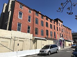 Buildings on the 600 block of W. Lexington Street in the University of Maryland neighborhood, Baltimore | |
 University of Maryland Location within Baltimore  University of Maryland Location within Maryland  University of Maryland Location within the United States | |
| Coordinates: 39°17′24″N76°37′30″W / 39.290°N 76.625°W | |
| Country | |
| State | |
| City | |
| Time zone | UTC−5 (Eastern) |
| • Summer (DST) | UTC−4 (EDT) |
| Area Codes | 410, 443, 667 |
The University of Maryland neighborhood, encompasses a southwestern portion of downtown Baltimore which includes the University of Maryland, Baltimore. [1]